New information panels and adjustments to the route along the Red Trail in Switzerland
The replacement of the information panels is completed! During last summer, 149 new panels were installed along the Red Trail in Switzerland. They were placed in approx. 3km-intervals in the cantons Tessin, Valais, Bern and Vaud. The substitution was organised by the Swiss Hiking Federation.
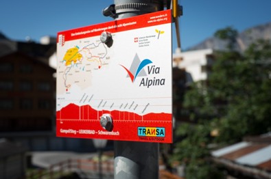
The new information panels (see picture) replace the older ones from 2004, which had become barely legible due to weathering. To increase the length of their life, they have been printed with a special UV-resistant technique and also boast higher resistance to scratching and rubbing. Generally the location of the panels remains the same, except in Valais where the routes were also checked. This led to adaptations of the route and the location of the panels. The GPS tracks on the website were accordingly updated in the last weeks by the Swiss Hiking Federation. These are mostly minor modifications.
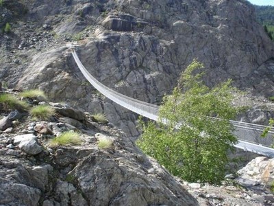
A completely new route has however been defined for stage R96 from the Riederalp to Mund, where the trail now leads over the suspended bridge (built in 2008, see picture) instead of the village of Blatten. This confers a new attractiveness to this section in the heart of the Jungfrau-Aletsch UNESCO World Natural Heritage Site.
At the same time, the information (accommodation, restauration, web links) on the Swiss stages have been checked and updated where necessary.

