Over to the Via Alpinists!


Here you can find links to the experiences of the mountain lovers who have walked the Via Alpina or who are planning their adventure, and you’ll discover their advice and top travel tips for walking the trails! (Do also check our
Questions / Answers section and our Facebook page!)
 
Have you walked part of the Via Alpina and have your own website or travel diary to share? Do you have an ambitious
project concerning the Via Alpina that you want to present? Contact
the Via Alpina National Secretariats so we can publish your project here. 

    
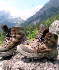
Hiking boots ( C. Schwann)

NB. The information here below (reports and comments) is not checked by the Via Alpina network and the authors are solely responsible for the content.


 Playlist "Best of Via Alpina":


Do you have an experience you want to share or a question for the Via Alpinists? Make the most of this blog to share practical advice and travel tips for walking the Via Alpina. Don’t hold back and share your experience! (For specific remarks on a particular stage please use the comments section on the stage sheets of the Trails section.)  

Comments

Favourites, criticisms ? Make your personal comments on this stage. For more general notes please use the comments section of the page Over to the Via Alpinists.


max. 1000 characters
  • Michael Schmitz - 2023-10-31
    Die Gelbe Via Alpina als #Thruhike.
    Von Triest nach Oberstdorf. 800 Kilometer über die Alpen. Das war ein schönes Abenteuer im letzten Sommer.
    Die Strecke wird kaum gegangen, neue Alpenregionen sind zu entdecken, die Welt braucht Infos aus erster Hand. Da helfe ich doch gern :-)
    So fühlt sich eine lange Wanderung an:
    https://amzn.to/3GbVIjh
    Mehr Infos zur Gelben Via Alpina gibt es auch hier: https://soziales4u.de/viaalpina/
  • Carsten Holz - 2023-10-02
    Walking the red trail in the summers of 2021-23, I kept (some) track of water availability, bivouac possibilities, grocery stores en route, possibly difficult passages, and thoughts about alternative routing. -- Entered here for R1-R40, but not for R41-R161 due to the space limit on personal comments. For full notes covering all stages see http://carstenholz.com/Via-Alpina.pdf
  • Görge Blendermann - 2023-09-22
    Bonjour.
    J'ai parcouru le tronçon Via Alipna bleu D19 à D11. Voici quelques remarques:
    - Les indications de distance et surtout de dénivelé sont en partie fausses dans le topo-guide (étape D18: +1330 au lieu de +2986 / -1380 au lieu de -2924!)
    - Le topo-guide indique un point "Quota 1540m" à plusieurs étapes, ce point ne correspond à rien...
    - La signalétique Via Alpina est +/- inutile: les plaquettes sont illisibles et placées à des endroits qui ne servent à rien. Elles devraient être aux intersections sur le panneau de direction.
    - D11: le tronçon entre le Bivuacco Alpe Pian des Lago et le Rifugio Alpe del Lago est quasi impraticable et très mal signalé dans le sens sud-nord.
    - Sinon très chouette!
  • Gambas - 2023-07-20
    Hello.
    My 2022 Via Alpina with my mountain bike was hard but awesome. Thank you for this creation.

    I added the Via Dinarica this same summer. Here is a sum up with pictures of my journey:

    https://www.pinkbike.com/u/gambas90/blog/via-alpinarica-solo-riding-adventure-across-the-entire-alps.html
  • Piet Clerinx - 2023-07-18
    Tot anyone hiking the Via Alpina, I recommend downloading the GPS app 'Open Street Maps' (osm). The app contains all Via Alpina stages and much more (GR, PR, local tours, ...). Not possible anylire to get lost. Just open the app and you will see your location and the Via Alpina trail nearby. Another advantage: no need to be connected, you can download the maps you need on beforehand.
  • EG - 2023-06-28
    übernachteten im Hotel Sonne in Elm, sehr zu empfehlen. Das Essen war fantastisch…
  • lasenza - 2023-06-21
    Ich bin auf der Via Alpina Schweiz unterwegs und dokumentiere die Etappen auf meinem Blog. https://www.off-the-trail.de/wandern/mehrtageswanderungen/via-alpina-20-tage/ Bei Fragen gerne melden!
  • Nigel L - 2023-05-29
    I hope to take a walking group a cover Red 53 to 58 in September. Does anyone know of a taxi company that will do luggage transfers for us between hotels?
  • POPEYE GG - 2023-04-27
    J'ai effectué la Via Alpina (circuit rouge) le plus fidèlement possible, en 6 ans de 2017 à 2022, en 160 étapes, environ 2750km à mon propre compteur. Superbe expérience (paysages, rencontres, anecdotes)!
    GPS recommandé, car le balisage n'est toujours au top.

    Voir mon blog: vivelaretraitesurlaviaalpina.blogspot.com.

    Je tiens à votre disposition mon circuit sous forme de tableau, que vous pourrez modifier à votre guise, ainsi que les traces GPS, plus autres informations vous permettant d'adapter le circuit vous-mêmes selon vos envies.
    Bon courage au futur randonneur!
  • roland - 2023-04-10
    Nous voulons aller faire les étapes (rouge) 149 à 157 (région Tende Cuneo): est-ce que c'est praticable? Neige en face nord? Cabanes?
  • Zana - 2023-03-13
    Voilà ;La distance entre Simplon dorf et Gabi n est pas 2km!
  • Shay yadel - 2023-03-05
    I love to travel I haven't visited the Alps yet I would love to enter the blog and learn information before I arrive
  • Michael Schmitz - 2023-01-07
    Die Gelbe Via Alpina als #Thruhike. Von Triest nach Oberstdorf. 800 Kilometer über die Alpen. Das war ein schönes Abenteuer in diesem Sommer.
    Die Strecke wird kaum gegangen, neue Alpenregionen sind zu entdecken, die Welt braucht Infos aus erster Hand. Da helfe ich doch gern :-)
    So fühlt sich eine lange Wanderung an:
    https://amzn.to/3GbVIjh
    Mehr Infos zur Gelben Via Alpina gibt es auch hier: https://soziales4u.de/viaalpina/
  • IfhdgfDapapsper - 2022-12-05
    [url=https://www.mariedduncan.online]https://www.mariedduncan.online[/url] [url=https://www.mariedduncan.online/noclegi-augustow-sydney-zarzecze-401655]https://www.mariedduncan.online/noclegi-augustow-sydney-zarzecze-401655[/url] Dapapsper ferietow Astece
  • Ravay Stéphane - 2022-03-17
    bonjour,
    je suis a la recherche d'information,pour faire slovénie-Saint gingolph par la via Alpina a VTT existe t'il une trace GPS pour ce parcours.
    merci salutations
  • Carsten - 2022-01-10
    The Via Alpina is *not* consistently signposted and doesn’t have its own paint-marks. There are many stages without a single Via Alpina sign. A couple of Via Alpina signs can be found in a few stages. The Via Alpina is simply the assurance that one can get through, on typically otherwise marked trails.
    Long-distance hikers may want to pay more attention to good resupply opportunities and to possibilities to camp in each stage than the guidebook provides (and to keep in mind that the "official" Via Alpina is designed to earn income for local businesses, not for hikers' optimal hiking experience).
  • Carsten - 2022-01-10
    I walked stages R1-R40 of the Via Alpina Red Trail between 30 June and 24 July 2021. For navigation I loaded the GPS data (.kml file) available on the via-alpina.org website into the (free) app Maps.me on my Android phone (and downloaded the detailed regional maps of Maps.me for the regions that I walked through). These GPS data are of mixed quality, including of very poor quality for some stages. I also loaded the GPS data into the app Gaia GPS, which only displays one chosen stage at a time whereas Maps.me displays all stages on the map at once. The app AllTrails has superior (independent) GPS data for all stages and displays the trail well on detailed topographical maps as long as one has cellular reception; downloads require payment in form of a recurrent annual subscription. I mostly relied on Maps.me, which I would also use to figure out how to walk from point A to B when I diverged from the Via Alpina.
  • Carsten - 2022-01-10
    Google translate of old guidebook entry for Dun (R35): "The Via Alpina is a hiking trail that aims to promote local development, both for private individuals as well as affected local authorities - 30 regions and over 200 municipalities that benefit from an increase or a better distribution of tourist visits. Its aim is to create a new tool for mountain guides, companions and hut and inn operators who can offer stays and discovery hikes around the paths." -> This suggests using the Via Alpina as guideline rather than definitive route.
  • John - 2021-12-29
    In September 2021 we walked the first week of the Via Alpina Red route, starting at Trieste (Muggia).
    You can find the stroy and pictures here: https://crossingthealpswithease.wordpress.com/via-alpina-red-week-1-muggia-to-petrovo-brdo/
  • Tinu - 2021-12-25
    Wo kann man Höhenprofile zu den einzelnen Etappen finden?
    Das wäre vielleicht noch hilfreich bei den Vorbereitungen
  • Christina - 2021-12-15
    Dear Via Alpina Hikers

    I hiked the red Via Alpina in summer 2020. I skipped two weeks (Germany part) and walked directly to the Dolomites (total 2300km, no car, bus or train). The whole journey (solo, with my tent) is on my blog for further trail information or preparation and equipement details.

    Christina
  • Via Alpina - 2021-09-29
    Dear Maiensäss,
    we are sorry to hear you were not able to finish Yellow Via Alpina. For yellow trail we advice to see page ViaTransalpina that can be reached via this link:
    https://via-transalpina.eu/

    All the best to you.
  • Maiensäss - 2021-09-29
    Liebe Via AlpinistInnen,letztes Jahr hab`ich roten Weg vollendet,startet dieses Jahr gelben Weg, aber bereits am 10.Tag abgebrochen.

    Weg geprägt von Irrwegen,schlechter Markierung, Beschilderung; Beschreibungen vage, Km-u.Zeit-Angaben nicht zutreffend, aber schönes Maiensäss und viele Alphütten und Rustico.

    Vermute, AutorInnen sind Weg (zumindest erste Etappen)nie selbst gegangen.Kann nur jeden abraten,diesen Weg zu beginnen.Macht besser den roten Weg. Sorry, Andreas
  • Ljanssens - 2021-09-10
    Hi, I would like to hike part of the via alpina but only have 4 days, does anybody know where i should start the hike etc? Also we would like to do a loop ( end back at our car)
  • walter - 2020-11-04
    Salut Greg, merci pour ton conseil, pourrais tu me dire quel itinéraire tu as pris, j'envisage de faire le rouge , mais le violet me parait bien aussi, merci d'avance pour ta réponse
    walter Jeannin
  • Grèg - 2020-10-27
    Hello Jeannin, cet été je l'ai faite de Trieste (Muggia) à Valgrisenche. Contraint d'arrêter à cause de la neige et des tempêtes de la fin septembre/début octobre...
    Encombre-toi pas des cartes (lourdes et volumineuses). Sur l'application ViewRanger, il y a tout le tracé. Télécharge des cartes hors ligne (environ 10 jusqu'à Monaco) et ensuite tu navigues en mode avion. Ça marche d'enfer.
  • jeannin - 2020-10-11
    bonjour,j'envisage de faire la via alpina en integral,en été 2021,si quelqu'un possede des cartes,je suis preneur.Merci d'avance
    Walter
  • jeannin - 2020-08-30
    je souhaite répondre à Maxime,message du 04/03/2019,puisque moi aussi j,envisage de faire l'intégrale mi mai,débur juin 2021
  • Danykar - 2020-08-24
    Bonjour, je souhaite faire une semaine sur la via Alpina en France avec un départ proche de la Suisse. Quel départ et arrivée (environ) conseillez vous ? <facilité d'accès par transport publics)
  • Houdeng - 2020-07-16
    Bonjour, je souhaiterais contacter un responsable par mail
  • sennburk - 2020-07-06
    Eine Etappe entweder zum erholen oder man wandert einfach weiter und versucht in Finkenberg-Astegg über den wunderbar angelegten Leonhard-Stock Weg und anschl. über den Mariensteig dort eine Übernachtungsmöglichkeit zu finden. Reservierung vorab unbedingt nötig- da es dann am Penken recht schwierig wird. Schiane Griaß Burki
  • Pimprenelle67 - 2020-06-11
    Bonjour à tous,, quelles cartes sont le meilleures pour la Via Jaune, notamment dans les Dolomites ? merci de votre aide !
  • Moe&Guily - 2020-03-31
    Bonjour
    Je voulais savoir si il était possible de parcourir la via alpina en tente (en dormant à côté des refuges ou dans des campings ou en bivouacs). L'option de dormir seulement en refuge étant trop chère pour nous.
    merci beaucoup.
  • Robinet - 2020-03-07
    Bonjour, j'enviseage d'aller découvrir la Via Alpina et je suis à la recherche de conseils et témoignages relatifs à ce magnifique tracé.
  • viagra prices - 2020-01-13
    viagra without a doctor prescription <a href=https://tinyurl.com/uo2jdyt>viagra pills</a> sildenafil 20 mg tablet reviews
  • Via Alpina International Secretariat - 2019-09-30
    Dear Souris48,

    almost all the answers you can find on our page. Please take some time to investigate it. Otherwise here you can read all about the project:
    http://www.via-alpina.org/en/page/73/project-presentation

    Contacts are here: http://www.via-alpina.org/fr/contact

    We have a problem with Google maps but you can still download all the GPX data here: http://www.via-alpina.org/en/roadbook
    Choose the starting and ending point and than in the left corner Guidebook summary you can download GPX and open them in different apps such as Komoot.

    Best regards,
    Via Alpina Team
  • souris48 - 2019-09-27
    Une dernière question ?
    Y a t'il un autre site plus à jour ? Celui-ci m'a bien rendu service pour la description des itinéraires ( même s'ils ne sont pas toujours précis) et surtout pour les explications concernant le patrimoine naturel et culturel
    Automatic translation [Google]
    One last question ? Is there another site more up to date? This one did me a good service for the description of the itineraries (even if they are not always precise) and especially for the explanations concerning the natural and cultural heritage
  • souris48 - 2019-09-27
    Bonjour,
    Est ce que quelqu'un pourrait me renseigner sur cette fameuse Via Alpina ?
    Question : Qui a eu l'idée de ce projet ?
    Qui s'occupe de mettre à jour ce site avec les différentes étapes ?
    Pour quelles raisons les cartes n’apparaissent plus depuis un bon bout de temps ?
    Éventuellement, si quelqu’un peut me donner une adresse ou mail pour contact ?
    Merci et bonne randonnée à tous.
    Automatic translation [Google]
    Hello, Can someone tell me about this famous Via Alpina? Question: Who got the idea for this project? Who takes care of updating this site with the different steps? Why are the cards no longer appearing for a long time? Eventually, if someone can give me an address or mail for contact? Thank you and have a good hike.
  • lizh - 2019-09-04
    Liebe erfahrene Wandersleute! Ich möchte Ende September gerne die ersten 5 Etappen der grünen Strecke von Vaduz bis Urner Boden wandern. Ich bin trittsicher und konditionell in guter Verfassung, allerdings nicht ganz schwindelfrei. Gibt es Passagen, die sehr steil abfallend sind oder sind diese Etappen auch machbar für Leute wie mich? Danke für eure Tipps!
    Automatic translation [Google]
    Dear experienced hikers! At the end of September, I would like to hike the first 5 stages of the green route from Vaduz to Urner Boden. I am sure-footed and in good condition, but not completely free from giddiness. Are there any passages that are very steep or are these stages also feasible for people like me? Thanks for your tips!
  • Via Alpina International Secretariat - 2019-08-29
    Dear UrsL,

    yes it is true that we had to put our hiking maps off line. But you can still download GPX data for a separate stage and export them in OpenStreet maps.
    We are currently working towards creating a new website with open source maps.

    Best regards,
    Via Alpina Team
  • UrsL - 2019-08-28
    www.via-alpina.org Webseite zeigt die Karten der Etappen nicht mehr an. Was gibt es für Alternativen eine Route zu planen von CH bis Monaco?
    Automatic translation [Google]
    www.via-alpina.org Website no longer displays the maps of the stages. What alternatives are there for planning a route from CH to Monaco?
  • Andreas W. - 2019-08-06
    After 5 years I finished the green track (Vaduz till Adelboden). I walked on Sunday / Monday from Engelberg to Meiringen. I stayed at the Tannalp Hut. It was a wonderful experience, I have run several routes several times, cause I live in Switzerland. Likewise I have run some routes of the red and blue trail in Piedmont in 2015-2019, hope in 2020 or 2021 to make some stages in Slovenia.

    Unfortunately, this website has been out of date for a long time, a lot of information is old and nobody is responding to Instagram. Hope this project will soon be pursued with the necessary seriousness, as it is in Switzerland. This year, a documentary came on TV about the green track. You can watch it on | https://www.srf.ch/play/tv/sendung/srf-bi-de-luet---wunderland?id=d4bcf224-6bd0-4f04-a9e7-645892fa2a2d |

    Wish you all a good hike and take care of you.

    Andreas
  • souris48 - 2019-08-03
    Une étape difficile, surtout à la descente...l'ai signalé à la gardienne. Des câbles où chaînes seraient bien utiles...il semble que la demande à été faite à la section. Avons rencontré un sentier presque identique du côté de la Prinz Leopold Hütte = là, il y avait heureusement des câbles et même un escalier dans la caillasse. Très bon accueil à la Jamtalhütte. Pour ceux qui le désirent : service de taxi jusqu'à Galtür pour 8€
    Automatic translation [Google]
    A difficult stage, especially downhill ... reported it to the babysitter. Cables where chains would be very useful ... it seems that the request has been made to the section. We met an almost identical path on the side of the Prinz Leopold Hütte = there, there were fortunately cables and even a staircase in the pebble. Very welcome at the Jamtalhütte. For those who wish: taxi service to Galtür for 8 €
  • Claude - 2019-07-23
    Depuis quelques temps sur le site, les cartes apparaissent furtivement et disparaissent en laissant la place à un message d'erreur:
    "Petit problème... Une erreur s'est produite
    Google Maps ne s'est pas chargé correctement sur cette page. Pour plus d'informations techniques sur cette erreur, veuillez consulter la console JavaScript."
    Le secrétariat national France n'existe plus???
    Quelqu'un a-t-il une solution?
    Merci.
    Automatic translation [Google]
    For some time on the site, the cards appear furtively and disappear leaving room for an error message: "Small problem ... An error occurred Google Maps did not load correctly on this page. more technical information about this error, please consult the JavaScript console. " The national secretariat France no longer exists ??? Does anyone have a solution? Thank you.
  • Alex - 2019-05-17
    Dear Lupachiotta and Jean Maurice, i will start in Triest the 5th of June. What about you guys drop me a mail to xajanei@gmx.ch then we can conect each other and maybe catch up on the way.
    Kind Regards
    Alex
  • Vagabund - 2019-05-16
    Hello fellow hikers,
    Is anyone familiar with the route from the beginning of the blue trail in Riale, Piedmont, North into Switzerland ? I am trying to get to the Nufenen pass and down into the Goms valley. Ultimately, I want to intersect with the green Swiss trail. Any info is much welcome.
    Vagabund
  • Charlotte - 2019-05-15
    Me and my partner are planning to walk the route "From the French-Italian border down to the Mediterranean" but I'm unsure if it's too difficult for beginners who have not walked for many days in a row before.
    Do any of you have any experience with how difficult the hike is? (to find your way and follow the trail).
    /Charlotte
  • Lupachiotta - 2019-05-14
    Hello everybody,

    I'm going to start my hiking tour on the red Via Alpina Trail on 04th June in Trieste. Is somebody else starting this time?
    Marina
  • jean maurice - 2019-05-11
    Hello Alex, I start the red route in Trieste on 6th June...
  • Alex - 2019-05-08
    I am starting the Red route beginning of June in triest, someone plans to leave the same time? Best regards Alex
  • Vagabund - 2019-05-08
    Thanks for your valuable response about the the intersection of the red and blue trails
  • Via Alpina - 2019-05-08
    Dear LECUYER
    unfortunately we do not have a list of shelters on the Via Alpin Red and Blue. You can help yourself with our guidebook
    http://www.via-alpina.org/en/roadbook
  • Via Alpina - 2019-05-08
    Dear Vagabund
    the green and blue trail do not meet. But the red and green does in Adelboden.
    This map may help you http://www.via-alpina.org/uploads/htmldocuments/Documentation/VA_mapAD2010_en.pdf
  • Vagabund - 2019-05-05
    Planning sections of the Via Alpina this summer starting in NW Italy, Piedmont region, heading North. Where do the blue and green trails meet up in Switzerland ? Thanks for any comments and happy trails,
    Klaus
  • sylvain - 2019-05-03
    Bonjour , je vais effectué la Via Alpina de juillet à fin Août 2019 et je ne pourrais pas la terminer cette année , mais je pensais la reprendre et la finir en 2020 .Aussi si vous êtes intéressé pour m'accompagner une partie du trajet contacter moi .
    Amicalement
    Sylvain
    Voici mon mail : 1956syllec@gmail.com
    Automatic translation [Google]
    Hello, I will do the Via Alpina from July to the end of August 2019 and I could not finish this year, but I thought to take it back and finish it in 2020.Also if you are interested to accompany me part of the journey contact me . Sincerely Sylvain Here is my email: 1956syllec@gmail.com
  • LECUYER - 2019-05-03
    Bonjour , pourriez vous SVP me communiquer la liste des refuges sur la Via Alpin Rouge et Bleu .Existe t il un fichier ou je pourrais télécharger cette liste ? Merci de votre réponse .Bien cordialement
    Automatic translation [Google]
    Hello, could you please tell me the list of shelters on the Via Alpin Red and Blue. Is there a file where I could download this list? Thank you for your reply.
  • Maxime - 2019-03-04
    Bonjour
    J'envisage la via alpina en entier itinéraire rouge en 2021 depart debut juin quel est le meilleur sens pour la faire ? Pour éviter un maximum la neige et etre bloquer au debut de parcour ? Départ de Monaco et les Alpes Maritimes ou l'inverse départ de trieste ?
    Automatic translation [Google]
    Hello I consider the via alpina entire red route in 2021 from early June what is the best way to do it? To avoid a maximum snow and to be blocked at the beginning of the course? Departure from Monaco and the Alpes Maritimes or the reverse departure of trieste?
  • Francesca - 2018-12-18
    Buongiorno!
    Dove si possono trovare informazioni dettagliate sull'intero itinerario rosso? In inglese, italiano francese o spagnolo, non ha importanza.

    Inoltre quali cartine consigliate?

    E, qual'è il periodo migliore per affrontare il percorso, è mia intenzione percorrerlo tutto senza dovere affrontare eccessive quantità di neve

    Grazie

    Francesca
    Automatic translation [Google]
    Good morning! Where can you find detailed information on the entire red route? In English, Italian, French or Spanish, it does not matter. What are the recommended maps? And, what is the best time to tackle the route, it is my intention to follow it all without having to deal with excessive amounts of snow Thanks Francesca
  • Thorsten - 2018-10-03
    Hello,

    after having walked the first about 30 parts of the red trail (starting in Triest), we don't need our used hiking maps any longer. If anybody is interested, we would like to sell them. We have the following maps to sell:

    Primorska (1:40000 - Stages 1 to 3)
    Skofjelosko, Idrijsko in Cerljansko Hribovje (1:40000 - Stages 4 to 9)
    Julisjke Alpe (1:40000 - Stages 9 to 15)
    Gaitaler Alpen, Karnische Alpen, Oberdrautal (1:50000 - Stages 17 to 20)

    The maps are used, but still in good state. The bundle would cost 32 Euro + shipping charges (I send from Germany).

    If you are interested, contact me at
    t.kraeling{ÄTT}gmx.de

    Thorsten
  • Alain - 2018-08-12
    Pour Gilles et Gaelle : Je serais intéressé à suivre la via alpina entre la Slovénie et l'Italie (Dolomites) Juin-juillet 2019 Un cheminement entre les parcours rouge et jaune ? Si ça peut vous intéresser, contactez-moi par mail a.golay@sunrise.ch
    Automatic translation [Google]
    For Gilles and Gaelle: I would be interested to follow the via alpina between Slovenia and Italy (Dolomites) June-July 2019 A path between the red and yellow courses? If it interests you, contact me by mail a.golay@sunrise.ch
  • Gaelle - 2018-08-05
    Bonjour Gilles, je recherche aussi des personnes pour repartir sur la via Alpina, a plusieurs et mieux organisée cette fois... J'ai 28 ans et je suis Française . voici mon Mail si tu vois ce message ( et quiconque souhaite avoir plus d'infos sur le projet et/ ou particper) n'hésitez pas a me contacter : gaelle.brt06@gmail.com . tshusss !
    Automatic translation [Google]
    Hello Gilles, I am also looking for people to leave on the Via Alpina, has several and better organized this time ... I'm 28 years old and I'm French. here is my mail if you see this message (and whoever wants more information about the project and / or particper) do not hesitate to contact me: gaelle.brt06@gmail.com. tshusss!
  • Rüdiger - 2018-06-20
    Bin das erste mal auf der Via Alpina.
    Was baucht es im allgemeinen. Übernachten mit Zelt oder in Hütte was ist besser. Lg Rüdiger
    Automatic translation [Google]
    This is my first time on the Via Alpina. What is it in general? Staying in a tent or hut is better. Lg Rüdiger
  • vaeltava tohtori - 2018-01-14
    I'm planning walking the yellow route beginning in end of May. After reading a lot of travel writings I've come to conclusion there are some areas with no refuges left. Any suggestions to make rerouting in beforehand?
  • switzerland - 2017-10-16
    Hallo Valerie

    Der grüne Weg der Via Alpina ist gleichzeitig die nationale Route Nr. 1 im Netz von Wanderland Schweiz:
    http://www.schweizmobil.ch/de/wanderland/routen/nationale-routen/route-01.html
    Auf der Website findest du Karten und Höhenprofil.
    Einziger Unterschied: die Route führt nach dem Trüttlisbergpass (dort stösst der grüne Weg auf den roten Weg der Via Alpina) noch weiter bis Montreux. Eine wunderbare Ergänzung und ein schöner Abschluss der Route.

    Markus Ruff
    Schweizer Wanderwege
    Automatic translation [Google]
    Hello Valerie The green route of the Via Alpina is at the same time the national route No. 1 in the network of hiking Switzerland: http://www.schweizmobil.ch/de/wanderland/routen/nationale-routen/route-01.html On the website find maps and elevation profile. The only difference: the route continues after the Trüttlisberg pass (where the green path meets the red road of the Via Alpina) to Montreux. A wonderful addition and a nice end of the route. Markus Ruff Swiss hiking trails
  • Jean-Louis - 2017-10-08
    Je peux répondre à Valérie (carte et profils GPX de la Via verte faite en 2016). Comment la joindre ?
    Automatic translation [Google]
    I can answer Valérie (map and GPX profiles of the Via Verte made in 2016). How to join?
  • valerie - 2017-10-01
    Hi, can anyone recommend a certain map for the green trail?

    I am also looking for a goo elevation profile, any tips?

    Hallo, kann jemand eine bestimmte Karte für den Grünen Weg empfehlen?

    Ich suche auch nach einem guten Höhenprofil, vielleicht hat jemand einen Tipp?

    Thank you!
    Automatic translation [Google]
    Hi, can anyone recommend a certain map for the green trail? I am looking for a goo elevation profile, any tips? Hello, can anyone recommend a specific map for the Green Path? I'm also looking for a good height profile, maybe someone has a tip? Thank you!
  • Gilles - 2017-09-16
    Bonjour,

    Je suis un Suisse de 27ans et je recherche une ou plusieurs personnes pour m'accompagner sur des rando au long cours, avec comme objectif, la Via Alpina en 2019.

    Automatic translation [Google]
    Hello, I am a Swiss of 27 years and I am looking for one or more people to accompany me on long-distance hiking, with the goal of Via Alpina in 2019.
  • Casera-Rif. Tragonia - 2017-08-25
    Between stage B15 Sauris and B16 Forni di Sopra is as! Casera-Rif. Tragonia. A Casera transformed in Rifugio, where you can relax, sleep, breaking your long walk from Sauris to Forni.
    Call us for any informetion.
  • theresan - 2017-02-26
    Hi. I'm looking for a "Übersichtskarte" of the Alps (a map with the entire alps on it) - any ideas if sth like that exists?
  • Robi - 2016-12-09
    Hi,
    I' m Robi, Me project will be: Walk the Via Alpina how cheap how is possible, or you could say a: nice and funy Low Budget tour:). Every one how has ideas for save money, like good bivac (or camping)places, or you have other ideas for saving money on the trail then let me know.
    Btw. is there a good German guide with maps maybe also with tracks?
    olmabua-juhuuu(ET)yahoo.com
    Cheers, Robi
  • Frankie2249 - 2016-12-07
    Hattie, I am also planning on hiking the red trail next year. Could you message me with any info that would be of use?
  • Hattiefrances1 - 2016-09-18
    Hi I am planning to walk the entire via alpina red trail next year from Monaco to Trieste. Please could direct me to the appropriate maps/ guidebooks to help me learnore about the trail?
    Thanks!
  • BONHOMME - 2016-03-27
    Bonjour,
    Propriétaire-gérant du refuge du col de la Pousterle (France), je vous propose une mise à jour :
    -nous n'avons plus de fax, mais disposons d'internet ;
    - le portable +33 6 44 27 72 08 ;
    - tous commerces et facilités (dont train ) à 8 km et/ou 2 h de marche.
    Automatic translation [Google]
    Hello, owner-manager of the refuge of the neck of the Pousterle (France), I offer an update: -we do not fax, but have internet; - Mobile +33 6 44 27 72 08; - Shops and facilities (including train) 8 km and / or 2 hours of walking.
  • Igor Gruber - 2016-02-04
    Check blog of walking a red trail form Monte Carlo to Trieste:
    1 HIKER, 107 DAYS, 2.600+ KM, 140 KM ALTITUDE GAIN, 5 PAIRS OF SHOES, 12.000 PHOTOS.
  • thopper - 2016-01-26
    Check out my article and pictures from my 4 week solo trek on the Via Alpina last summer . I followed the red trail from Chamonix into Switzerland, the green one across Switzerland and joined back up with the red in Liechtenstein. https://travelingtaymar.wordpress.com/2016/01/25/on-the-via-alpina-trail/
  • John - 2015-12-20
    I made a 63 day solo journey from Slovenia to Monaco taking in more than 60 summits and more or less following the Italian border. I used some of the Via Alpina red route but linked 25 via ferrata and took a high level route for the most part, combining walking, via ferrata and some climbing. The blog includes a film, photo book, photos, more details
  • Felmi - 2015-09-06
    Letzten Herbst bin ich von Vaduz nach Lenk gewandert. Nun fehlen mir noch 4 Etappen bis an den Genfersee (Montreux).
    Die Wetterprognose ist nicht schlecht und ich werde am Donnerstag (10.9.15) in Lenk starten und weiter bloggen.
    Freundliche Wandergrüsse Mathias
    Automatic translation [Google]
    Last fall, I walked from Vaduz to steering. Now I still need 4 stages to Lake Geneva (Montreux). The weather forecast is not bad and I'll start on Thursday (09.10.15) in the steering and continue blogging. Friendly hiking regards Mathias
  • Andreas - 2015-08-02
    Wir sind vom 11.7. - 21.7.2015 die Grande Traversata delle Alpi von Macugnaga über Alagna - Rima - Carcoforo - Rimella - Campello Monti nach Molini Calasca gewandert. Zwischen Alagna und Molini Calasca ist die GTA identisch mit der blauen Via Alpina D11, D12, D13, D14 und D15. Ein Teil der Etappe D9 sind wir in der Zeit vom 25.7. - 28.7.2015 gewandert. Es gibt einen Blogbericht unter http://teutoni.blogspot.ch sowie viele Bilder unter https://www.flickr.com/photos/107089145@N07/albums. Neben Bilder der aktuellen Wanderung, gibt es auch Bilder von Etappen der roten Via Alpina im Tessin (Etappen R86, R87 und R88) sowie der grünen Via Alpina (Etappen C3a, C3b, C4, C5, C6, C9, C10, C11 und C12). Wer Zeit und Lust hat: schaut einfach rein! Grüsse, Andreas
    Automatic translation [Google]
    We are from 11.7. - 07.21.2015 the Grande Traversata delle Alpi from Macugnaga about Alagna - hiked Campello Monti Molini Calasca - Rima - Carcoforo - Rimella. Between Alagna and Molini Calasca the GTA is identical to the blue Via Alpina D11, D12, D13, D14 and D15. Part of the stage D9 we are in the period from 25.7. - 28/07/2015 hiked. There is a blog reporting under http://teutoni.blogspot.ch and many pictures in https://www.flickr.com/photos/107089145@N07/albums. In addition to images of current migration, there are also pictures of the stages of red Via Alpina in Ticino (stages R86, R87 and R88) and the green Via Alpina (stages C3a, C3b, C4, C5, C6, C9, C10, C11 and C12 ). Who has time and desire: just look out! Regards, Andreas
  • Christina, ÖAV - 2015-06-30
    Der Anstieg zum Riemannhaus ist im oberen Bereich sehr steil. Steinstufen, ein paar Eisentritte und ein Seil erleichtern den Aufstieg. Trittsicherheit und Schwindelfreiheit sind erforderlich, wobei es im Aufstieg leichter ist, als im Abstieg. Klettersteigausrüstung ist nicht erforderlich. Ein Bild findet sich direkt bei Etappe 39, Detailbeschreibung.
    Automatic translation [Google]
    The increase for Riemannhaus is very steep at the top. Stone steps, a few metal rungs and a rope to facilitate the ascent. Surefootedness and head for heights are required, it is easier on the rise, as in the descent. Climbing equipment is not required. A picture can be found directly at stage 39, detailed description.
  • Christian - 2015-06-30
    Wir wollen die Etappe über das Steinerne Meer machen. Der Aufstieg zum Riemannhaus wird überall unterschiedlich beschrieben. Teilweise wird Klettersteigausrüstung empfohlen. Wie schwierig ist der Aufstieg nun wirklich. Gibt es Bilder zu den schwierigen Stellen? Danke im voraus!
    Automatic translation [Google]
    We want to make the stage over the Stony Sea. The ascent to Riemannhaus describes different everywhere. Partly climbing equipment is recommended. How difficult the climb is really. Are there any pictures of the difficult places? Thanks in advance!
  • Donna - 2015-06-27
    We want to hike the Purple trail 7 days 120 km from Dolic to Jezerski, Slovenia. Is the trail well marked? How can we get from Munich to Dolic and return from Jezerski back to Munich?
  • Pironi - 2015-05-13
    Yellow Trail.
    I went the tours Nr. 8,9,10 last Weekend. Good signages but bad descriptions at the VIA - HP. Most of the Rifugios are not existing anymore, and the timetable is incorrect too.
  • Aypc - 2015-04-26
    I'm planning to walk the yellow trail this summer. I have a few questions: how easy it is to walk in the opposite direction given that the guide notes are only detailed for starting in Italy? What are the most reliable GPS coordinates for this route (via alpina website, Kompass, other)? What does it typically cost To stay in the refuges? Thanks!
  • MK - 2015-02-06
    Wir wollen im August 2015 von Trieste aus die ersten 8 Etappen des roten Wegs in Angriff nehmen. Hat jemand gute GPS Tracks?
    We want to start the red track from Trieste this August. Does somebody have good GPS tracks and suggestions for staying the nights?
    Thanks a lot.
    Automatic translation [Google]
    We will take of Trieste from the first 8 stages of the red path in attack in August 2015. Does anyone have good GPS Tracks? We want to start the red track from Trieste this August. Does somebody have good GPS tracks and suggestions for staying the nights? Thanks a lot.
  • Tof - 2015-02-06
    Trieste - Monaco en 2014

    du 12/06 au 23/10 dont 111j de marche, le reste en repos ou avaries:

    - 12j en Slovénie,
    - 19j en Autriche,
    - 13j en Italie (Via et hors Via)
    - 2j en Allemagne
    - 2j au Liechstenstein
    - 24j en Suisse
    - 39j en France (Via, Gr5 partiel et variante),
    - 2heures à Monaco.

    Budget (hors équipements préalables): 3400 euros

    Tous itinéraires sauf le violet. Renseignements en cours sur les étapes de la Via.

    Préparation: le site de la Via Alpina, Vincent Tornay (www.itinerance.ch), Thierry M. ( viaalpina2013.wordpress.com).

    Bonne route aux suivant(s)-e(s) !
    Automatic translation [Google]
    Trieste - Monaco in 2014 from 12/06 to 23/10 which 111j walk the rest at rest or damage: - 12j Slovenia - 19j Austria - 13j Italy (Via Via and out) - 2d in Germany - 2d at Liechtenstein - 24j Switzerland - 39j in France (Via, part Gr5 and variant) - 2hours in Monaco. Budget (excluding pre equipment): 3400 euros All routes except purple. Current information on the steps of the Via. Preparation: the site of the Via Alpina, Vincent Tornay (www.itinerance.ch), Thierry M. (viaalpina2013.wordpress.com). Good road to the next (s) -e (s)!
  • majogian - 2014-12-08
    6 sem. de rando de Muggia au 3cime di Lavaredo. Sentiers pas tjrs bien indiqués en Slovénie. Fabuleuse expérience humaine. 2 "cabanes" a éviter : Platnerhütte et Hochweisstein = lamentables ! finances plus importantes que l'accueil...
    Automatic translation [Google]
    6 weeks. touring in Muggia 3cime di Lavaredo. Not well marked trails tjrs Slovenia. Fabulous human experience. 2 "huts" to Avoid: Platnerhütte and Hochweisstein = pathetic! most important finance the home ...
  • Porot - 2014-09-29
    Bonjour, Je vien de " Boucler " la traversée des Alpes ( le 10 Septembre ) de Bled en slovenie a Menthon. J'ai fais un " mix " de plusieurs itinéraires, Via Alpina ( rouge et jaune, parcour de mon crus, et transalpe. Je pense d'ici quelques semaines vous faire part de mon trajet et des conditions dans lesquels je l'ai parcouru, ( beaucoup de mauvais temps,pluie, neige et pas mal de sentiers dégradés par l'hiverrude cette année ). A bientôt donc . Patrick.

    Automatic translation [Google]
    Hello, I vien of "Loop" through the Alps (September 10) Bled in slovenia has Menthon. I made a "mix" of several routes, Via Alpina (red and yellow are browsing my raw, and Transalpe., I think in a few weeks to share my journey and the conditions in which I traveled (a lot of bad weather, rain, snow and quite degraded by hiverrude this year trails). soon then. Patrick.
  • Felmi - 2014-09-21
    War diesen Herbst bereits 7 Tage auf dem grünen Weg in der Schweiz unterwegs (Nationale Route 1). Habe Unterkünfte und Vorschläge zur Etappierung auf der Website.
    Freundliche Wandergrüsse
    Mathias
    Automatic translation [Google]
    Was this autumn as early as 7 days on the green path in Switzerland go (National Route 1). Have suggestions for accommodation and of staged on the site. Guests traveling Regards Mathias
  • auf-guten-wegen - 2014-09-18
    Auch diesen Sommer waren wir wieder auf dem roten Weg der Via Alpina unterwegs, und zwar von Tirano nach Ulrichen (R76 - R93). Trotz des oft ziemlich feuchten Wetters kamen wir recht gut voran. Einige Fotos haben wir auf dem Blog veröffentlicht.
    Automatic translation [Google]
    This summer we were back on the red road of Via Alpina road, from Tirano to Ulrichen (R76 - R93). Despite the often quite humid weather we progressed quite well. We have published on the blog some photos.
  • klaus - 2014-08-14
    Hallo Via Alpina Team,
    Ich habe eine sehr gute Übernachtungsmöglichkeit für die Etappe Rot 2 / Rot 3 in Lokev gefunden:
    Gostilna Muha
    Inhaber: Andrej Muha s.p.
    Lokev 138 a. 6219 Lokev
    Telefon: +386 5 767 00 55
    Übernachtung: 30 EUR
    Sehr gutes Abendessen: 20 EUR
    Automatic translation [Google]
    Hello Via Alpina Team, I have a very good place to stay for the stage Red 2 / Red 3 found in Lokev: Gostilna Muha owner: Andrej Muha sp Lokev 138 a 6219 Lokev phone. +386 5767 00 55 night 30 EUR Very good Dinner: EUR 20
  • Lemmy - 2014-08-07
    Liebe Via AlpinistInnen,letztes Jahr hab`ich roten Weg vollendet,startet dieses Jahr gelben Weg, aber bereits am 10.Tag abgebrochen.Weg geprägt von Irrwegen,schlechter Markierung, Beschilderung;Beschreibungen vage, Km-u.Zeit-Angaben nicht zutreffend.Vermute, AutorInnen sind Weg (zumindest erste Etappen)nie selbst gegangen.Kann nur jeden abraten,diesen Weg zu beginnen.Macht besser den roten Weg. Sorry, Andreas
    Automatic translation [Google]
    Descriptions Km u.Zeit figures vague, not applicable; Love Via mountaineers, completed hab`ich red trail last year, this year poor marking, signage starts yellow path, but already at Day 10 abgebrochen.Weg marked by false starts. Suspect authors are way (at least the first stages) never even only gegangen.Kann any advise against this route to better beginnen.Macht the red path. Sorry, Andreas
  • Hiking&Biking Slovenia - 2014-07-06
    @dsviel: Via Alpina in Slowenien ab 15.7.:
    * Besser ist Huetten paar Tage voraus reservieren
    * Alternative Uebernachtung moeglichkeit am Vogel ist Huette Merjasec 00386 51644316 (100m von Skihotel)
    * Huette Dolič ist geoffnet aber im Moment ist rund der Huette noch viel Schnee. Aber jede Tag ist besser
    Automatic translation [Google]
    dsviel: Via Alpina in Slovenia from 15.7 .: * Better Huts Reserve is few days ahead * Alternative to stay at the bird hut merjasec 00386 51644316 (100m from ski) * Cottage Dolič is open but at the moment is around the hut still a lot of snow . But every day is better
  • emeline - 2014-07-03
    Bonjour,
    je me prépare à partir sur la via alpina, itinéraire rouge au départ de trieste. mes principales interrogations vont à la cartographie. J'ai commandé la carte slovène pour les premières étapes. Est-il possible d'acheter les cartes au fur et à mesure du parcours? Je ne veux pas m'encombrer d'un trop grand nombre de cartes au départ. Je ne souhaite pas non plus acheter l'ensemble des cartes mais plutôt les principales au 1/50 000ème. Auriez-vous une liste des cartes principales et/ou indispensables?
    merci
    Automatic translation [Google]
    Hello, I am preparing to go on via alpina, red route from Trieste. my main questions are mapping. I ordered the Slovenian map for the early stages. Is it possible to buy the cards as the background? I do not want to burden myself with too many cards out. I do not want either buy all the cards but the main 1:50 000th. Do you have a list of key cards and / or necessary? thank you
  • dsviel - 2014-07-02
    Hi, wir planen die Via Alpina rot in Slowenien von Idrija bis Villach zu wandern ab 15.07.14 (10 Tage). Wir (2 personen) haben folgende Fragen:
    1.) muss ich alle Unterkünfte/Hütten im voraus reservieren, oder reicht es jeweils am Vorabend von der letzten Unterkunft aus die nächste anzumelden?
    2. Wo kann ich alternativ übernachten am Ende von Etappe 10a (Crna prst -> Rjava skala), denn das angegebene Skihotel Vogel hat im Sommer geschlossen.
    3. Ist die Passage 2.33om zur Hütte Trzaska koca na Dolicu schneefrei und die Hütte geöffnet? Gibt es ggf eine Alternative?
    Danke für jede Auskunft
    Automatic translation [Google]
    Hi, we are planning the Via Alpina red in Slovenia Idrija to migrate to Villach from 07/15/14 (10 days). We (2 people) have the following questions: 1) I have all accommodations / cabins reserved ahead of time, or is it on the eve of the last property from the next login? 2 Where can I alternatively stay at the end of Section 10a (Crna Prst -&gt; Rjava scale), for the specified ski bird has closed in the summer. 3 Is the passage 2.33om the hut Trzaska koca na Dolicu free of snow and opened the cabin? Is there possibly an alternative? Thank you for any information
  • M.Keller - 2014-06-05
    Pour ceux qui sont tentés d'aller arpenter l'itinéraire violet, voici un aperçu des panoramas et ambiances qu'il vous réverve entre Oberstdorf et Werfen :
    http://www.partance.org/2014/02/17/via-alpina-violette-1/
    http://www.partance.org/2014/02/17/via-alpina-violette-2/
    Cordialement,
    M.Keller

    PS: contrairement à la majorité des via-alpinistes, j'ai parcouru cet itinéraire en commençant par la fin.
    Automatic translation [Google]
    For those who are tempted to pace the Purple Trail, here is an overview of the sights and scenes that you réverve between Oberstdorf and Werfen http://www.partance.org/2014/02/17/via-alpina -violette-1 / http://www.partance.org/2014/02/17/via-alpina-violet-2/ Sincerely, M.Keller PS: unlike the majority of via-climbers, I have traveled this route starting from the end.
  • Ruth123 - 2014-05-23
    hi, we are a family with children aged 4.5 and 9, looking for a 6 day hut to hut hike, preferably near to Zermatt but on the Italian side. Any suggestions welcome
  • Alain grinda - 2014-05-18
    Je compte reprendre ma marche sur le tracé rouge du R58 au R75 (Vaduz-Tirano) en août prochain. J'ai 74 ans et je souhaite raccourcir les étapes longues. Y at-il des refuges intermédiares ? Des crampons sont sûrementnécessaires pour les cols les plus hauts, névés ? Merci de me renseigner !
    Automatic translation [Google]
    I intend to resume my walk on the red line of R58 to R75 (Vaduz-Tirano) in August. I am 74 years old and wants to shorten the long stages. Are there intermediates shelters? Spikes are sûrementnécessaires for the highest passes, snowfields? Thank you for informing me!
  • Via Alpina international secretariat - 2014-05-16
    @Samu: ja tatsächlich gibt es momentan noch viel Schnee, jedenfalls ab 2000m Höhe. Schneefrei sind die südlichen Enden der Via Alpina (südliche Seealpen, Ligurische Alpen und slowenischer Karst). Bis Mitte Juni wird sich das hoffentlich stark verändern aber ein Start in den Westalpen scheint momentan ratsam.
    Automatic translation [Google]
    Samu: Yes indeed, there is currently still a lot of snow, at least from an altitude of 2000m. Snow Day, the southern ends of the Via Alpina (southern Alps, Ligurian Alps and Slovenian Karst). By mid-June, is the strong change but hopefully a start in the Western Alps currently seems advisable.
  • Via Alpina - Austria - 2014-05-15
    Hallo, aktuell schneit es in den Nordalpen wieder sehr kräftig. Im Süden liegt vom vergangenen Winter noch sehr viel Schnee. Aus diesem Grund würde ich empfehlen, den Start der Wanderung nach hinten zu verlegen. Abgesehen davon öffnen die Hütten nicht vor Pfingsten - einige heuer sogar aufgrund der Schneelage etwas später. Informationen zu den Hüttenöffnungszeiten finden Sie auf www.alpenverein.at - Hütten. Beste Grüße, Christina.
    Automatic translation [Google]
    Hi, currently it is snowing very strong again in the Northern Alps. To the south is from last winter still a lot of snow. For this reason I would recommend to move the start of the hike back. Apart from not open the huts before Pentecost - some even this year due to the snow a little later. Information on the hut opening times can be found on www.alpenverein.at - huts. Regards, Christina.
  • Samu - 2014-05-12
    Hallo zusammen
    Wir möchten gerne Anfang Juni bis Anfang August auf der Via Alpina unterwegs sein. Welche Etappe/Streckenstück würde sich als Beginn eignen? Momentan liegt ja noch sehr viel Schnee..
    Danke und liebe Grüsse
    Automatic translation [Google]
    Hi We would like to be in early June to early August on the Via Alpina go. What stage / track piece would be suitable as a start? Currently is still a lot of snow .. Thanks and best regards
  • Daniela - 2014-03-16
    Hello!
    I plan to walk A3-A27 of the Purple trail in August 2014. I will be hiking solo and I am not an experienced hiker. This makes me a little anxious. I would really appreciate it someone could give me some more detailed information on the Purple trail (particularly in Slovenia).
    For example:
    1) Will I need any special winter gear in August (e.g. crampons)?
    2) How difficult will it be for me to book accommodation if I don't speak any Slovenian or German?
    3) Are all the huts without showers in Slovenia?
    4) Is it not possible to get drinking water anywhere besides at the huts?
    5) How popular is this part of the trail? Will I be walking alone most of the time, or will there be others? Thank you in advance!
  • Thierry - 2014-02-25
    Monaco - Trieste 76 days 2200km

    Find detailed informations (before, during and after the trail) of a Via Alpina itinerary during summer 2013 on the red, blue, red again, green, yellow trail and off via alpine (no bus or cable car riding)

    Lots of informations/details for anyone willing to take time to read. Sign up your email on the blog for updates (video documentary release and upcoming via alpine related project)

    Enjoy
  • John - 2014-02-12
    Hello everyone, my girlfriend and I will be walking the Via Alpine R1 to R15 stages upcoming summer. I would love to be able to have a few contacts that have hiked this part of the red Via Alpina trail before us and are willing to share their experiences and knowledge with us. If you are willing to answer a few questions when they arise please let me know at john.neerdael@gmail.com, it would mean a lot to us.

    Greetings, John and Mirjam
  • Notre Via Alpina - 2014-01-06
    Retrouver toutes les informations sur notre traversée des Alpes sur les itinéraires rouge et bleu de la Via Alpina, entre le 9 juillet et 9 octobre 2013. Equipements, étapes, photos, et plein d'autres infos à partager !

    Et le récit au fil des jours sur le blog :
    http://notreviaalpina.blogspot.fr/
    Christophe & Laetitia
    Automatic translation [Google]
    Find all information on our crossing of the Alps on the red and blue routes of the Via Alpina, between 9 July and 9 October 2013. Equipment, steps, photos, and lots of other information to share! And the story as the days on the blog: Laetitia & Christophe http://notreviaalpina.blogspot.fr/
  • Carol - 2013-11-11
    In Aug/Sept, 2013 my husband & I covered ~80% of the yellow trail. We carried camping (but not cooking) gear, and at a leisurely pace spent 49 days. We skipped B4 through 8 due to hot weather and B14 due to heavy rain. Signage was occasionally challenging early on (definitely needed 1:25,000 maps), and in the online hikers’ comments on particular stages I have noted some specifics. Upon reaching the Dolomites and other well-travelled areas, 1:50000 would probably work okay. We stayed indoors 10 nights, mostly due to inclement weather. During the first 3-4 weeks of our trip most streams were dry even where the map showed solid blue lines. We hit our first snow on Sept. 10 at Refuge Bolzano, and slogged through snow in higher elevations a few times afterwards. Would definitely recommend N to S if starting in August, although route-finding would be more challenging. A wonderful trip… many thanks to all who created and maintain the VA!
  • Auf-guten-Wegen - 2013-11-07
    Eindrücke von der wunderschönen Wanderung Feldkirch - Tirano (roter Weg R56 - R75) im Sommer 2013 auf meinem Blog: http://www.auf-guten-wegen.blogspot.ch/2013/07/via-alpina-rot-von-feldkirch-nach-tirano.html
    Automatic translation [Google]
    Impressions of the beautiful hike Feldkirch - Tirano (R56 - R75 red way) in the summer of 2013 on my blog: http://www.auf-guten-wegen.blogspot.ch/2013/07/via-alpina-rot-von-feldkirch-nach-tirano.html
  • aurélia - 2013-08-31
    Risposta al Pino, per rispondere alla tua domanda, ho iniziato sentiero giallo, il 12 luglio, ma molto poco marcato, mi sono perso più di una volta. Arrivo a Gorizia, ho subito capito che il mio sogno di raggiungere le Dolomiti è distrutto da un numero eccessivo di città e villaggi incroci, goudronées troppo per i miei gusti sui Trail strade gialle. La mia pazienza ha un limite, volevo camminare in montagna. A Gorizia ho deciso di unire l'itinerario rosso e non ho rimpianti.
    Automatic translation [Google]
    Response to Pine, to answer your question, I started yellow trail, on 12 July, but very slightly marked, I got lost more than once. Check in Gorizia, I quickly realized that my dream of reaching the Dolomites is destroyed by an excessive number of towns and villages intersections, goudronées too much for my taste on the Yellow Trail roads. My patience has a limit, I wanted to walk in the mountains. In Gorizia, I decided to join the Red Trail and I have no regrets.
  • christophe - 2013-08-27
    randonnée superbe réalisée en aout 2013
    mention spéciale à Maena qui est devenue la seconde mama de ma fille pendant une journée de " moins bien" et à Viktor pour ses palatinkas
    Automatic translation [Google]
    great hiking made in August 2013 special mention Maena which became the second mama to my daughter for a day of "less" and Viktor for his palatinkas
  • giovanni - 2013-08-19
    :e foto inserite sopra i commenti non si aprono.
    Automatic translation [Google]
    : Photos and comments entered above do not open.
  • Pino - 2013-08-19
    Via Alpina percorso giallo. Chi mi può dare informazioni sul percorso dal Rifugio Bolzano al Rifugio Antermoia?
    Automatic translation [Google]
    Via Alpina yellow route. Who can give me information about the route from Rifugio Bolzano to Rifugio Antermoia?
  • aurelia - 2013-08-15
    A Razdrto je me suis trompee le prenom de la jeune femme qui vous accueil au Mirjam Camp est Angelique elle est Francaise.
    Automatic translation [Google]
    A Razdrto I was wrong the first name of the woman who welcome you to Mirjam Camp Angelique is French.
  • aurelia - 2013-08-14
    A Gorizia pas de camping j'ai du passer la frontiere Slovene pour en trouver un sur la route de Ljubljana. De la je me decide de retrouver l'itineraire rouge, decue par l'itineraire jaune, dans mon topo guide que j'ai telecharge ici vous dites que je peux le recuperer a Postojna, j'y suis allee en stop malheureusement l'info est mauvaise Grrrr!!!! C'est a Razdrto que la Via Alpina rouge passe. Maintenant que je suis au bon endroit je vous recommande de venir vous ressourcer au Mirjam Penzion & Camp Myriame vous accueille elle est Francaise trop trop bien!!! A bientot pour la suite de mes aventures.
    Automatic translation [Google]
    A Gorizia no camping I have spend the Slovene border to find one on the road to Ljubljana. From I decide me to find the red trail, decue by the yellow trail in my guidebook that I downloaded here you say that I can recover in Postojna, I am allee hitchhiking unfortunately Info is bad Grrrr !!!! This is a Razdrto the Via Alpina red pass. Now that I'm in the right place I recommend you to come and relax Mirjam Penzion &amp; Camp Myriam welcomes you Francaise is too too well !!! See you soon for the rest of my adventures.
  • aurelia - 2013-08-14
    De Sistiana je commence a marcher jusqu'au Chateau de Duino pas de problemes, mais de Duino a Gorizia, la galere... Le marquage rouge blanc quasiment inexistant!!! Arrivee a mede je suis le marquage 79 sentier schmid qui va directement a Gabria, mais tres dure et surtout tres long, par la montagne.
    Automatic translation [Google]
    Sistiana I started walking to the Castle of Duino no problems, but Duino in Gorizia, the galley ... Red white markings almost nonexistent! Arrive in mede I schmid trail marking 79 which goes directly Gabria, but very hard and very long especially by the mountain.
  • aurelia - 2013-08-14
    j'ai commence la Via Alpina itineraire jaune de trieste, deja la bas au point info ils ne connaissent pas la Via Alpina. Je leur dit que je dois partir de Muggia, il me disent de prendre le bateau, arrivee a Muggia au point info on me dit que la Via Alpina est fermee, et qu'il faut prendre bus et bus et bus, demotivee, je reprends le bateau et encore un autre bateau pour aller a Sistiana.
    Automatic translation [Google]
    I started the Via Alpina yellow trail of Trieste, the already low at the information they do not know the Via Alpina. I told them that I have from Muggia, he told me to take the boat, arrival at Muggia info point I was told that the Via Alpina is closed, and must take regular buses and bus, unmotivated, I take the boat and another boat to go Sistiana.
  • Internationales Sekretariat der Via Alpina - 2013-07-04
    @dabi: Wir bedauern dass Sie keine gute Erfahrung auf den Grünen Weg gemacht haben. Normalerweise erhalten wir gerade über die Qualität dieses Weges sehr gute Rückmeldungen. Siehe zum Beispiel das aktuelle blog everystepcount5.blogspot.com. Über präzise Kritiken auf den Seiten der jeweiligen Etappen wären wir dankbar!
    Automatic translation [Google]
    @dabi: We are sorry that you did not a good experience on the Green way. Usually, we get very good feedback just about the quality of this path. See for example the current blog everystepcount5.blogspot.com. Through a precise criticisms on the pages of the respective stages, we would be grateful
  • Via Alpina International Secretariat - 2013-07-04
    @Leila: unfortunately, due to writing and translation costs we have only prepared the detailed stage descriptions in one direction, you will have to reverse it in your head :-)
  • dabi - 2013-07-03
    Hallo, habe die ersten 5 Etappen vom grünen Weg gemacht und musste feststellen dass an vielen Wegabschnitten die Wegqualiät sehr schlecht und nicht unterhalten waren auch fehlten Weghinweise das zum verlaufen führte. Und sehr schwer zum laufen sind.
    Automatic translation [Google]
    Hi, did the first 5 stages of the Green way and had to admit that on many road sections the Wegqualiät were very bad and not talk too way notes were missing the to the run led. And very difficult to the run are.
  • Leila - 2013-07-03
    Do you have the track notes available in reverse.I can see I am able to reverse the walk when I make my own guidebook but the detailed description does not describe the walk in the reverse direction.
  • Pierre.S - 2013-07-01
    L'été dernier (2012), j'ai parcouru la via Alpina, particulièrement entre Nice et Vadus. Je n'ai absolument pas eu de problem avec l'orientation. J'ai parcouru la partie Suisse sans carte, avec uniquement le topo fourni sur le site. Il ne faut cependant pas hesiter à continuer de marcher si les paneaux tardent à arriver.
    Automatic translation [Google]
    Last summer (2012), I traveled via Alpina, especially between Nice and Vadus. I absolutely had no problem with orientation. I walked part of Switzerland without a map with only the topo provided on the site. However, do not hesitate to continue to work if the Pannels slow to arrive.
  • M.Keller - 2013-06-15
    Bonjour,

    L'été dernier j'ai parcouru l'itinéraire jaune entre Obertsdorf (Allemagne) et Tolmezzo (Italie). Il est vraiment très beau.
    - On ne voit pas souvent le logo de la Via Alpina, mais le chemin est globalement bien balisé; je n'ai pas eu besoin d'utiliser le GPS. Les cartes suffisent.
    - une étape m'a paru difficile et un peu dangereuse (Padova/Pordenone B17), mais si vous êtes expérimentés, vous pourrez passer cette difficulté.
    - certains cols étaient enneigés (Pitztaler Jöchl, Simalaun). je pense que cette année il y aura encore plus neige. Les crampons peuvent être utiles.
    Bonne randonnée. M.Keller
    Automatic translation [Google]
    Hello, Last summer I traveled the route between Obertsdorf yellow (Germany) and Tolmezzo (Italy). It is really beautiful. - We do not often see the logo of the Via Alpina, but the road is generally well marked; I have not needed to use the GPS. Maps sufficient. - A step seemed difficult and somewhat dangerous (Padova / Pordenone B17), but if you are experienced, you can spend this difficulty. - Some passes were snow (Pitztaler Jöchl, Simalaun). I think this year there will be more snow. The spikes can be useful. Happy trails. M.Keller
  • M.Keller - 2013-06-15
    Hello,

    Last summer I trekked the yellow route between Obertsdorf (Germany) and Tolmezzo (Italy). It is really beautiful.

    - We don't often see the logo of the Via Alpina, but the path is generally well marked and I did not need to use the GPS. Maps are sufficient.
    - One step (Padova/Pordenone B17) was difficult and relatively dangerous for me thowever. But if you have some experience in hiking, it should not be a big problem for you.
    - Some passes were snowy (Pitztal Jöchl, Simalaun). I think this year there will be more snow. The crampons can be useful.
    Happy trail. M.Keller
  • Jim - 2013-06-10
    Hello,

    Last summer my wife and I trekked the GR 5 /GR 52 from Thonon-les-Bains (Lac Léman) to Menton. This summer we are considering trekking the Via Alpina yellow trail. We would welcome comments on the ease of route-finding along this trail. We are experienced trekkers but do not have a GPS.

    Thanks!

    ~~~~~~~~~~~~~~~~~~~
    Bonjour,

    L’été dernier, ma femme et moi, nous avons parcouru le GR 5 /GR 52 de Thonon-les-Bains (Lac Léman) à Menton. Cet été nous envisageons l’itinéraire Via Alpina, sentier jaune. Nous voudrions recevoir vos commentaires au sujet de la difficulté (ou pas !) de trouver et suivre ce sentier. Nous sommes les randonneurs expérimentés mais nous n’avons pas de GPS.

    Merci.
    Automatic translation [Google]
    Hello, Last summer my wife and I trekked the GR 5 / GR 52 from Thonon-les-Bains (Lake Geneva) to Menton. This summer we are trekking Considering the Via Alpina yellow trail. We Would welcome comments on the ease of route-finding along this trail. We are Experienced trekkers purpose do not-have a GPS. Thanks! ~~~~~~~~~~~~~~~~~~~ Hello, Last summer my wife and I have traveled the GR 5 / GR 52 of Thonon-les-Bains (Lake Geneva) Menton. This summer we plan the route Via Alpina yellow trail. We would like your feedback about the difficulty (or not!) To find and follow the trail. We are experienced hikers but we have no GPS. Thank you.
  • M.Keller - 2013-05-14
    Bonjour à tous,
    J'envisage de parcourir une partie de l'itinéraire violet en juillet en partant d'Obertsdorf. Je cherche les cartes (pas neuves) couvrant cet itinéraire. En échange je propose des cartes italiennes (déjà utilisées) couvrant l'itinéraire bleu entre Larche et le Simplon, ainsi que les cartes suisses de l'itinéraire vert entre Adelboden et Vaduz. Si quelqu'un est intéressé par l'échange, il peut me contacter à mk@partance.org
    Bonne journée à tous. M.Keller
    Automatic translation [Google]
    Hello everyone, I plan to cover a part of the Purple Trail in July starting from Obertsdorf. Looking for maps (not new) covering this route. In exchange I offer Italian cards (already used) covering the Blue Route between Larche and Simplon and Swiss maps green route between Adelboden and Vaduz. If anyone is interested in the exchange, he can contact me mk@partance.org nice day. M.Keller
  • Nico Hebinger - 2012-12-17
    Salut à tous !!
    La nouvelle du mois de Décembre est sortie !! Elle s’intitule « Le Semeur» à retrouver sur www.viaterra.fr rubrique « Nouvelles » ou directement depuis http://www.viaterra.fr/?page_id=1335
    Bonne journée à tous !!
    Automatic translation [Google]
    Hi to all! The new month of December is out! It is called "The Sower" find www.viaterra.fr on "News" or directly from http://www.viaterra.fr/?page_id=1335 Good day to all!
  • Henri ROUSSELLE - 2012-11-22
    J'ai parcouru l'intégralité de la Via Alpina en 5 étés (135 j au total) avec des amis du CAF de LILLE. En réponse à Elisabeth, je dirais que la Via alpina n'est pas un itinéraire propre à lui même mais une compilation d'itinéraires préexistants. Le balisage dépend donc de ceux ci : par ex la traversée des parcs nationaux est facile, par contre de nombreux tronçons de "liaison" sont moins bien fléchés. Depuis 2008 où j'ai démarré la VA, le descriptif et le site internet ont bien évolué et la trace GPS téléchargeable est un précieux outil qui facilite grandement l'absence éventuelle de balisage. Quant aux temps indiqués pour les étapes, ce sont toujours des temps de marche (certes assez secs mais tenables) auxquels il faut ajouter les pauses : ce sont donc des références plutôt que des horaires absolus.
    Automatic translation [Google]
    I have read all of the Via Alpina in five summers (135 j in total) with friends from CAF LILLE. In response to Elizabeth, I would say that the Via Alpina is not a clean route itself but a compilation of pre-existing routes. The markup depends on those one: eg the crossing of the national parks is easy, by against many sections of "linking" are less well signposted. Since 2008 when I started the VA, description and website developed well and downloadable GPS track is a valuable tool that greatly facilitates the possible absence of markup. As for the times indicated for steps, it is always run times (admittedly fairly dry but unsustainable) which must be added the breaks: they are therefore references rather than absolute times.
  • Lou Papé - 2012-11-19
    Tout à fait d'accord avec Elisabeth. Je pense même que l'on devrait goudronner tous les sentiers, mettre un ranger à chaque embranchement et pourquoi pas un Mac Donald à chaque sommet. Pour ma part, j'ai fait Monaco - Scharnitz en 3 fois.
    Automatic translation [Google]
    Totally agree with Elizabeth. I even think we should pave every path to a ranger at each branch and why not a McDonald's at each vertex. For my part, I did Monaco - Scharnitz 3 times.
  • Elisabeth - 2012-11-19
    J'ai parcouru l'itinéraire rouge de Trieste à Oberstdorf où je suis arrivée fin août en me basant sur les topos détaillés du site Via Alpina. Très déçue : temps de marche largement sous-estimés par rapport au fléchage sur place (et déjà écart d'horaire entre le texte et l'en-tête), traduction approximative, erreurs d'altitude, précisions manquantes à des points cruciaux, absence fréquent de balisage... J'ai su que des randonneurs du Club Alpin avaient même abandonné ! Il serait temps que cet itinéraire fasse l'objet d'une vraie mise à jour sur le papier et sur le terrain. Je précise que j'ai 30 ans d'expérience dans ce domaine et que j'ai randonné dans des pays plus "compliqués" (Japon, Patagonie par exemple) sans aucun problème.
    Automatic translation [Google]
    I have read the Red Trail from Trieste to Oberstdorf I arrived late August it based on detailed topos Site Via Alpina. Very disappointed: running time significantly underestimated compared to the signs on site (and already scheduling gap between the text and the header), rough translation, altitude errors, missing information at crucial points no common markup ... I knew hikers Alpine Club had even left! It is time that this route is the subject of a real update on the paper and on the ground. Note that I am 30 years of experience in this field and I hiked in countries more "complicated" (Japan, Patagonia for example) without any problems.
  • Nico Hebinger - 2012-11-18
    Salut à tous !!
    La nouvelle du mois de Novembre est sortie !! Elle s’intitule « Confidence d’une amie. » à retrouver sur www.viaterra.fr rubrique « Nouvelles » ou directement depuis http://www.viaterra.fr/?page_id=1323
    Bonne journée à tous !!
    Automatic translation [Google]
    Hi to all! The new month of November is out! It is called "Confidence of a friend. "Www.viaterra.fr find on" News "or directly from http://www.viaterra.fr/?page_id=1323 Good day to all!
  • Via Alpina International Secretariat - 2012-11-01
    @vaeltavatohtori: currently the only Italian guidebook for Via Alpina is the one of the Yellow Trail, available for free from the addresses at the link above (in German also, few copies remaining in English). There are five versions with the same booklet and a different map highlighting sights or tourist offers in one of the regions. Else, there are leaflets on the Via Alpina in Piedmont (Blue and Red Trails) and Lombardy (Red) (see via-alpina.org/page/681).
  • vaeltavatohtori - 2012-10-22
    Does anyone know the name or ISBN number for italian guide book about Via Alpina? It has three or four seperate booklets and it covers the whole of Italian Via Alpina routes.
  • Nico Hebinger - 2012-10-14
    Salut à tous !!
    Au delà du voyage, des paysages et des rencontres nos différentes escapades sont avant tout l’occasion de se recentrer sur soi et de s’ouvrir au voyage intérieur. L’esprit vidé des petits tracas du quotidien il prend lui aussi les chemins et vagabonde à travers les sentiers de notre esprit et gravit les sommets de nos pensées.
    Afin de prolonger le voyage nous avons decidé de proposer chaque mois une Nouvelle fruit de ces voyages « extérieurs » qui mènent au voyage intérieur. Elles ont germées dans nos esprits sous la berceuse que chante la pluie sur la toile de tente, elles ont grandis devant un levé de soleil et sont arrivées à maturité dans l’eau glaciale d’un torrent…

    La nouvelle du mois d’octobre s’intitule : Le petit Garçon à la craie blanche venez vite la lire sur www.viaterra.fr rubrique: Nouvelles

    Bonne journée à tous !!
    Automatic translation [Google]
    Hi everyone !! Beyond travel, landscapes and meetings our various escapades are primarily an opportunity to refocus on self and to embrace the inner journey. The mind emptied of small everyday worries him as he takes the paths and wandering through the paths of our mind and climbed the heights of our thoughts. To prolong the trip we decided to offer a monthly New fruit of these "external" trips that lead to inner journey. They sprouted in our minds as the lullaby sung by the rain on the tent, they have grown up in front of a sunrise and have reached maturity in the icy water of a stream ... The news of October's 'entitled: The little boy with white chalk come quick read on www.viaterra.fr category: News nice day !!
  • Madeleine Berenger - 2012-10-11
    Je suis revenue le 1er septembre. Après avoir parcouru, en utilisant les itinéraires de la via alpina, de la gta, de différents sentiers, l'arc alpin de Muggia à Monaco. Je ferai quelques commentaires plus tard sur cette merveilleuse aventure.
    Automatic translation [Google]
    I returned on September 1. After traveling, using routes via alpina, the GTA, different trails, alpine Muggia in Monaco. I will comment later on this wonderful adventure.
  • licialicia66 - 2012-09-01
    leggendo certi commenti resto dispiaciuta sapendo l'impegno messo da parte di due persone anziane.......e resto costernata nel leggere certe affermazioni...a casa mia c'è sempre stata l'acqua calda e poi i miei cari alpinisti nn sempre a 1800m si puo' fare la doccia calda.....cmq grz
    Automatic translation [Google]
    reading some notes sorry rest knowing the commitment made by two elderly people ....... and the rest dismayed to read some statements ... in my house there was always hot water and then my dear nn mountaineers always at 1800m you can 'take a hot shower ..... cm ² grz
  • Hans Diem - 2012-08-08
    Der Grüne Weg der Schweiz führt von Adelboden weiter in 4 Etappen über die Orte Lenk, Gstaad, L'Etivaz, den Berg Rochers de Naye nach Montreux, ist bestens beschildert (siehe Nationale Route 1 der Wanderwege Schweiz).
    Automatic translation [Google]
    The Green Trail leads from the Switzerland Adelboden further in 4 stages over the places Lenk, Gstaad, Etivaz, the Montreux to Rochers de Naye, is well signposted (see National Route 1 of the trails Switzerland).
  • Luciano Paschini - 2012-08-05
    Traversée faite en 2012 de Trieste à Bolzano.
    Relevé GPS (Garmin Dakota20) nettoyé et publié sur mon site Web et sur Wikiloc.
    Corrige certaines erreurs du site officiel sur les parties communes et notamment l'étape 16 de l'itinéraire "rouge" (Thorl-Maglen à Freistritzr Alm).
    Automatic translation [Google]
    Crossing made in 2012 from Trieste to Bolzano. Record GPS (Garmin Dakota20) cleaned and posted on my website and on Wikiloc. Corrects some errors on the official site of the common areas including the step 16 of the "red" route (Thorl-Maglen to Freistritzr Alm).
  • dcd 38 - 2012-07-27
    je viens de parcourir la Via Alpina sur sa partie suisse et je souhaite vous signaler que le logo de la Via Alpina n'apparait plus à partir de Lauenenn.....la signalisation au col de Sanetch est imprécise ou même absente , à Tsanfleuron les poteaux indicateurs sont vierges de toute indication ou mal positionnés....et les marques peu visibles........ce qui compte tenu de la configuration des lieux entraine inévitablement des désagréments imprtants dans la progression sur cette partie de l'itinéraire....
    Automatic translation [Google]
    I just walk along the Via Alpina on the Swiss side and I wish to point out that the Via Alpina logo no longer appears from Lauenenn ..... signaling to Sanetch neck is inaccurate or absent, to Tsanfleuron signposts are free of any indication or crimped .... and very visible marks ........ which given the physical setting of imprtants inevitably causes inconvenience in the progression of this part of the route ....
  • nicolas hebinger - 2012-07-16
    Salut à tous !!!

    Après quelques mois de travail notre site www.viaterra.fr est enfin en ligne !!
    En effet après quelques aventures plus ou moins longues nous avons décidé de partager nos quelques expériences sur le net.
    Du Tour du Mont Blanc à la Via Alpina en passant par l'Islande notre site retrace nos galères et nos découvertes.

    Quelques films, des conseils pour le matériel sans oublier une bonne dose d'humour voilà ce que nous vous proposons !!!

    Au passage il y a une chasse aux fautes d'orthographe qui est ouverte ...

    A bientôt sur www.viaterra.fr
    Automatic translation [Google]
    Hi all!   After a few months of work www.viaterra.fr our website is finally online! Indeed, after some adventures more or less long we decided to share some experiences on the net. Tour du Mont Blanc in the Via Alpina through Iceland tells our galleys our site and our discoveries.   Some films, recommendations for hardware not to mention a good dose of humor is what we offer you!   Incidentally there is a hunt for spelling mistakes which is open ...   A soon www.viaterra.fr
  • saleve67 - 2012-07-06
    bonjour je vais partir de Binn sur la voie bleue jusqu'au Grand Paradis , le 30 juillet. l'itinéraire est il bien balisé et faut il prendre des cartes au 25 ou 50.000 est il suffisant ? merci de votre aide!
    Automatic translation [Google]
    hello I'm from Binn on the way to Grand Paradise Blue, July 30. the route is well marked and it must be taken to 25 cards or 50,000 is enough? thank you for your help!
  • Andreas - 2012-07-02
    Liebe Via Alpinistinnen und Alpinisten,

    ich werde dieses Jahr meine Tour auf dem Roten Weg in Ulrichen fortsetzen. Ich werde ca. drei Wochen wandern und komme dann auch erstmals nach Frankreich.
    Nachdem ich des Französischen nicht mächtig bin, wollte ich fragen, ob jemand Erfahrung hat, ob man mit Englisch auf den französischen Hütten gut durchkommt.

    Vieln Dank,
    Andreas
    Automatic translation [Google]
    Love Via mountaineers and climbers, I will continue my tour this year on the Red Trail in Ulrichen. I will walk for about three weeks and then come to France for the first time. After I'm the French do not speak, I was just wondering if anyone has experience, whether with good English to the French huts through. Vieln Thanks, Andreas
  • Andrea Mantelli - 2012-06-19
    la nostra associazione ha organizzato per il 21 e 22 luglio di percorrere le tappe D30 e D31 (da Pialpetta a Usseglio) con un accompagnatore naturalistico abilitato. Info e costi sul sito.
    Automatic translation [Google]
    our association has organized on 21 and 22 July to take the steps D30 and D31 (from Pialpetta in Usseglio) with a qualified nature guide. Info and prices on the site.
  • Via Alpina Internationales Sekretariat - 2012-05-21
    @solander: jede "offizielle" Etappe ist als Tageswanderung gedacht so dass für den Violetten Weg 66 Tage benötigt werden - in etwa, weil jeder die Aufteilung anpassen kann, insbesondere wenn nicht an Unterkünfte gebunden. Aber das Biwakieren ist reglementiert, siehe Link oben - meistens nur im hochalpinen Gelände toleriert.
    Automatic translation [Google]
    @ Solander: any "official" stage is intended as a day hike so that the Purple Trail for 66 days are needed - in about because anyone can customize the layout, especially when not tied to accommodation. But the bivouac is regulated, see link above - usually only in high alpine terrain tolerated.
  • Lee Tintary - 2012-05-19
    I am coming to Switzerland in July to walk the green trail. I have heard that this year the Alps received their greatest snowfall in the past 10 years. Do you think that I will need to bring snowshoes with me to avoid deep patches of snow on the higher passes. Thank you for your response.
  • solander - 2012-05-17
    danke!
    und wie lange wuerde es ungefaehr dauern, den ganzen violetten weg zu gehen?
    Kann man am ende des tages auch einfach sein zelt irgendwo aufbauen, oder ist das dort verboten?
    Automatic translation [Google]
    thank you! and how long it would take us around, to go all the purple away? At the end of the day you can be a simple tent set up somewhere, or is prohibited there?
  • Via Alpina Internationales Sekretariat - 2012-05-11
    @solander: in 3 Wochen kann man wirklich sehr viele verschiedene Landschaften durchwandern, Wasser und Grün gibt es ziemlich überall... Zum Beispiel auf dem Violette Weg (kein Hochgebirge)?
    Zur Frage des Biwakieren, siehe den Link oben! Ansonsten mit Halbpension auf Hütten, Tagsproviant, ab und an öffentliche Verkehrsmittel, usw. rechnet man 50-80 EUR pro Tag.
    Automatic translation [Google]
    @ Solander: in 3 weeks you can really walk through a lot of different landscapes, water and greenery, it pretty much anywhere ... For example, on the Purple Trail (no mountains)? On the question of the bivouac, see the links above! Otherwise, half board in huts, food tags, and from public transportation, etc. is expected EUR 50-80 per day.
  • Secrétariat international Via Alpina - 2012-05-11
    @mout : Bonjour, une classique dans le Karwendel est la traversée Scharnitz-Schwaz par les refuges Karwendel, Falken et Lamsenjoch (étapes R43 à R41). Les 2 extrémités sont desservies par le train (et vous pourrez continuer direct vers Vienne ; horaires exhaustifs et en français sur www.bahn.de). Ou encore, plus à l'est, dans le parc national de Berchtesgaden (Königssee-Kärlingerhaus-Riemannhaus-Maria Alm, étapes A41 à A39). Bonne rando !
    Automatic translation [Google]
    @ Mash: Hello, a classic in the Karwendel is the crossing-Scharnitz Karwendel Schwaz by shelters, and Falken Lamsenjoch (R43 to R41 steps). The two ends are served by the train (and you can go direct to Vienna comprehensive schedules and French www.bahn.de). Or, more to the east, in the Berchtesgaden National Park (Königssee-Kärlingerhaus-Riemannhaus Maria Alm, A41 to A39 steps). Good hike!
  • solander - 2012-05-09
    Hallo!
    Ich moechte im Juli einen Teil der via alpina gehen. Das Zeitfenster das mirzur verfuegung steht betraegt etwa 3wochen. Ich liebe Wasserfaelle, klare Fluesse, viel gruen, gehe aber auch gerne durch kurze Gebirgsabschnitte.
    Welche Strecke wuerdet ihr mir da empfehlen?

    Und wie ist das eigtl? Kann man dort ueberall zelten? Wie hoch sind so die durchschnittlichen tagesausgaben auf der via alpina?

    danke im voraus fuer eure antworten!
    Automatic translation [Google]
    Hello! I want to go in July, a portion of the via alpina. The window of the mirzur available is about 3 weeks. I love waterfalls, clear rivers, lots of green, but also likes to go by short mountain sections. What route would you recommend me there? And how is eigtl? You can camp there, everywhere? What are the average daily expenditure on via alpina? thanks in advance for your reply!
  • mout - 2012-04-03
    Bonjour,
    Dans le mois de juin j'aimerais effectuer une randonné de 2-3 jours en Autriche dans le Karwendel ou autres. Nous arriverions de Munich et ils nous faudraient un moyen de transport (autobus, train) pour s'y rendre et pour repartir vers Vienne après la randonnée. Nous aimerions avoir la possibilité de dormir dans un refuge pendant notre randonnée. Nous sommes jeunes et sportif mais pas les plus expérimenté en ascension et nous n'avons pas d'équipements spéciaux donc nous recherchons un parcours assez simple à suivre et de difficultée modéré.


    Merci de nous donnée vos suggestion et infos qui pourrait nous aider à planifier notre randonnée en montagne en Autriche!


    Nous sommes ouvert à toutes vos suggestions

    Merci
    Automatic translation [Google]
    Hello, In June I would make a 2-3 day hiking in the Karwendel, Austria and others. We arrive in Munich and we faudraient means of transport (bus, train) to get there and go back to Vienna after the hike. We would appreciate the opportunity to sleep in a shelter for our hike. We are young and athletic but not the most experienced rise and we have no special equipment so we are looking for a fairly simple path to follow and Difficulty moderate.   Thank you for your suggestion data and information that could help us plan our trekking in Austria!   We are open to your suggestions   Thank you
  • David - 2012-02-17
    Hello
    Me and my girlfriend want to hike the green trail. Is it possible to take a tent and sleeping bags and sleep outside? Is it practical? Do people do it? And if not is it true that sleeping in a hut costs 30-50€ a night?
  • M.Keller - 2012-02-06
    Un grand bravo pour les films réalisés par les lauréats de la Bourse Via Alpina. Coup de chapeau pour les professeurs et accompagnateurs de l'école Talander qui, par ce pojet de marche au long cours, ont permis à des ados de se découvrir et de modifier leur façon de se comporter, de réfléchir, d'affronter la difficulté et d'ouvrir les yeux sur la beauté de la nature.
    Automatic translation [Google]
    A big bravo for films made by the winners of the Via Alpina Exchange. Hats off to the teachers and school coaches Talander which pojet by running the long course, have allowed teenagers to discover and change the way they behave, think, and to face the challenge to open their eyes to the beauty of nature.
  • Via Alpina International Secretariat - 2012-02-06
    @Aaron: for sure in April there will still be lots of snow, at least from 1500m upwards. Crampons and ice-axes plus snowshoes will be necessary, and we don't recommend going without experience of winter mountaineering, sorry. Look for trails along the valleys instead, there must be very nice ones. Nathalie, Via Alpina International Co-ordinator
  • pascale puechavy - 2012-02-05
    AVIS DE DISPARITION
    Nous recherchons Soueï Puéchavy, 27 ans parti le 9 décembre dernier à pied depuis puget-thénier dans les Alpes maritimes françaises. Son intention était d'aller dans les Alpes maritimes italiennes. Il est possible qu’il soit passé par le refuge de Nice coté français, sans plus de précision.
    Nous sommes sans nouvelle de lui depuis. Ce silence est anormal et inquiétant.
    Soueï a les cheveux bruns dégarnis, des yeux noirs, mesure environ 1m75, il est mince mais musclé(a l'habitude des travaux manuels, maçonnerie et autres). Il portait au moment de sa disparition un anorak noir aigle, une chapka en fourrure synthétique et des chaussures Timberland. Il transportait une tente de couleur verte de marque Vaude.
    Il voyage seul, à pied avec un sac à dos noir volumineux dans lequel il avait pris des vivres pour un mois. Il a forcément dû se ravitailler à nouveau depuis à un village proche de son campement ou refuge.
    Soueï connait et aime la montagne. Il est fils de berger, il a vécu enfant dans une ferme isolée des Alpes de haute Provence.
    Si vous l'avez rencontré, entendu parler de lui ou avez une quelconque information sur lui, merci d’en informer au plus vite :
    le PGHM (peloton de gendarmerie de haute montagne)de Saint Sauveur sur Tinée. Téléphone: 04 93 02 01 17 à l'attention de Monsieur l'adjudant chef Boniffone.
    Vous pouvez aussi contacter sa famille par mail ou par téléphone :
    Pascale Puéchavy
    06 29 35 53 76
    pascale.puechavy@free.fr
    Merci de votre aide
    Pascale Puéchavy
    Automatic translation [Google]
    NOTICE OF DISAPPEARANCE We are looking Sui Puéchavy, 27 years left on 9 December walk from puget-Thénier in the Maritime Alps French. His intention was to go to the Italian Maritime Alps. It may be passed through the refuge de Nice on the French side, no more precision. We have not heard from him since. This silence is abnormal and disturbing. Sui balding brown hair, black eyes, is about 1m75, he is thin but muscular (a usual handicrafts, masonry and other). It was at the time of his death an anorak black eagle in a fur hat and fur boots Timberland. He was carrying a tent green brand Vaude. He traveled alone, on foot with a large black backpack in which he had taken food for a month. He necessarily had to refuel again from a village near his camp or shelter. Sui knows and loves the mountain. He is the son of a shepherd, he lived as a child in an isolated farm in the Alps of Haute Provence. If you met him, heard of him or have any information on him, thank you to inform as soon as possible: the PGHM (police squad mountain) Saint Saviour on Tinée. Phone: 04 93 02 01 17 to the attention of Mr. Chief Warrant Officer Boniffone. You can also contact his family by email or phone: Pascale Puéchavy 06 29 35 53 76 pascale.puechavy @ free.fr Thank you for your help Pascale Puéchavy
  • Aaron - 2012-02-03
    Hey,
    Part of a business trip will see me and a mate spending some down time in Switzerland and I thought it'd be a cracking time to do a 4-5 day hike along the green trail. Only problem is this trip would be around the start of April. Where fairly competent hikers in our own backyard (Australia) but more accustomed to hiking in 40 degree heat as opposed to snow. Bar the usual decent boots/pack/clothes, will any tech gear be required (I'm assuming crampons)?
  • julianlievesley - 2012-01-19
    My husband and I want to hike a part of this route, probably two weeks in late august september 2013 but need more information and ideas Thanks
  • Hans Thurner - 2011-12-05
    Vienna-Nice
    It was a long-held idea that we have implemented in the summer of 2011 in action. Partly because we went on the VIA ALPINA. The launch was on 7 April 2011 in Vienna on the Danube - on 8 September, we reached the sea after 101 wakingdays near Nice. In between were up about 1,800 km and 90,000 vertical meters walking distance, as well as back down. In a blog we wrote about it constantly!
  • Hans Thurner - 2011-12-05
    WIEN-NIZZA
    Es war eine lang gehegte Idee, die wir im Sommer 2011 in die Tat umgesetzt haben. Teilweise gingen wir auch auf Wegen der VIA-ALPINA. Der Start war am 7. April 2011 in Wien an der Donau - am 8. September haben wir nach 101 Gehtagen das Meer bei Nizza erreicht. Dazwischen lagen etwa 1800 Km Gehstrecke und 90.000 Höhenmeter hinauf, sowie auch wieder hinunter. In einem Blog haben wir laufend darüber berichtet!
    Automatic translation [Google]
    VIENNA-NICE It was a long-held idea that we have implemented in the summer of 2011 into reality. Sometimes we went on because of the VIA ALPINA. The start was on 7 April 2011 in Vienna on the Danube - 8 September, we reached after 101 Go Agen sea near Nice. In between were up about 1800 Km walk distance and 90,000 meters, as well as back down. In a blog we wrote about it constantly!
  • Martine Keller - 2011-11-12
    La publication du récit de ma randonnée sur la Via Alpina entre le Col du Simplon (Suisse) et Wenns (Autriche) effectuée en été 2011 fait suite au récit de la partie faite en juillet 2010 entre Larche et le Col du Simplon. Le texte sera édité, comme le précédent, par épisode hebdomadaire.
    Si vous voulez me suivre, confortablement installé devant votre ordinateur et pourquoi vous laisser convaincre de faire le même itinéraire, rendez-vous sur le site.

    Automatic translation [Google]
    The publication of the story of my hike on the Via Alpina between the Simplon (Switzerland) and Wenns (Austria) was carried out in 2011 follows the story of the game in July 2010 made between Larche and Simplon. The text will be published, as the previous episode weekly. If you want to follow me, comfortably in front of your computer and why you persuaded to do the same route, visit the website.
  • Nicolas - 2011-11-01
    Histoire de rigoler un peu: http://youtu.be/B_03lZXOMoE
    Automatic translation [Google]
    Laugh a little history: http://youtu.be/B_03lZXOMoE
  • hubelise - 2011-10-24
    Bonjour,
    Pour tous les amis via alpinistes qui passeront par le sanetsch sur la commune de saviese, je vous informe que l'hotel restaurant du sanetsch a changer de gerant depuis deux ans et que s'est vraiment sympa aujourd'hui, on peut s'y arreter sans crainte. je vous met l'adresse de leur site pour information http://www.hotel-restaurant-sanetsch.ch/
    Automatic translation [Google]
    Hello, For all friends via climbers going to the Sanetsch the common Savièse, I inform you that the hotel restaurant was Sanetsch change as manager for two years and that was really nice today, might be stop safely. I put the address of their website for information http://www.hotel-restaurant-sanetsch.ch/
  • Nicolas - 2011-10-08
    Salut Philippe nous avons bouclés à 2 cet été notre transalpine Samoens Trieste en 10 semaines en suivant principalement l'itinéraire rouge. Si tu as des questions en tout genre n'hésite pas à me contacter sur aurian.dig@hotmail.fr

    A très bientôt !!!
    Automatic translation [Google]
    Hi Philippe we have two curly this was our Samoens transalpine Trieste 10 weeks following the route mainly red. If you have questions of any kind do not hesitate to contact me on aurian.dig @ hotmail.fr See you soon!
  • monepedia - 2011-09-24
    Please say hallo to Daniel who we met on the Triglav trail. We made the Triglav this year and had a wonderful time. Some pictures (and where we have been) are on our homepage.
  • Martine Keller - 2011-09-17
    Via Alpina multicolore

    Ma saison 2011 est définitivement bouclée après avoir atteint approximativement le but que je m’étais fixé.

    Partie du Col du Simplon le 28 juin 2011 (où j'avais arrêté l'année dernière), j’ai retrouvé pour 4 étapes helvético-italiennes la fin de la voie bleue. J’ai ensuite traversé la Suisse par la voie rouge suivie de la voie verte qui se termine au Liechtenstein. Là, j’ai récupéré la voie rouge pour quelques étapes autrichiennes. Lors de ma petite incursion en Allemagne, découragée par le mauvais temps qui s’acharnait depuis plus de 15 jours, le 26 juillet, j’ai arrêté à Obersdorf.

    Mais, très rapidement, l’idée de reprendre cette randonnée écourtée germa dans ma tête et profitant de quelques jours de liberté avant la reprise du travail, je renouai avec mon itinérance le 26 août pour quelques étapes sur la voie jaune.

    Je mis un point final à cette saison 2011 le 30 août à Wenns en Autriche.

    La publication du récit de cette traversée bleue-rouge-verte-jaune entre le Simplon et Wenns viendra à la suite de celle de la saison 2010 (novembre).
    Automatic translation [Google]
    Via Alpina multi My 2011 season is finally buckled after reaching approximately the goal I set myself. Part of the Simplon Pass June 28, 2011 (where I stopped last year), I found four steps to the Swiss-Italian blue end of the lane. I then crossed Switzerland followed by the red channel of the greenway that ends in Liechtenstein. There, I got the red channel for a few steps Austrian. During my foray into Germany, discouraged by the bad weather that was bent over 15 days, July 26, I stopped at Oberstdorf. But soon, the idea of ​​taking this hike shorter germinated in my head and enjoying a few days of freedom before returning to work, I renewed with my roaming August 26 for a few steps towards yellow. I put an end to the 2011 season on 30 August in Wenns in Austria. The publication of this story through blue-red-green-yellow between the Simplon and Wenns come after that of the 2010 season (November).
  • toon - 2011-09-13
    bonjour je suis interesser par des cartes de la via alpina rouge je rachette si y fo voicie mon adresse msn gwenliaz@hotmail.fr merci d avance
    Automatic translation [Google]
    Hello, I am interest to the card by using red alpina I rachette if there fo voicie my msn gwenliaz@hotmail.fr thank you in advance
  • Alpinisten - 2011-09-08
    Wir sind am 28.Juli von Muggia aus gestartet und wollen den roten Weg in Abschnitten gehen. Diesen Sommer haben wir 25 Etappen geschafft und sind vollkommen begeistert von der Strecke. Die Wege sind nach unserer Erfahrung meistens gut markiert. Allerdings sind die Gehzeiten laut Via Alpina sehr knapp bemessen. Wir waren im Durchschnitt immer eine Stunde langsamer als geplant. Wir freuen uns schon jetzt auf den Sommer 2012!
    Automatic translation [Google]
    We started on 28 July of Muggia, and want to take the red trail in sections. This summer we made 25 stops and are absolutely thrilled by the wayside. The trails are in our experience, usually well marked. However, the walking times are noisy Via Alpina very tight. We were always an hour on average slower than planned. We are looking forward to the summer of 2012!
  • philippe - 2011-08-19
    J'envisage de faire la traversée des Alpes. Pour moi c'est une première, je suis plutôt randonneur de plaine longues distances. Si je dois le faire je pense le réaliser en une seule fois, en partant pour plusieurs mois. Je demande, à ceux qui pratiquent la montagne régulièrement, des informations sur le matériel, l’équipement particulier à emporter et éventuellement des conseilles pratiques pour assuré ce périple.
    Je remercie par avance ceux ou celles qui vont prendre en considération ma demande.
    Automatic translation [Google]
    I plan to make the crossing of the Alps. For me this is a first, I'm pretty plain long-distance hiker. If I have to think I realize at once, starting for several months. I ask those who practice mountain regularly, information on materials, special equipment and possibly to take for granted what RECOMMENDED practical journey. I thank in advance those of you who will consider my request.
  • Via Alpina International Secretariat - 2011-08-17
    @Nicolas & Janek: Hi and thanks for your feedback! Yes, when setting the Via Alpina stages we had to choose places with a hut or other accommodation at the end, because we wanted to make the trail available to people without a tent. Where there are only few possibilities it can lead to irregular day hike length. Also, the Via Alpina signs don't aim at being anything else than a "reminder", to confirm you are on the way (and make it known to others!) but for orientation the system relies on the basis marking and signing, normally the color is mentioned on the rigthmost column in the stage pages. In some places the creation of Via Alpina was a catalyst for improving it, in others there is still work to be done... As regards the overall ascents/descents they are being improved with the upload of more and more detailed gps tracks (now all of Slovenia is online too!) and the respective countries shall check discrepancies with each hiker comment as soon as possible. We'll also try to update the descriptions but writing and translation costs are very high so it won't be possible in the near future... We are doing what we can and are confident that once on the way, you long-distance hikers will make the most of it! - Nathalie, Via Alpina International Co-ordinator
  • Nicolas - 2011-08-17
    Salut à tous, nous avons fini notre transalpine Samoëns – Trieste le samedi 13 août 2011, 10 semaines jours pour jours en autonomie complète. On aurait voulu le faire exprès on aurait pas réussi !! Ceci vient s’ajouter à notre traversée de la France par le GR5 (Nice – Wissembourg) en 2008 et ainsi boucler la traversée du massif alpin.
    Nous nous sommes grandement inspiré du parcours rouge proposé sur le site en adaptant notre tracé au climat (très difficile cet été…), à notre forme, nos envies et à la logique. Car il faut savoir que les parcours Via Alpina sont construits sur une logique « refuge » c’est à dire que parfois de « petits » détours sont proposés uniquement pour rejoindre un refuge sans qu’il y ai un quelconque intérêt que de faire des km…
    Je confirme également ce qui est dit un peu plus bas, le balisage Via Alpina est un balisage symbolique, c’est à dire qu’on le trouve ponctuellement mais en aucun cas il est possible de suivre un balisage Via Alpina comme on suit un balisage GR en France . Il est arrivé que nous perdions sa trace plusieurs jours tout en restant sur l’itinéraire défini sur le site.
    Bien qu’il y ait quelques désagréments minimes, le tracé est vraiment exceptionnel, les sites traversés sont grandioses. Pour l’instant on a encore du mal à réaliser. Voici donc mes quelques réactions à chaud en attendant un récit beaucoup plus étoffé dans quelques mois et également un film qui devrait accompagner ce récit.

    En attendant si vous avez des questions ou que vous voulez un petit aperçu photographique n’hésitez pas à me contacter sur aurian.dig@hotmail.fr Pour ceux qui partent l’an prochain je revends à un prix très intéressant les cartes au 1/ 50 0000 de l’itinéraire rouge entre Samoëns et Trieste, elles sont neuves j’ai utilisé des photocopies pour partir.
    Bon vent à tous et n’oubliez pas : Rien n’arrive par hasard…
    Automatic translation [Google]
    Hi all, we finished our transalpine Samoëns - Trieste Saturday, August 13, 2011, 10 weeks days for days in complete autonomy. We wanted to do it on purpose it would not have succeeded !! This is in addition to our journey through France by the GR5 (Nice - Wissembourg) in 2008 and thus close the crossing of the Alps. We were greatly inspired by the red course offered on the site by adapting our route to the climate (very difficult this summer ...), our form, our desires and logic. For you must know that the Via Alpina trails are built on a logical "refuge" that is sometimes "small" detours are offered only to reach a shelter without there was any interest in doing km ... I also confirm what was said a little lower, the Via Alpina is a symbolic markup markup, ie it is found occasionally but in any case it is possible to follow a markup as Via Alpina follows a GR markup in France. It happened that we lost his trail several days while staying on the set route to the site. Although there are some minor inconveniences, the course is really exceptional, the crossed sites are grandiose. For the time being it is difficult to achieve. Here are my few immediate reactions while waiting for a much more fleshed story in a few months and also a film that should accompany this story. Meanwhile if you have questions or want a small photographic overview please contact me on aurian.dig@hotmail.fr For those who leave next year I sell at a great price charts 1 / 50 0000 of the Red Trail between Samoëns and Trieste, they are new I used photocopies to leave. Good luck to all and remember: Nothing happens by chance ...
  • Sabrina - 2011-08-06
    Ciao a tutti! my husband and I will leave on 9th Aug from Stelvio to Maloja!!!we hope to have a great time!!
  • Janek - 2011-07-21
    I think you should proofread all the stages and review the overall ascents/descents. Occasionally they are very wrong that in the middle of this years walk I didn't even bother to check them any more. They also differ from the big posters that are in the end of stages (I couldn't find the poster in every stage end though), which confued me greatly last year.
    I really liked the small plaques that I encountered in Switzerland with the elevation diagram and a map on them, but I wished a little marking on that map indication where I was. Similar to the big poster. What I also found to be disturbing was that occasionally the detailed desription veered off from being the "detailed" description of the track to explaining something that should be in the cultural and natural heritage section. And in sme occasion the path description was IN the natural and cultural heitage section. I think that's something You should look into.
    One more thing - why have you cut some of the stages so short - there are some decent 20-30 stages, but also some which are only like 2 hours long. I think that they should be more even. Of course one doesn't have to go by the indicated stage lenghts and choose their own starting and finishing point, but still. I would hate to think that's to end the stage near some partiular hut or other accomodation.
    Otherwise it was pretty good. Thanks a lot.
  • Andrea - 2011-07-16
    Hallo! Kennt jemand die Hütten (- und Hüttendichte) auf dem grünen Weg der via Alpina? Sind es mehrheitlich bewirtschaftete Berghütten von Alpenvereinen oder Privatunterkünfte? Vielen Dank für die Auskunft! Andrea
    Automatic translation [Google]
    Hello! Does anyone know the huts (- hut and density) on the green path of Via Alpina? Are they mostly managed mountain huts of alpine clubs or private accommodation? Thanks for the information! Andrea
  • Nicole - 2011-07-13
    mon mari et moi venons d'effectuer les étapes de la Maloja à Fieschertal (nous faisons la Via Alpina par périodes, avons démarré en juin 2008 de Slovénie)et avons constaté que dans le Tessin le balisage "Via Alpina" n'apparaît jamais sur les panneaux indicateurs, contrairement à toutes les régions que nous avons traversées jusque là;vu la rudesse des sentiers et des dénivelés sur cette partie, cela nous aurait réconfortés....!!
    Automatic translation [Google]
    My husband and I have to perform the steps of the Maloja Fieschertal (we Via Alpina through periods have started in June 2008, Slovenia) and found that in Ticino markup "Via Alpina" never appears on signs, contrary to all the places we have experienced so far, given the harsh and uneven trails on this part, it would have comforted ....!
  • Via Alpina International Secretariat - 2011-06-30
    @claire-marine : Bien entendu il existe d'innombrables possibilités de choisir un tronçon de la Via Alpina pour une semaine (ou n'importe quelle autre durée). Je laisse les autres randonneurs vous donner leurs recommandations, ou bien contactez les secrétariats des pays qui vous tentent le plus. Les étapes sont décrites dans la section "Les itinéraires" du site, avec les coordonnées des hébergements (cliquer sur les noms ou pictogrammes). Pour la question du bivouac, voir "La Via Alpina > Questions/Réponses". Bonne route ! - Nathalie Morelle, Secrétariat international Via Alpina
    Automatic translation [Google]
    @ Claire-navy: Of course there are countless possibilities to choose a section of the Via Alpina for a week (or any other time). I let other hikers give you their recommendations, or contact the secretariats of the country in which you try the most. The steps are described in the section "routes" site, with details of accommodation (click on the names or symbols). To the question of bivouac, see "Via Alpina> Questions / Answers". Bonne route! - Nathalie Morelle, Via Alpina International Secretariat
  • claire-marine - 2011-06-29
    bonjour, nous sommes deux (un garçon, une fille), et nous aimerions partir une semaine. Est-ce qu'il existe des trajets sympas à faire en une semaine? Où pourrai-je trouver les étapes, les refuges? quels sont les trajets les plus beaux, interessants? Est-ce possible de dormir sous la tente tout le tps?
    Automatic translation [Google]
    hello, we are two (one boy, one girl), and we'd go a week. Is there any cool trips to do in a week? Where can I find the steps shelters? What are the most beautiful routes, interesting? Is it possible to sleep in the tent while the tps?
  • Via Alpina International Secretariat - 2011-06-13
    @Jean BOUNIOL : vous trouverez une liste d'hébergements sur la page du point d'étape considéré (lien ci-dessus). Bon séjour ! - Nathalie (Secrétariat international Via Alpina)
    Automatic translation [Google]
    @ Jean BOUNIOL: you will find a list of accommodations on the page of the destination in question (link above). Enjoy your stay! - Nathalie (Via Alpina International Secretariat)
  • Lou papé - 2011-06-13
    Après 120 étapes de taites, je peux te confirmer que les infos concernant les commerces sont assez exactes, ce qui n'empêche pas les mauvaises mais aussi les bonnes surprises parfois.
    Concernant l'étape de Juf- tu as - certes en allemand - la confirmation de l'existence d'un kiosque à la page R80
    Automatic translation [Google]
    After 120 steps taites, I can confirm that the information on the shops are fairly accurate, which does not prevent bad surprises but good times. On the step-Juf you - albeit in German - the confirmation of the existence of a booth at the page R80
  • éric - 2011-06-10
    Je voudrais savoir si les informations sur la présence de commerces d'alimentation et (ou) boulangerie sont pertinentes et à jour. Je prends exemple sur JUF (R80 itinéraire rouge). c'est un village de 30 habitants et il est indiqué sur le tpop qu'il y aurait une alimentation. est-ce vrai ?
    Automatic translation [Google]
    I want to know if the information on the presence of grocery stores and (or) bakery are relevant and current. I take example JUF (R80 red route). This is a village of 30 inhabitants and is indicated on the TPOP there would be a supply. is this true?
  • BOUNIOL Jean - 2011-06-10
    BONJOUR JE VOUDRAIS ALLER QUELQUES JOURS A COLLE DI NAVA A L'HOTEL? PEUT- ON ME DONNER UNE LISTE D'HOTELS. MERCI
  • liaz - 2011-06-09
    bonjour
    je voulais savoir si il y a kelk un qui me dire comment sa se passe de la gare de trieste jusque le debut de letape comment sa se passe comment ont si rend merci
    Automatic translation [Google]
    hello I wanted to know if there is one that kelk tell me how its going to trieste station until the start of the Etape how its going so how have made thank you
  • éric - 2011-06-06
    Bonjour, Je serais le 22/06 au départ d'Isola (au-dessus de Milano), pour aller vers l'est, en quittant l'it rouge au passo Stelvio, pour traverser le Parc de Stelvio, passer juste au-dessus de Bolzano, traverser les Dolomites par l'Alta Via n° 9 puis remonter par l'Alta via n°4, et rejoindre l'it rouge au refuge Locatelli (au-dessus de Cortina). Je finirai jusqu'à Trieste l'année prochaine. J'ai déjà fait de Menton à Isola en plusieurs années, soit à pieds, soit en ski de rando. Cette année, je serai en semi-autonomie complète, en dormant sous tente et en achetant la nourriture au fur et à mesure dans les villages, pour tenir 3 à 4 jours de suite. J'espère que le temps actuel va s'améliorer parce que pour le moment, c'est chaud question orages !
    Automatic translation [Google]
    Hello, I would be on 22/06 at the start of Isola (Milano above) to go to the east, leaving it red passo Stelvio Park to cross the Stelvio pass just above Bolzano through the Dolomites Alta Via the No. 9 and then back via the Alta No. 4, and join it to the shelter red Locatelli (above Cortina). I will end up next year Trieste. I've made Menton Isola in several years, either on foot or by ski touring. This year, I will be semi-complete autonomy, sleeping in a tent and buying food at As in the villages to take 3-4 days in a row. I hope the weather will improve today because for the moment, it's hot issue thunderstorms!
  • lyaz - 2011-06-03
    bonjours
    je seraie le 10 juin a trieste pour une traverser des alpes si il y a quelqu un qui veut prendre le depar avec moi jchui la proteger la nature qui disparait
    Automatic translation [Google]
    hello I seraie June 10 for a trieste through the Alps if there is somebody who wants to take with me jchui the depar protect nature which disappears
  • Astrid - 2011-05-29
    @MartineAb:
    sorry, la correcte e-mail e: asri@orangemail.ch
    Automatic translation [Google]
    @ MartineAb: sorry, la correcte e-mail e: asri@orangemail.ch
  • Astrid - 2011-05-29
    @ MartineAb - 14.04.11
    cartes à donner (itinéraire jaune en entier... et un peu de rouge). J'habite en région parisienne
    -
    tu as les cartes encore a donner? je suis interessée. est-ce que tu peuz me donner plusieurs informations des cartes et combien tu veux? tu peux les envoyer en suisse?
    astrid.rickenmann@orangemail.ch
    Automatic translation [Google]
    @ MartineAb - 04/14/11 give cards (yellow route over ... and a little red). I live in the Paris region - cards you have yet to give? I'm interested. is that you give me more information peuz cards and how much you want? you can send in Switzerland? astrid.rickenmann @ orangemail.ch
  • Jean-Luc - 2011-05-23
    @ Jean-Pierre
    Bonjour Jean-Pierre.
    n'hésites pas à me contacter si tu veux des infos sur la VA. je serais heureux de partager mon expérience du chemin avec toi
    Automatic translation [Google]
    @ Jean-Pierre Hello Jean-Pierre. do not hesitate to contact me if you want info on the VA. I'd be happy to share my experience with you the way
  • Jean Pierre VALLEE - 2011-05-14
    J'ai l'intention de commencer la Via Alpina à partir de Trieste : départ le 12 juin, pour 5 semaines.
    Par manque de temps, j'ai négligé la recherche de cartes, ce qui compromet cette rando. Y a-t-il d'autres randonneurs qui ont le même projet sur la période identique?
    Automatic translation [Google]
    I intend to start the Via Alpina from Trieste starting June 12 for five weeks. For lack of time, I neglected research cards, which compromises this hike. Are there other hikers who have the same project on the same period?
  • Daniele - 2011-05-05
    Ciao a tutti, in Luglio vorrei cimentarmi con la Via alpina per una 10ina di giorni...qualcuno ha già programmato qualcosa? Sono solo con il mio cane!
    Daniele
    Automatic translation [Google]
    Hello everyone, I would like to venture in July with the Via Alpina for a 10ina of days ... someone has already planned something? I am alone with my dog! Daniele
  • simon - 2011-04-28
    he möchte den roten weg von monaco bis auf die zugspitze diesen sommer laufen. wer karten sucht für frankreich und italien (mapfox de) ist eine gute adresse.
    Automatic translation [Google]
    he wants to run away from the red to the Zugspitze monaco this summer. who seeks cards for france and italy (mapfox en) is a good address.
  • MartineAb - 2011-04-14
    cartes à donner (itinéraire jaune en entier... et un peu de rouge). J'habite en région parisienne
    Automatic translation [Google]
    give cards (yellow route over ... and a little red). I live in the Paris region
  • Helga - 2011-04-04
    Hallo, werde mich heuer auf den Weg von München nach Monaco machen. Wer Lust hat, meine Tour zu verfolgen, ist herzlich dazu eingeladen! Helga Bleml
    Automatic translation [Google]
    Hello would make me this year on the way from Munich to Monaco. Who wants to pursue my tour is very welcome! Helga Bleml
  • Kris - 2011-03-29
    Hi. My girlfriend and I would like to hike a portion of the Green and Red trails during the last two weeks of June (Altdorf to Grindelwald to Adelboden and down through Leukerbad). Since the trail travels over some 2000m and 2500m passes, will trail conditions be okay for us during this time (snow-free)? We are planning to hike with trekking poles and light packs (no technical gear; crampons, etc). Thank you!
  • Via Alpina International Secretariat - 2011-03-23
    @Josh: because the Alps, even where wild and seemingly empty, have been a cultural landscape for millenia, there are strict regulations on camping: see the link above to our Questions/Answers section. This being said, you'll find in the "Those who are back" section quite a few reports of people who have already crossed Via Alpina with a tent. A mix of huts and camping is definitely possible. Enjoy! - Nathalie Morelle, Via Alpina International Co-ordinator
  • Josh - 2011-03-23
    Hey. I was very excited to discover this website and to find out that such a trail system exists. I live in the U.S. and have thru-hiked the Appalachian and Pacific Crest trails and am interested in doing something similar in Europe. My main question: Are these trails set up to put you in the wilderness or is it mainly hut hopping. Coming off the PCT this year I'm used to carrying a week of food and sleeping in my tent/tarp every night. The thought of huts every day makes me feel a little hesitant.

    Is it possible to walk this trail and camp out in your tent most night or must you stay in huts?
  • Via Alpina International Secretariat - 2011-03-22
    @eric: sur l'itinéraire rouge, voir l'excellent récit de voyage de Vincent Tornay "2500km d'une mer à l'autre" (section Documentation/Autres publications). Mais il n'existe pas actuellement de topo-guides avec extraits des cartes détaillées, qui doivent donc être achetées séparément (voir aussi le lien ci-dessus vers nos pages Questions/Réponses). Bons préparatifs ! - Nathalie Morelle (coordinatrice internationale Via Alpina)
    Automatic translation [Google]
    @ Eric: the red route, see the excellent travelogue Vincent Tornay "2500km of coast to coast" (section Documentation / Other Publications). But there is currently no guidebooks extracted with detailed maps, which must be purchased separately (see the link above to our pages Questions / Answers). Good preparation! - Nathalie Morelle (Via Alpina International Coordinator)
  • Thomas - 2011-03-21
    Bei meiner Nachricht vom 20.03. habe ich was vergessen: t.e.j@t-online.de
    Automatic translation [Google]
    In my message from 20.03. I forget what: t.e.j @ t-online.de
  • eric - 2011-03-20
    Bonjour,
    Je voudrais réaliser l'itinéraire rouge l'année prochaine en intégrale et je voulais savoir s'il existe des topos comme pour le gr5 ou est ce qu'il faut acheter toute les cartes pour réaliser le parcour ? Et si jamais sa dit quelqu'un pour cette été j'ai prévu la traverser Munich Venise en aout !! (eric_67_@hotmail.fr)
    Automatic translation [Google]
    Hello, I would make the red route next year in full and I wanted to know if there are any topos as for gr5 or is it to buy all the cards to make the parcour? And if someone told her this was I planned the Munich through Venice in August! (Eric_67_@hotmail.fr)
  • Thomas - 2011-03-20
    Hallo Zusammen, alleine wandern ist schön, zu zweit oder zu dritt ist es schöner. Ich möchte ab Anfang Juli den Gelben Weg gehen - von Oberstdorf nach Triest. Welche nette Frau hat Lust und Zeit mitzukommen? Thomas
    Automatic translation [Google]
    Hi, walking alone is good to two or three people, it is beautiful. I want to go from the beginning of July the Yellow Trail - of Oberstdorf to Trieste. Which lovely lady has to come with me and time? Thomas
  • Gregoire Bel French national secretariat - 2011-03-07
    Hello,
    There are two main difficulties hiking so early: accommodation – some of the mountain huts may have not open yet ; and remains of snow. On northern slopes, those can still be quite big, slippery and therefore, dangerous to cross (take light studs/crampons and a light ice axe to secure yourself).
    I would recommend to head for the southern part of the trail, depending both on the snow melting and the date of opening of the mountain huts accommodation (you can ask both information to the mountain huts keepers, they are the best informed people on the trail).
    For instance, you could start on the blue trail in St Etienne de Tinée (stage D55) to reach Monaco 8 days/stages latter. If spring is warm enough to melt most of the winter snow, another possibility is to take the red trail from Mont Dauphin (stage R131) cross the Queyras range (smoothest slopes)and reaching Chiappera (stage R134), change and take the blue trail to St Sauveur sur Tinée or St Martin Vésubie where you can get a bus down to Nice and take a train or a flight back.

    Gregoire Bel - French National Secretariat
  • lauramichelle - 2011-03-06
    Hello!
    My boyfriend and I are looking for a good 12-15 day hike in late May. Are there any sections of the Via Alpina that are accessible this early in the season? We are in very good shape and have experience with mountaineering and hiking in the Rocky Mountains.

    Thank you for the recommendations!
  • Martine Keller - 2011-01-14
    Après le tronçon entre Monaco et Larche de la Via Alpina fait en 2008 et 2009, j'ai continué du 30 juin au 4 août 2010 la partie entre Larche et Simplonpass par l'itinéraire bleu ou voie italienne. Cette traversée en solitaire est relatée dans un blog. Au travers du récit, j’y décris mon vécu sur le chemin, qui se veut être davantage le reflet d'une vision personnelle plutôt qu'un topoguide. Il laisse la part belle aux réflexions, aux émotions, aux anecdotes cocasses, marquantes ou éprouvantes et au plaisir des rencontres inattendues.

    Le blog http://www.partance.org remplace dorénavant le site : http://martine.keller67.free.fr
    Automatic translation [Google]
    After the stretch between Monaco and Larche Via Alpina made in 2008 and 2009, I continued from June 30 to August 4, 2010 between the part and Larche Simplonpass the blue route or Italian way. This solo crossing is described in a blog. Through the story, I describe my experiences along the way, who wants to be more a reflection of a personal vision rather than a guidebook. It makes great reflections, emotions, funny anecdotes, striking or demanding and enjoyment of unexpected encounters. Blog http://www.partance.org now replaces the site: http://martine.keller67.free.fr
  • Urs - 2011-01-12
    Ich bin am 4. Juni 2010 in Muggia/Triest allein zur Alpenüberquerung auf dem Roten Weg der Via Alpina aufgebrochen, mit der Absicht, im gleichen Jahr in Monaco anzukommen. Nach der 112. Etappe war für mich am 23. September 2010 in La Flégère/Chamonix Schluss (Hütten geschlossen, Kälteeinbruch mit Schnee). Die Etappenliste der Via Alpina habe ich wörtlich genommen und diese brav eingehalten. Für mich ist klar geworden, dass der gigantische Rote Weg nicht in einer Saison zu schaffen ist. Alle, die im gleichen Jahr in Monaco angekommen sind, haben den Roten Weg wahrscheinlich abgekürzt oder sind Strecken gefahren. Ich werde Ende Juni 2011 in Chamonix den Weg nach Monaco wieder aufnehmen. Die von der Via Alpina Organisation angegebenen Gehzeiten konnte ich nicht immer einhalten, beispielsweise in Slowenien war ich immer länger unterwegs. www.berg-frei.ch
    Automatic translation [Google]
    I am on 4 June 2010 in Muggia / Trieste alone for crossing the Alps on the Red Trail of Via Alpina broken up, with the intention, in the same year to arrive in Monaco. After the 112th Stage for me was on 23 September 2010 Flégère / Chamonix (closed cabins, cold snap with snow) circuit. The stage list of Via Alpina I've taken literally and they dutifully complied. For me, it has become clear that the gigantic Red Road is not to create in a single season. All who have arrived in the same year in Monaco, have abbreviated the Red Trail, or are likely to run routes. I'll take end of June 2011 in Chamonix the way back to Monaco. The specifications of the Via Alpina organization walking times I could not keep still, for example in Slovenia, I was always on the road longer. www.berg frei.ch
  • auriandig - 2011-01-11
    Salut LeuLeu

    Je serais intéressé par tes cartes est ce que tu les as encore en ta possession et lesquelles as tu exactement. Merci d'avance !!!
    Automatic translation [Google]
    Hi leuleu I'd be interested in your cards is this that thou hast still in your possession and that you have exactly. Thank you in advance!
  • Via Alpina International Secretariat - 2010-12-20
    @luc hoebeke: L'itinéraire rouge comporte 161 étapes, soient 5 mois de rando mais tout dépend des conditions de neige en début et fin de saison, de votre rythme, de la météo etc. En lisant les récits des précédents Via Alpinistes vous verrez que plusieurs ont réussi la traversée intégrale en un été (souvent en bivouaquant entre les refuges), d'autres ont combiné plusieurs itinéraires pour la raccourcir - à chacun son chemin ! Bons préparatifs !
    Automatic translation [Google]
    @ Luc Hoebeke: The red route has 161 steps are 5 months touring but it all depends on the snow conditions at the beginning and end of the season, your pace, weather etc.. Reading the stories of previous Mountaineers Via you will see that many have successfully crossed a full summer (often bivouacking between shelters), others have combined several routes to shorten - to each his own way! Good preparation!
  • luc hoebeke - 2010-12-18
    en 2011 je veux faire l'itinéraire rouge: commencer à Monaco pour terminer à Trieste. Est-ce que c'est faisable?
    Automatic translation [Google]
    in 2011 I want to route the red start to finish in Monaco to Trieste. Is that feasible?
  • liaz - 2010-12-16
    voila je part en solo pour le circuit rouge d une traite en autonomie pas de refuge ou otre que du bivouac total je cherche encor un peu de materiel si vous pouver me les preter ou vendre meme louer meme votre experience me seraie un plus merci a toute et tous voici mon adresse mail pour tous discutions liaz@live.fr
    Automatic translation [Google]
    here I share solo for the red channel of a draft autonomy in no refuge or bivouac as ur total encor I want some material that directory you can lend me the same rent or sell your experience even more seraie me thank you to all and all this is my email address to discuss all liaz@live.fr
  • liaz - 2010-12-16
    bonjour
    a jean luc
    jarive pas a vous joindres via votre site web jaimeraie bien vous parles vue votre experience ce serai un plus pour moi bravo pour la traverse en courant
    Automatic translation [Google]
    hello a jean luc Contact Us jarive not to you via your website you talk to jaimeraie well that your experience will be a plus for me congratulations for the current through
  • Via Alpina International Secretariat - 2010-12-02
    Regarding leuleu's message, and any other direct contact with other Via Alpinists: send a message to mail@via-alpina.org and we'll forward your contact request to the person! Regards, Nathalie Morelle - Via Alpina International Secretariat
  • leuleu - 2010-12-02
    bonjour
    je vends a moitié prix cartes itinéraires rouge jamais servis
    Automatic translation [Google]
    hello I sell half price cards never used red routes
  • Via Alpina International Secretariat - 2010-11-22
    @ironpapy: Chacun peut donner libre cours à ses envies pour "broder" des ascensions autour de la Via Alpina, mais les itinéraires eux-mêmes sont (sauf conditions météo particulières) sans difficulté technique majeure. Les jeunes (et moins jeunes) retraités sont bien représentés parmi les Via Alpinistes au long cours (à commencer par le pionnier, Hans Diem, qui a parcouru les 5 itinéraires entre 64 et 71 ans). Nous nous réjouissons de vous compter bientôt parmi eux ! - Nathalie Morelle (Coordinatrice internationale Via Alpina)
    Automatic translation [Google]
    @ Ironpapy: Anyone can give free rein to his desires for "embroidery" ascents around the Via Alpina, but the routes themselves are (except special weather) without major technical difficulties. Young (and old) retirees are well represented among the long-term Via Mountaineers (starting with the pioneer, Hans Diem, who has traveled the five routes between 64 and 71 years). We look forward to having you among them! - Nathalie Morelle (Via Alpina International Coordinator)
  • ironpapy - 2010-11-18
    Bonjour, depuis quelques jours je suis accro à votre aventure. j'ai toujours été "un fou de montagnes" quelques sommets en oisans, plusieurs rando en ski. Après un débaugage (?) en triathlon longue distance (Nice, Embrun et tutti quanti )à l'âge de 61 ans , j'ai envie de retourner là haut. Vos photos des Dolomites, que je ne connais pas m'ont émerveilés...N'ayant plus la souplesse et la force (je passais "à vue 6b) les via ferrata et la rando en autonomie me font rêver. pourriez vous me rassurer sur ce rêve?
    Au point de vue physique je courre encore régulièrement et m'inscrit plusieurs fois à des marathons que je termine en 4h. Et puis ce qu'il m'a touché est votre évocation de pateick bérault avec qui j'ai eu l'occasion de parler un jour.. j'espère ne pas vous importuner

    ironpapy
    Automatic translation [Google]
    Hello, since a few days I'm addicted to your adventure. I've always been a "crazy mountains" in oisans few peaks, several ski touring. After débaugage (?) In long distance triathlon (Nice, Embrun and tutti quanti) at the age of 61 years, I want to go up there. Photos of Dolomites, I do not know me ... Do émerveilés with more flexibility and strength (I went "sight 6b) via ferrata and trekking independently make me dream. Could you reassure me this dream? The physical point of view I run and I still regularly listed several times in marathons that I finished in 4 hours. And then it hit me is your mention of pateick Bérault with whom I had the opportunity to talk one day .. I hope you do not bother ironpapy
  • philippe - 2010-11-18
    i will proceed the red trail (first 100 days) from half June till end September. If anyone wants to join for the train or a piece be welcome
  • jean-Luc - 2010-11-09
    A Liaz

    Bonjour Liaz : tu peux me contacter par l'intermédiaire de mon site web.
    Nous pourrons échanger sur la traversée que j'ai faite et je te transmettrais le contact de quelqu'un qui a fait en 2009 la traversée que tu envisages en autonomie
    A bientot
    Automatic translation [Google]
    A Liaz Hello Liaz: you can contact me through my website. We will discuss the cross that I made and I transmettrais contact with someone who has made the crossing in 2009 that you're thinking independently See you soon
  • Cheryl - 2010-10-25
    Hi. My partner & I did the TMB last year & we really loved it. We would like to do another hike, similar to the TMB & we thought the Via Alpina would be great. We have between 10 & 14 days and would like to stay in refugios or B&B's. We would also like the difficulty to be like the TMB (easier is ok). We have just found that there are too many choices & it is hard to zoom in on an area.

    Thanks!
  • liaz - 2010-10-08
    bonjour
    jai lintention de faire la via alpina rouge en bivouac entierement de mai a septembre 2011 et
    j aimerai avoir des renseignement temoignages de persone qui lon deja faites
    merci a toutes et tous
    Automatic translation [Google]
    hello i lintention to the Via Alpina Red bivouac entirely from May to September 2011 and d like to have information testimonials of nobody who already made lon thank you to everyone
  • Simon - 2010-09-27
    I'm planning on walking the Purple Trail, stages 39 to 66 in October. Can anyone give advice about normal weather conditions at this time. Also, what are the possibilities for wild camping? I'm also interested to walk the route with a partner if anyone has similar plans. Thanks.
  • brunis - 2010-09-26
    J'avais un mois ...... je voulais partir de Trieste. En sautant quelques étapes de l'itinéraire jaune, j'ai pu relier Muggia à l'Engadine (Scuol en Suisse) en "sortant" de l'itinéraire jaune à Mittelsberg.
    Automatic translation [Google]
    I had a month ...... I wanted to go to Trieste. Jumping a few steps from the yellow route, I was able to connect Muggia Engadine (Scuol, Switzerland) in "outbound" route Mittelsberg yellow.
  • Via Alpina International Secretariat - 2010-09-13
    @erikus: Throughout this website one stage is equivalent to one day - although often you may split your route differently. So to hike the whole Red Trail takes about 5 months, although some hiked it in 3! Please refer to our Questions / Answers sections for information on climate etc. To discuss the Costa Rican project your contact can email us directly at mail@via-alpina.org! Regards, Nathalie Morelle, Via Alpina International Secretariat
  • erikus - 2010-09-12
    I came to Italy with my wife to make a Dottorato di Ricerca and will love to make the Via Alpina. Unfortunately, I know little about climate conditions. How long will it take to walk all the red via ? When is the best time to do it ? I can exchange the same information to someone who wants to do the same in the Costa Rican Natural Parks ! I can read French/German and Italian.
    Grazie
  • M.Keller - 2010-08-22
    En juillet, il y avait de la neige sur certains cols de la voie bleue, mais on pouvait passer sans difficulté. Mais en montagne, on ne peut pas faire de prévision : En septembre, il peut faire froid et neiger (comme c’est parfois le cas en été !), parfois le temps est plus chaud et il ne neige pas. Personne ne peut donner de réponse exacte à l’avance.
    Les “posto tappa” sont en général ouverts en septembre. Les refuges (CAI) sont souvent fermés en septembre, mais il y a un local d’hiver “locale iverno” qui reste ouvert. Dans le local d’hiver, il y a des lits et on peut cuisiner.
    Automatic translation [Google]
    In July, there was some snow on the way blue collars, but you could pass without difficulty. But in the mountains, we can not forecast: In September, it can be cold and snow (as is sometimes the case in the summer!), Sometimes the weather is warmer and it does not snow. Nobody can give an exact answer in advance. The "posto tappa" are generally open in September. Shelters (CAI) are often closed in September, but there is a local winter "local iverno" which remains open. In the winter room, there are beds and can cook.
  • Beate - 2010-08-21
    ist die Wahrscheinlichkeit für Schnee auf den Wegen der blauen Route bzw. via alpina traversata Mitte bis Ende September sehr hoch? Sind die Hütten bis Ende September noch geöffnet? Kann man für eine Nacht zelten? Danke and alle.
    Automatic translation [Google]
    the probability of snow on the trails of the Blue Route or via alpina traversata mid to late September is very high? The huts are open until the end of September? You can camp for one night? Thank you and all.
  • Martine keller - 2010-08-19
    Le 21 avril 2010, je lançais un appel pour avoir des renseignements sur l'état du balisage de la voie bleue (italienne) entre Larche et Riale. N'ayant eu aucune réponse, j'en ai déduit qu'elle était peu connue, donc peu fréquentée. Je suis donc allée me rendre compte par moi -même de la réalité sur le terrain en partant de Larche et remontant sur Simplonpass (du 30 juin au 4 août 2010).
    Eh bien, effectivement elle est bien déserte! 2 italiens allant dans le même sens que moi et un français en sens inverse ( Bonjour Maurice!) en 36 jours de marche. Les autres randonneurs étaient sur la GTA ou sur différentes boucles de quelques jours.
    Si vous souhaitez parcourir cette voie bleue, vous pourrez retrouver sur mon site des commentaires et suggestions concernant les étapes et les hébergements, les problèmes qui se sont posés et les alternatives de parcours possibles.
    Pour ceux qui n'aiment pas les sentiers et les refuges encombrés, ce chemin est fait pour vous, il saura vous offrir le (grand) paradis...
    Automatic translation [Google]
    On 21 April 2010, I launched an appeal for information on the status of tagging the blue channel (Italian) and between Larche Riale. Who had no response, I figured it was little known, so little frequented. So I went to realize for myself the reality on the ground starting from Larche and back on Simplonpass (June 30 to August 4, 2010). Well, actually it is empty! 2 Italian going in the same direction as me and a reverse French (Hello Maurice!) Within 36 days of walking. The other hikers were on the GTA or different loops a few days. If you want to pursue this route blue you can find on my site comments and suggestions regarding the steps and accommodation, the problems that arose and the alternative route possible. For those who do not like crowded trails and shelters, this path is for you, it will give you the (large) paradise ...
  • Philippe - 2010-08-05
    to Marie and Ben,
    We did this piece of Via Alpina 2 years ago (Martigny - Meirigen) and last year (Meiringen Obersdorf) so the opposite direction to yours. There are some campings, not always. This is possible to camp in high mountain. Ask to people if you are close to their house, usually the answer is positive.They are some really nice spots to camp. On memory, the places we put our tent on your track:1 night at Engstlensee, 1 night close to a farm above Reuti, 1 good camping in Lauterbrunnen, good camping in Kandersteg. the other nights in refuges or hotels due to bad weather conditions, but some possibilities exist. We just come back from 14 days on yellow track, Obersdorf- Bolzano. Have fun
  • Marie & Ben - 2010-07-27
    Hello,

    We plan to walk from Altdorf to Kandersteg (green track) this summer and we can't find any information on camping in this area. Is camping allowed in Switzerland? Are there camping on this part of the Via Alpina? thanks a lot for your answers!
    Marie & Ben
  • joan miller - 2010-07-26
    In 2009 we walked the yellow trail from Oberstdorf to Calalzo di Cadore and found the distances and timings on the website fairly consistent and reliable. Recently we have walked from Cormons to Calalzo and found the distances wrong and timings inconsistent and totally unrealistic in many cases. We enjoyed the walk, but had to adapt the stages to a more manageable length.
  • tina - 2010-07-23
    guten tag

    gäste aus unserem hotel waren enttäuscht, dass die etappe r101 der fahrstrasse folgt. es gäbe auch die möglichkeit das hahnenmoos via bütschi zu erreichen. die wanderung würde etwas mehr zeit beanspruchen, wäre doch aber mehr "wandern" als "spazieren". danke für die kenntnisnahme
    Automatic translation [Google]
    Good day guests from our hotel were disappointed that the stages of the r101-propelled road follows. there was also the opportunity to reach the faucet via Bütschi moss. The hike would take some more time, but would be more "walk", "walking" as. thanks for the EXPECTATIONS
  • Via Alpina International Secretariat - 2010-07-05
    "Gonzom", from Poland, started on the trail in Trieste on 1 July too. Have a look at his blog on the link above! - Nathalie Morelle, Via Alpina International Coordinator
  • Via Alpina International Secretariat - 2010-06-15
    Oui, il y a un bug sur le calcul des dénivelées cumulées, qui sont largement surévaluées. Nous y travaillons et espérons avoir la solution rapidement ! Désolée...

    Nathalie Morelle, Coordinatrice Internationale Via Alpina
    Automatic translation [Google]
    Yes, there is a bug in the calculation of vertical cumulative, which are widely overstated. We are working on and hope to have a solution soon! Sorry ... Nathalie Morelle, International Coordinator Via Alpina
  • monique - 2010-06-11
    je n'arrive pas à expliquer les dénivellés indiqués : ils ont profondement changés entre février et maintenant. Pourquoi ?? Par exemple étape R51 52 53... lesquels sont corrects ???
    Automatic translation [Google]
    I can not explain dénivellés indicated: they have profoundly changed between now and February. Why? Eg step R51 52 53 ... which is correct???
  • Monique & Antoine - 2010-06-09
    C'est fait : la date de départ est arrêtée, nous partons de Briançon le 18 juin (c'est notre "Appel" de la Montagne !) pour rejoindre Innsbruck en Autriche mi-Août si tout va bien...
    Un départ tardif à cause de l'enneigement des cols mais aussi de l'ouverture des refuges, notamment celui du Thabor, 2ème jour de trek, qui ré-ouvre le 19 juin.
    Le 13 juin nous quittons Millau pour rejoindre Serre-Chevalier et nous mettre en condition d'altitude : les sacs sont prêts, le road-book rédigé et relié en prenant les infos nécessaires sur le site de la via-alpina.Ce sera notre plus long trek en montagne si nous y parvenons après le GR20 (14 jours).
    Agés de 63 ans tous les deux, avec une bonne condition physique et un bon entrainement lors de l'hiver passé, nous devrions avoir des étoiles plein les yeux comme pour le Chemin de Compostelle effectué en 2008 avec 60 jours de marche.
    Buen Camino à tous ceux qui prendront le sentier cette année!
    Automatic translation [Google]
    Done: the departure date is stopped, we start from Briançon June 18 (our "Call" Mountain!) To reach Innsbruck in Austria in mid-August if all goes well ... A late start because of the snow but also passes the opening of shelters, including the Tabor, the second day of the trek, which re-opens on June 19 On June 13, we leave Millau to join Serre-Chevalier and put us in a condition of altitude: the bags are ready, the road book written and bound in taking the necessary info on the site of the via-alpina.Ce will be our long mountain trek if we succeed after GR20 (14 days). Aged 63 years both with a good physical condition and good training during the past winter, we should have stars in their eyes as the Camino de Santiago conducted in 2008 with 60 days of walking. Buen Camino to all those who take the trail this year!
  • Via Alpina International Secretariat - 2010-06-07
    An interesting project, not directly on Via Alpina but with a similar philosophy: three Frenchmen going from Ljubljana to Nice this summer on their mountain bikes! Good luck to them!

    Nathalie Morelle, Via Alpina International Coordinator
  • hanna - 2010-06-06
    2008+09 bin ich nur mitgelaufen.habe dabei schon manches kennengelernt.Bin aber noch Anfänger, möchte im August 2010 mit Freundin ab R38/R39/R40... rote Route gehen.Suchen erfahrene, vertrauenswürdige Mitgeher/innen?
    Automatic translation [Google]
    2008 +09 I'm just here already some mitgelaufen.habe kennengelernt.Bin but beginners would, in August 2010 with a friend from R38/R39/R40 ... red route gehen.Suchen experienced, trusted Mitgeher / inside?
  • Greg - 2010-05-19
    @Jean. Salut Jean, effectivement ça va faire beausoup de cartes à transporter. Il existe une salution gratuite! C'est de faire de copies des cartes disponibles sur internet. Tous les pays de la Via Alpina sont couverts. J'ai mis des liens vers ces cartes sur mon blog, http://2010alpinecrossing.blogspot.com/2010/01/maps-gps-guidebook-etc-for-2000.html

    Ensuite, il ne reste plus qu'à faire beaucoup de captures d'écran, et imprimer les cartes dont tu as besoin.

    L'option que j'ai finalement choisie, plus légère à transporter, est de construire un fichier GPX pour mon GPS à partir des données fournies pour chaque étape sur le site de la Via Alpina. En plus, il ne faut pas trop s'inquiéter pour les cartes. Les Alpes sont très touristiques, et la majorité des villages, hammeaux, cols, et refuges sont signalés par des panneaux. Donc un roadbook avec les lieux de passage de ton itinéraire est souvent suffisant.

    Je pars le 1er juin de Monaco pour marcher les itinéraires rouge et jaune. Mon itinéraire détaillé est ici: http://2010alpinecrossing.blogspot.com/p/map-of-alpine-crossing.html
    N'hésite pas à me faire signe avant le départ s'il y a des chances pour qu'on se croise sur les chemins des Alpes.

    Ciao, Greg.
    Automatic translation [Google]
    @ John. Hi John, actually it's going to beausoup card to carry. There is a salution free! This is to make copies of the maps available on the internet. All countries of the Via Alpina are covered. I put links to these maps on my blog, http://2010alpinecrossing.blogspot.com/2010/01/maps-gps-guidebook-etc-for-2000.html Then it only remains to make a lot of screenshots, and print maps you need. The option that I finally selected, lighter to carry, is build a GPX file to my GPS from the data provided for each step on the site of the Via Alpina. In addition, we should not worry too much for cards. The Alps are very touristy, and most of the villages, hammeaux, collars, and shelters are indicated by signs. So a roadbook with the crossing points of your route is often sufficient. I leave June 1 Monaco to walk the red and yellow routes. My route is detailed here: http://2010alpinecrossing.blogspot.com/p/map-of-alpine-crossing.html Do not hesitate to let me know before departure if there are chances that crosses the paths of the Alps. Cheers, Greg.
  • Jean Monferini - 2010-05-17
    Bonjour !!!

    Je vais me lancer sur la voie rouge de la via-alpina dès début juillet ! J'ai regardé pour me procurer des cartes mais ça va faire énormément mal à mon budget !!! Il me faut les cartes pour l'AUTRICHE, l'Italie et la France ... est-ce que quelqu'un pourrait m'en fournir, me les prêter ou me les vendre à bon prix ???
    MERCI ...

    Jean
    Automatic translation [Google]
    Hello! I'll start on the road via the red-alpina early July! I looked to get me cards but it will do a lot wrong with my budget! I need the maps for Austria, Italy and France ... is that someone could provide me me me lend or sell them at a good price??? THANK YOU ... John
  • soid of freedom - 2010-05-03
    Bonjour,
    Voila je vais chercher mon cheval en haute savoie la roche sur foron pour le ramener dans le 05 vers Gap. Je voudrais calculer mon itiéraire pedestre par les alpes, mais je ne sais pas quel carte acheter ou quel site regarder. merci de vôtre aide. départ prevu le 15 mais.
    Automatic translation [Google]
    Hello, Here I get my horse in Haute Savoie on the rock foron to bring in the 05 to Gap. I want to calculate my itiéraire Pedestrian by the Alps, but I do not know what to buy or what site map view. thank you for your help. initially planned on 15 but.
  • Jean-Luc - 2010-04-26
    @Alain . Bonjour Alain. Il n'y a pas de balisage à proprement parler dans ces grandes villes. Il est préférable de te munir d'une carte (au 50 000 ça suffit) afin de pouvoir de repérer et aussi pouvoir construire ton propre itinéraire. Et puis ne pas avoir de balisage oblige et favorise le contact et les rencontres. La Via Alpina, n'est pas un chemin trop balisé et c'est bien ce qui en fait le charme.
    Automatic translation [Google]
    @ Alain. Hello Alain. There is no markup itself in these cities. It is best to bring you a card (enough to 50,000) in order to identify and also be able to build your own itinerary. And then not have markup requires and promotes contact and meetings. Via Alpina, a path is not too marked and this is what makes the charm.
  • Greg - 2010-04-26
    @Asher. Hi Asher, I'm afraid I can't recommend any particular sectionof the Via Alpina. I'll only be able to do that next autumn when I come back from my Alpine Crossing.
    Lokking at your target though (8-10 days, 10-20km a day, in July) I'd recommend the "Tour du Mont-Blanc". It's a classic walk in the Alps through France, Italy, and Switzerland. There's plenty of refuges, literature, and internet resources to plan a great Tour du Mont-Blanc.
    Hope you have a great trip in Europe and enjoy the Alps with your family.
    I'll be walking part of the Tour du mont-Blanc during my Alpine Crossing towards the end of July... May be I'll see you on the trail.
    Greg
  • alain guffon - 2010-04-22
    le balisage, est il existant dans les villes comme BOLZANO ,MERANO .sans moyen mecanique bien sur; merci
    Automatic translation [Google]
    markup, it is existing in cities such as Bolzano MERANO. mechanical means without of course, thank you
  • Keller Martine - 2010-04-21
    Je souhaiterais faire l'itinéraire bleu entre Larche et Riale cet été. Il semble moins fréquenté que le parcours rouge. Je souhaiterais savoir si le balisage est suffisamment évident. D'après le commentaire de quelques randonneurs, certains passages semblent un peu problématiques. Quelqu'un connait-il cette partie de la Via Alpina?
    Automatic translation [Google]
    I would make the route between blue and Larche Riale this summer. It seems less crowded than the red course. I would like to know if the markup is sufficiently obvious. According to the commentary of some hikers, some passages seem a bit problematic. Anyone know it this part of the Via Alpina?
  • Asher - 2010-04-19
    I am coming over from the States with my family in July and want to do a 8-10 day trek at roughly 10-20Km per day. We would love a suggestion for a great section to do that has good huts along the way.
  • Janek - 2010-04-14
    to stockhorn. I'm starting few days behind you, but maybe I'll catch up.
  • xavier - 2010-04-13
    Pour Greg, Merci beaucoup pour ta réponse, oui l'idée de tracer l'entier de l'itinéraire sur le gps est un long travail mais une excellente idée, le gain de poids est indiscutable. De mon côté j'irai finalement en Amérique du Sud également pour faire de la montagne, l'été (l'hiver là-bas) est la bonne saison pour le Pérou Bolivie, le parcours rouge est un défi impressionnant que je ne fais que reporter, il y a 2 ans j'avais été en Slovénie depuis Leysin je varie les plaisirs voilà pourquoi j'ai opté pour l'Amérique du Sud, j immagine que la date de départ se rapporoche alors bon courage il t'en faudra assurémment....ciao
    Automatic translation [Google]
    Greg, Thanks for your reply, yes the idea to trace the entire route on the gps is a lot of work but a great idea, weight gain is indisputable. From my side I will eventually also in South America to the mountains in the summer (winter there) is the season for Peru Bolivia, the red course is a daunting challenge that I'm just reporter, 2 years ago I was in Slovenia since I vary the pleasures Leysin is why I opted for South America, I immagine that the departure date rapporoche then good luck to you it will assurémment. ciao ...
  • stockhorn - 2010-04-08
    Ich werde am 1. Juni 2010 allein in Muggia/Triest aufbrechen und die Alpen auf dem Roten Weg durchqueren. Ich hoffe im Oktober 2010 Monaco zu erreichen. Mein Fussmarsch kann auf www.berg-frei.ch mitverfolgt werden.
    Automatic translation [Google]
    I'm on 1 June 2010 set off alone in Muggia / Trieste and cross the Alps on the Red Trail. I hope to reach Monaco in October 2010. My walk can be followed on www.berg frei.ch.
  • masalemme - 2010-03-31
    Ho letto alcuni messaggi di chi vuole fare la Via Alpina, Mappe? Tenda? GPS?... io vi consiglio di scaricare le pagine direttamente da il sito ViaAlpina.org e seguire i segnavia che sono abbondanti: Troppa tecnologia ci distrae dal cammino che deve essere naturale e attento. Per fare bene un viaggio così lungo ci vuole concentrazione, spirito di sacrificio, ottimismo. La vera forza sta nella testa e nel cuore e la rotta giusta saranno i vostri occhi e la vostra prudenza
    Automatic translation [Google]
    I have read some of the messages of those who want the Via Alpina, Maps? Tent? GPS? ... I advise you to download the pages directly from the site ViaAlpina.org and follow the trail that are plentiful: Too much technology distracts us from the path must be natural and attentive. To do well such a long journey it takes concentration, a spirit of sacrifice, optimism. The real power is in the head and the heart and the right course will be your eyes and your prudence
  • Greg - 2010-03-18
    @xavier: Bonjour, je me suis posé les mêmes questions que toi pendant les préparatifs de ma traversée des Alpes. La solution que j'ai retenue est d'utiliser un GPS avec une trace de l'itinéraire complet. J'ai construis ma trace en grande partie en utilisant les données du site Via-Alpina. En complément, j'ai un "roadbook" de 4 pages pour la traversée entière et un bon stock de piles pour le GPS (voir lien ci-dessus pour plus de détails).
    Les cartes 1:25,000 sont disponibles gratuitement sur internet (voir lien ci-dessus). Tu peux te construire tes propres cartes avec de nombreux "screenshots". C’est gratuit, mais tu auras encore le problème du poids du papier…
    Bon courage pour ta traversée. Si tu traverses les Alpes d’Est en Ouest, on risque de se croiser. Fais-moi signe si c’est le cas.
    Salutations Alpines, Greg
    Automatic translation [Google]
    @ Xavier: Hi, I asked myself the same questions as you during my preparations for crossing the Alps. The solution I have adopted is to use a GPS with a trace of the entire route. I built my track largely using data-Site Via Alpina. In addition, I have a "roadbook" 4 pages for the entire voyage and a good stock of batteries for the GPS (see link above for more details). 1:25,000 maps are available free on the internet (see link above). You can build you your own cards with many "screenshots". It's free, but you will still have the problem of the weight of the paper ... Good luck for your crossing. If you cross the Alps from east to west, there is a risk of cross. Let me know if this is the case. Greetings Alpines, Greg
  • xavier - 2010-03-18
    Bonjour,

    En plein préparatifs pour l'entier du parcours rouge, je cherche le meilleur moyen me permettant d'obtenir l'intégralité du chemin topo compréssé sans devoir a transporté 80 pages recto verso, sur gps selon mes recherches l'arc alpin n'est pas recouvert en 25000, une possiblité serait d'acheter les cartes petit à petit et devoir les jeter après usage, pas très economique. L'itinéraire est ainsi que les renseignements du site sont excellents, j'aimerais pouvoir les utiliser sans devoir user mes lombaires, chaque nouvelle idée est bienvenue, merci d'avance pour votre aide, xavier
    Automatic translation [Google]
    Hello, Full preparations for the entire course of red, I want the best for me to get the full path without a topo compressed carried 80 double-sided pages, according to my research on GPS the Alpine is not covered in 25000, one possibility would be to buy the cards and have gradually discarded after use, not very economical. The route is as well as information on the site are excellent, I would be able to use without having to use my lumbar, every new idea is welcome, thank you in advance for your help, xavier
  • Nelly - 2010-03-17
    @Stéphanie: j'ai fait cette partie du parcours en conditions estivales, elle ne pose pas de difficulté qui nécessiterait un guide et sont très très bien balisées. Mais pour avril, prévoir des raquettes à mon avis, et demander un avis en cas d'enneigement sur les risques d'avalanche sur les étapes Linthal-Elm et Elm-Weisstannen !
    Automatic translation [Google]
    @ Stephanie: I made this part of the course in summer conditions, it is not a problem that would require a guide and are very well marked. But for April include rackets in my opinion, and seek advice if snow avalanche on the steps Linthal-Elm Elm-Weisstannen!
  • Stephanie - 2010-02-23
    Bonjour! J'envisage de marcher de Sargans a Urnerboden sur l'itineraire vert debut avril. Pensez-vous que ce soit possible sans guide? de quel équipement ai-je besoin? des raquettes? Des crampons?Merci
    Automatic translation [Google]
    Hello! I plan to walk a Sargans Urnerboden green on the itinerary early April. Do you think this is possible without a guide? what equipment do I need? snowshoes? Spikes? Thank you
  • Via Alpina International Secretariat - 2010-02-22
    @Marianne : Bonjour, il n'y a pas de recommandation particulière pour un sens de parcours plutôt que l'autre (les avantages et inconvénients varient selon les étapes), et vous pouvez générer sur le site le topo pour le sens choisi. Au contraire, si vous arrivez en fin d'été vous avez moins de risque de neige en terminant au sud. Bons préparatifs ! - Nathalie Morelle, Secrétariat international Via Alpina
    Automatic translation [Google]
    @ Marianne: Hello, there is no specific recommendation for a direction of travel rather than the other (the advantages and disadvantages vary stages), and you can generate the site topo for the chosen direction. Instead, if you arrive late you have been less chance of snow ending in the south. Good preparation! - Nathalie Morelle, Via Alpina International Secretariat
  • Marianne - 2010-02-22
    Bonjour,
    Nous avons prévu de suivre la Via Alpina rouge en août prochain, avec l'idée de rejoindre Trieste. Sur les topos et autres documents trouvés sur ce parcours les indications sont présentées au départ de Trieste, du coup nous hésitons sur le choix du lieu de départ. Peut-on nous renseigner s'il est préférable de suivre Trieste-Obersdorf plutôt que l'inverse ? et pourquoi ? Un grand merci d'avance pour vos conseils.
    Marianne
    Automatic translation [Google]
    Hello, We planned to follow the Via Alpina red in August, with the idea of ​​joining Trieste. On topos and other materials found on this route indications are presented from Trieste, therefore we hesitate on the choice of the place of departure. Can we learn if it is better to follow Trieste Obersdorf rather than the reverse? and why? A big thank you in advance for your advice. Marianne
  • Greg - 2010-02-21
    @Monique et Antoine : Salut, bonne chance pour votre traversée. Je vais aussi suivre les itinéraires rouge et jaune (et aussi un morceau du bleu) d'Ouest en Est. Pour moi, le départ est de Monaco le 1 juin. Pour trouver toutes les cartes au 1:25,000, c'est pas si simple. La solution que j'ai trouvé est d'utiliser au maximum les sites internet qui donnent accès au carte. Quelques liens par ici http://2010alpinecrossing.blogspot.com/2010/01/maps-gps-guidebook-etc-for-2000.html . C'est probablement en total désaccord avec les règles sur le copyright, mais c'est simple de faire des "screenshots" de ces site internet. Personnellement j'ai décidé de na pas transporter de cartes détaillées. J'ai compiler un fichier GPX à partir des traces du site Via-Alpina et de quelques cartes pour les section hors Via Alpina. Le résultat est beaucoup plus léger que des dizaines de pages de cartes.
    Le détail de mon itinéraire est sur mon blog, faites moi signe si vous passez par les mêmes étapes que moi au même moment... Je serai ravi de rencontrer et partager quelques étapes avec d'autres Via Alpinistes pendant ma traversée des Alpes.
    Salutations Alpines,
    Greg.
    Automatic translation [Google]
    @ Antoine and Monique: Hi, good luck for your crossing. I will also follow the routes red and yellow (and a piece of blue) from west to east. For me, the beginning of Monaco June 1 To find all 1:25,000 maps, it is not so simple. The solution I've found is to make maximum use of the websites that provide access to card. Some links here http://2010alpinecrossing.blogspot.com/2010/01/maps-gps-guidebook-etc-for-2000.html. This is probably disagree with copyright rules, but it is simple to make "screenshots" of the website. Personally I decided did not carry detailed maps. I compile a GPX file from traces Site Via Alpina, and some cards to section off Via Alpina. The result is much lighter than dozens of pages of maps. The details of my route is on my blog, let me know if you go through the same steps as me at the same time ... I would be happy to meet and share some steps with other Via Mountaineers during my crossing of the Alps. Greetings Alpines, Greg.
  • Pablo - 2010-02-17
    Ciao a tutti... Il campeggio libero è vietato, ma questo divieto si applica anche al dormire all'aperto con solo il sacco a pelo senza tenda??? sapete dove posso trovare i regolamenti relativi per la Svizzera?? saluti.
    Automatic translation [Google]
    Hello everyone ... Free camping is prohibited, but this prohibition shall also apply to sleep in the open with only a sleeping bag without a tent?? know where I can find the regulations for Switzerland? greetings.
  • Via Alpina International Secretariat - 2010-02-16
    @Monique et Antoine : toutes les cartes et documents disponibles sur la Via Alpina sont indiqués, avec les adresses où se les procurer, à la rubrique "Documentation" du site. Les cartes topographiques de chaque zone sont indiquées sur les fiches-étape de la section "Les itinéraires" et les coordonnées des hébergements disponibles, ou des offices de tourisme compétents, sur chaque fiche-point d'étape - vous pouvez également composer un topo-guide avec les informations souhaitées, dans le sens de parcours choisi. Bons préparatifs et bonne rando ! - Nathalie Morelle, Secrétariat International Via Alpina
    Automatic translation [Google]
    @ Monique and Anthony: all maps and documents available on the Via Alpina are listed, with addresses where to get them, the "Documentation" section of the site. Topographic maps of each zone are shown on the relevant step-in "Routes" and details of available accommodation, tourist offices or competent on each card-stage point - you can also call a topo- guide with the desired information in the selected direction of travel. Good preparation and good hike! - Nathalie Morelle, Via Alpina International Secretariat
  • Monique et Antoine - 2010-02-15
    Nous allons parcourir une partie de la Via_Alpina mais dans le sens contraire, en juin juillet 2010 au départ de Briançon vers Innsbruck.
    Nous emprunterons les itinéraires rouge et jaune.
    Est-il possible d'obtenir une carte détaillée du parcours et des renseignements concernant les hébergements?
    Automatic translation [Google]
    We will go through some of the Via_Alpina but in the opposite direction, in June and July 2010 departure from Briançon to Innsbruck. We borrow routes red and yellow. Is it possible to get a detailed map of the route and information about accommodation?
  • Nelly Morisot - 2010-01-21
    Un "journal" de mon voyage de Vaduz à Montreux qui correspond au tronçon vert de la Via Alpina sur http://monblogmontagne.over-blog.com/categorie-11231301.html
    Bons périples à tous les Via Alpinistes!
    Automatic translation [Google]
    A "diary" of my trip from Vaduz to Montreux which corresponds to the green section of the Via Alpina on http://monblogmontagne.over-blog.com/categorie-11231301.html Good travels all Via Mountaineers!
  • Via Alpina International Secretariat - 2010-01-21
    @Tole: Hallo, wir haben uns entschlossen, solch eine Kombination nicht anzubieten, weil der technische Aufwand sich unserer Ansicht nach wenig lohnt: da die Wege doch relativ weit von einander entfernt sind, braucht man einfach nur 2, für eine monatelange Tour höchstens 4 verschiedene Wanderführer herzustellen. Danke jedoch für die Anregung! - Nathalie Morelle, Internationales Sekretariat Via Alpina
    Automatic translation [Google]
    @ Tolerance: Hello, we have decided not to offer such a combination, because of the technical complexity to our way of thinking is worth: as trails are relatively far from each other but, it takes just 2, for a month-long tour at most 4 produce various guides. Thanks for the suggestion, however! - Nathalie Morelle, International Secretariat Via Alpina
  • Tole - 2010-01-21
    Hallo, der Datenexport der Wanderungen als Wanderführer ist gut, schön wäre die Möglichkeit auch Wanderungen über verschiedene Wege kombinieren zu können. Z.B. Start A56 über A66 und R50 bis R57.
    Automatic translation [Google]
    Hello, the data export of hikes as hiking is good, nice would be the ability to combine walks through different means. E.G. Start A56 via A66 and R50 to R57.
  • Via Alpina International Secretariat - 2010-01-19
    @Joan: I am emailing Maurice now, to check if I can give you his email address! Regards - Nathalie Morelle, Via Alpina International Secretariat
  • Joan Miller - 2010-01-18
    Have just enjoyed Maurice Chazalet's account of his trip through Slovenia. We were a couple of days behind him and knew this from his entries in books, but never caught him. Is there any way I could get in touch with him to thank him?
  • Via Alpina International Secretariat - 2009-12-30
    @claude: vous trouverez des campings dans un certain nombre de localités touristiques (vous renseigner auprès des offices de tourisme indiqués aux pages des points d'étape). Nous vous invitons à consulter la section "Questions/Réponses" pour des indications relatives au bivouac. Bons préparatifs ! - Nathalie Morelle, Secrétariat international Via Alpina
    Automatic translation [Google]
    @ Claude: you will find camping in a number of tourist resorts (ask at the tourist offices listed on pages route points). We invite you to see the "Questions / Answers" for information relating to the bivouac. Good preparation! - Nathalie Morelle, Via Alpina International Secretariat
  • claude - 2009-12-28
    bonjour, mon ami et moi souhaiterions faire le circuit rouge entièrement à pied cet été (nous avons de mai à octobre) mais en camping (nous faisons bpc de treks avec la tente). est ce possible sur tout le circuit rouge? merci
    Automatic translation [Google]
    hello, my friend and I would like to make the red channel entirely on foot this summer (we May to October) but camping (we bpc treks with the tent). is this possible on all the red channel? thank you
  • spider - 2009-12-11
    Sehr geehrter Webmaster,
    für mein Webprojekt www.terraalpin.de bin ich auf der Suche nach einem seriösen Linkpartner. Dabei bin ich auf Ihre Webseite Via Alpina gestoßen. Die dort gebotenen Inhalte finde ich nicht nur sehr nützlich und informativ, sondern sie werden auch ansprechend präsentiert und stellen somit auch für die Nutzer meines eigenen Onlineangebots eine sinnvolle Ergänzung dar. Aus diesem Grund habe ich einen entsprechenden Link zu Ihrer Seite gesetzt. Sie finden diesen Link auf Ihr Angebot unter der Adresse:
    http://www.terraalpin.de/weblinks/partner-und-freunde.html
    Bitte nehmen Sie sich etwas Zeit und schauen Sie sich meine Website www.terraalpin.de einmal genauer an. Wenn Sie dann zu derselben Einschätzung kommen, würde ich mich sehr freuen, wenn Sie im Gegenzug auf meine Webseite Z" zurücklinken würden. Gern passe ich auch den Linktext des Links, den ich auf Ihre Seite gesetzt habe, Ihren Vorgaben entsprechend an und ergänze ihn auf Wunsch um eine kurze Beschreibung.
    Eine langfristige Linkpartnerschaft bringt uns beiden entscheidende Vorteile. Neben einem echten Mehrwert für die Nutzer der am Linktausch beteiligten Partnerseiten gewinnen die Websites auch an Popularität und Relevanz bei Suchmaschinen und lassen so die Besucherzahlen stetig steigen.
    Mit freundlichen Grüßen
    Dieter Behrens
    Automatic translation [Google]
    Dear Webmaster, for my web project www.terraalpin.de I am looking for a reputable link partners. Here I came across your website Via Alpina. The content offered there I do not find very useful and informative, but they are also beautifully presented and so are also the users of my own online offer represents a useful addition for that reason that I put a link to your page. You can find this link on your offer at: http://www.terraalpin.de/weblinks/partner-und-freunde.html Please take a moment and look at my website www.terraalpin.de a closer look at. If you then come to the same judgment, I would be very happy if you would reciprocate on my website Z back left. "Glad I fit well the link text of the links I've added to your page, your specifications accordingly and fill it On request by a brief description. A long-term link partnership brings two important advantages. Besides a real added value for the users of the link exchange partners sites which sites gain in popularity and relevance in search engines, thus, allow the visitor numbers are steadily increasing. Sincerely yours Dieter Behrens
  • c. keefe - 2009-12-04
    Anyone who stayed at Refuge de MOEDE-ANTERNE remember the great story about the mountain legends. My French is very basic and would love to know the whole story!
  • Via Alpina International Secretariat - 2009-11-19
    @emanuelecosta: We have just published the Questions/Answers section, which replies to most of your questions - please have a look! As regards the duration of the Red Trail, well there are 161 day stages that is approx. 5 months, wheather permitting, but have a look in the "Those who are back" section for examples of achieved crossings. Grazie per l'interesse e buon proseguimento! - Nathalie Morelle, Via Alpina International Secretariat
  • emanuelecosta - 2009-11-18
    Dear sir, madam,

    I’m interested in the red trail and I’ve some questions:

    1) I’m not a expert. Will I need some professional training or the experience I have made in Italians mountain with walks will be enough?
    2) How long, average, I will need to complete the red trail?
    3) I will go only with my dog (bracco italiano). She is an hounting dog, but I don’t go hounting.
    3.1) will I face legal problem in any of the nation I will walk in?
    3.2) is there any forbidden walk with the dog?
    3.3) there is any point where dog cannot go because of the difficulty (i.e. climbing..)
    3.4) does the dog need special documentation?
    4) Do I need any special document over the international passport?
    5) there is any other thing I should know?

    I thank you very much for the support.

    If you prefer you can answer me in Italian.

    Thanks you again

    Emanuele costa
  • Janek - 2009-11-12
    @souris48

    I just received the copy of the map for the whole Red Trail in Slovenia from the Slovenian National Secretariate. It's very compact, but also easy to use. Just write to marko@via-avantura.com
  • Via Alpina International Secretariat - 2009-11-08
    @souris48: le secrétariat national Via Alpina-Slovénie diffuse un recueil des extraits de cartes utiles dont vous trouverez les références dans la section La Via Alpina > Documentation > Cartes et brochures. Par ailleurs les références des cartes topographiques usuelles sont indiquées en bas de chaque page étape. - Nathalie Morelle, Secrétariat international Via Alpina
    Automatic translation [Google]
    @ Souris48: National Secretariat Via Alpina Slovenia distributes a collection of extracts useful maps which can be found in the references section Via Alpina> Documentation> Maps and brochures. In addition, the usual references topographic maps are shown at the bottom of each page step. - Nathalie Morelle, Via Alpina International Secretariat
  • souris48 - 2009-11-08
    pourriez vous me donner les noms et no des cartes disponibles pour le sentier rouge en Slovénie.
    Avec mes remerciements et salutations.
    Automatic translation [Google]
    Could you give me the names and no maps available for the red trail in Slovenia. With thanks and greetings.
  • Janek - 2009-10-30
    The link to the Slovenian National Secretariate doesn't work. I'm trying to contact them to obtain the map they have put together for the Slovenian red trail.
  • Janek - 2009-10-29
    @El_Pragmatico

    Could I contact you somehow to ask some questions about your hike?
  • El_Pragmatico - 2009-10-24
    @Janek

    Absolutely! I hiked from trieste to Menton this summer, mostly bivouacking as high up as possible. During those 3 months I've only stayed at a campsite/hotel for 9 nights.

    In my opinion you'll get a better experience if you go bivouacking as opposed to staying in a hut every night. And off course it's a lot easier on your purse ;-)
  • Via Alpina International Secretariat - 2009-10-13
    Not everywhere: in some villages there are campsites, in other places responsible bivouacking may be tolerated, but it is forbidden in a number of areas, including many national parks and most forested areas. More info to come shortly in our Questions / Answers section! - Nathalie Morelle, Via Alpina International Secretariat
  • Janek - 2009-10-10
    Is it possible to camp through he Via Alpina?
  • Tuya85 - 2009-10-10
    Peut-on avoir une idée du budget nécessaire pour l'itinéraire rouge en Slovénie (22 étapes).
    Merci
    Automatic translation [Google]
    Can we get an idea of ​​the budget required for the red route in Slovenia (22 steps). Thank you
  • Via Alpina International Secretariat - 2009-10-09
    Bonjour, les fonctions de téléchargement des traces GPS correspondant à nos cartes seront actives dans la partie "Les itinéraires" du site d'ici quelques semaines, les tracés seront affinés par chaque pays au fur et à mesure de la disponibilité des relevés. - Nathalie Morelle, Secrétariat international Via Alpina
    Automatic translation [Google]
    Hello, the functions of downloading GPS tracks corresponding to our maps are active in the "routes" site a few weeks, the plots will be refined by each country As the availability of records. - Nathalie Morelle, Via Alpina International Secretariat
  • Tuya85 - 2009-10-09
    Salut, ou peut-on télécharger la trace GPS de la Via Alpina dans la traversée de la Slovénie. Merci
    Automatic translation [Google]
    Salvation, or can download the GPS track of the Via Alpina in the crossing of Slovenia. Thank you
  • Famba - 2009-09-20
    Antwort an Joachim: Wir haben eine Superunterkunft in Bagnoli(Ort 1 km vor Premuda) gefunden, gleich an der Straße neben einer Bar-direkte Empfehlung von Gastwirtin Premuda- wir sind bisher R1 bis R64 gelaufen, geben gerne Tipps. Gruß Heidi und Thomas
    Automatic translation [Google]
    Reply to Joachim: We have a super hotel in Bagnoli found (location 1 km before Premuda), just off the road next to a bar hostess Premuda direct recommendation of-date we have run R1 to R64 give you tips. Greeting and Heidi Thomas
  • Via Alpina International Secretariat - 2009-09-17
    Antwort an Joachim: ja, es stimmt, seit ein paar Jahren hat das Rifugio Premuda keinen Übernachtungsbetrieb mehr. Daher wird es auch nicht mehr als Unterkunft auf den Etappenseiten aufgelistet: wenn Sie auf den Etappenseiten R1 oder B1 auf "Rifugio Premuda" klicken (auf der Karte oder in der darunterstehenden Tabelle) werden Sie sehen, dass wir stattdessen den Kontakt des Privatzimmers "Affitocamere Rada" angeben.
    Gute Vorbereitungen! - Nathalie Morelle, Via Alpina Internationales Sekretariat
    Automatic translation [Google]
    Reply to Joachim: Yes, it is true for a few years, the Rifugio Premuda no more overnight operation. Therefore, it is no longer listed as a guest on the stage sides: if you are on the stage sides R1 or B1 "Rifugio Premuda" button (on the map or in the below table) you will see that instead we contact the private room "Affitocamere Rada specify ". Good and ready! - Nathalie Morelle, Via Alpina International Secretariat
  • ach04im - 2009-09-17
    Eine Anfrage bei triesteag@cai.it wegen einer Übernachtung auf dem ersten Etappenziel rifugio premuda wurde mir mitgeteilt, dass man da nicht sclafen kann. weiss jemand etwas in der Nähe?

    oder sollte man die Route hier etwas anpassen?


    viele Grüße
    Joachim
    Automatic translation [Google]
    An inquiry Premuda triesteag@cai.it for a night on the first destination rifugio was told that there may not sclafen. someone knows something nearby? or should we modify the route something here? greetings Joachim
  • manfredi salemme - 2009-08-27
    Sono nei pressi dell'arrivo, aspetto il giorno preciso perchè ho appuntamento con la Facoltà di Scienze Motorie fissato per il 31/8, è stata una esperienza meravigliosa, sto bene nonostante i tre mesi di cammino, sono felice di avercela fatta, complimenti alla Via Alpina.org per aver contribuito alla realizzazione del mio sogno.I problemi iniziali che ho avuto sono stati causati dalla troppa neve che quest'anno è caduta abbontantemente, ma superata la metà di giugno ho potuto apprezzare il percorso ben segnalato ovunque.
    Consiglio ai prossimi Vialpinisti di informarsi sempre delle condizioni meteo e comunque portarsi sempre una tenda e barrette energetiche.
    Viva la Via Alpina!
    Automatic translation [Google]
    Are close to arrival, look the exact date because I have an appointment with the Faculty of Kinesiology set for 31/8, it was a wonderful experience, I'm fine despite three months of walking, I'm happy to have done, congratulations to Via Alpina.org to have contributed to the realization of my sogno.I initial problems I had were caused by too much snow this year has fallen abbontantemente, but exceeded the middle of June I was able to appreciate the path signposted everywhere. Council to inform the next Vialpinisti always the weather conditions and in any case always carry a tent and energy bars. Viva la Via Alpina!
  • Kukko - 2009-08-26
    We walked the Via Alpina from Sargans to Montreaux this summer, and the full journal with all the photos can be found here: http://alpinepassroute.blogspot.com/

    Amazing route!
  • Via Alpina International Secretariat - 2009-08-24
    La rubrica "La Via Alpina > Documentazione" del sito presenta tutte le pubblicazioni disponibili. In questo momento purtroppo non esiste una guida dell'itinerario rosso in italiano pero, come gia indicato, entro poche settimane sarà possibile generare una topo-guida digitale "su misura" a partire dei dati web. Speriamo che questo risponderà alle attese. - Nathalie Morelle, Segretariato internazionale Via Alpina
    Automatic translation [Google]
    The book "The Via Alpina> Documentation" site presents all available publications. At this time, unfortunately, there is no red route guide in Italian but, as already indicated, within a few weeks it will be possible to generate a topo-guide digital "custom" data from the web. Hopefully this will answer the expectations. - Nathalie Morelle, International Secretariat Via Alpina
  • Giovanni Mazzolai - 2009-08-12
    E' possibile trovare la guida dell'itinerario rosso della via alpina in lingua italiana. Grazie
    Giovanni Mazzolani
    Automatic translation [Google]
    And 'possible to find the route guide red alpine route in Italian. Thanks John Mazzolani
  • Via Alpina International Secretariat - 2009-08-05
    Bonjour et merci de votre intérêt ! La Via Alpina ne présente pas de difficulté technique, mais certains tronçons plus exposés peuvent nécessiter le pied sûr et l'absence de vertige. Attention aussi aux névés en début de saison, à la longueur de certaines étapes et bien sûr aux conditions météo en haute montagne. Voir aussi www.via-alpina.org/page/31 et prochainement notre rubrique Questions/Réponses. Nathalie Morelle, Secrétariat international Via Alpina
    Automatic translation [Google]
    Hello and thank you for your interest! Via Alpina presents no technical difficulty, but some sections may require more exposed footing and the absence of vertigo. Beware also of early-season snow fields, the length of some stages and of course the weather in the mountains. See also our section and soon www.via-alpina.org/page/31 Questions / Answers. Nathalie Morelle, Via Alpina International Secretariat
  • Fredolafleur - 2009-08-03
    Quel est le niveau d'entrainement necessaire pour la via alpina ?
    Automatic translation [Google]
    What is the level of training necessary for via alpina?
  • manfredi salemme - 2009-07-26
    Sono partito da Muggia il 31/5, ora mi trovo a Valgrisenche, domani entro in Francia, sono felice di essere arrivato fin qui, ma vado avanti, saluto Pauline e Pascal, Michel che purtroppo ha dovuto abbandonare, ma è un grandissimo uomo, qui si soffre, si è felici, stanchi, forti.... ma si vive una esperienza meravigliosa
    Automatic translation [Google]
    I left Muggia the 31/5, now I'm Valgrisenche by tomorrow in France, I'm happy to have come this far, but I go on, I greet Pauline and Pascal Michel who unfortunately had to leave, but he is a great man, here we suffer, we are happy, tired, strong .... but you will live a wonderful experience
  • Sauron - 2009-07-06
    Un jour peut-être...
    Automatic translation [Google]
    One day maybe ...
  • heller luciano - 2009-07-03
    cerco compagni partenza da trieste per ??
    Automatic translation [Google]
    I'm looking for companions starting from trieste?