CLOSE X
Loading Image...
Create your own guidebook
Download track
Quality : rough
GPX KML CSV
Location
Italy
Veneto
Belluno
Livinallongo del Col di Lana
Catena del Padon - Gruppo del Sella

Key to symbols   
Stage point (start or end of stage)
Intermediate accommodation possibility
Summit
Pass
Town, village
Other locality

Catering
Doctor
Chemist
Bakery / grocery
Hardware / sports shop
Post
Bank / cash dispenser
Train
Coach
Taxi
Open automobile access

A Tarred or paved road
B Dirt track
C Mule trail
D Mountain trail
E Equipped trail (cables, ladders)
F No trail

Stroll / tourism (broad, non-exposed trail)
Hiking (mountain trail, in places narrow and exposed)
Alpine route (equipped or very exposed section, snow field, blocks)
B21 Pieve di Livinallongo » Passo Pordoi
  |   5h30   |   12.6 km   |   4126 m   |   3356 m

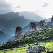
This stage leads to the Pordoi pass, on the border with the region of Trentino Alto Adige. The route is filled with traces of World War I. There are stunning views of the Dolomites from Mount Pelmo to the Sella range.

Point Segment
Name Services Information Marking
Pieve di Livinallongo
1470 m
| AD  1.3 km / 0h30
Sottil
1315 m
| BD  3.9 km / 0h15
Sottinghiazza
1446 m
| B  1.9 km / 0h30
Palùa - Ornela
1461 m
| BD  2 km / 2h00
Monti Alti d'Ornela
2160 m
| BD  3.5 km / 2h15
Passo Pordoi
2239 m
Detailed route description
Other long-distance trails and alternative routes
Alta via trail n. 2. the Arabba geological trail. Trail of the trenches. Climb to Piz Boè 3152m (EE). Visit the monument to Germans that died during the 1915-18 war.
Useful topographic maps
  • foglio 07 ~ Tabacco (1:25.000)
Useful guidebooks
Comments

Favourites, criticisms ? Make your personal comments on this stage. For more general notes please use the comments section of the page Over to the Via Alpinists.


max. 1000 characters
  • Olivier Hunziker - 2014-04-13
    This profile still hasn't been corrected ??!
  • Jean-Louis GIRAUD - 2014-03-08
    Depuis Pieve di Livinalongo,descendre pour traverser le torrent et rejoindre les hameaux de Sottil puis Sottinghiazza. Aprés une traversée, le sentier s'engage dans le Val d'Ornela. Arrivé au dessus de chalets vers 2200 m, j'ai préféré rejoindre le col / 2350 m situé a gauche de la Pointe Mesolina / 2642 m. L'intérét de cette variante est d'eviter les chemins de service en direction du Passo Pordoi pour rejoindre un magnifique sentier balcon, au dessus du Lac de Fedaia, en direction du Rifugio Viel dal Pan. Le sentier qui court le long de la montagne, reliant le Pas Fedaia au Pas Pordoi, était utilisé par les marchands de farine afin de traverser la région rapidement. C'est face aux glaciers de La Marmolada que j'ai passé la nuit. Bel endroit que ce nid d'aigle !
    Le profil de l'étape ainsi que les dénivellés seraient à vérifier.
    Rifugio Viel dal Pan :
    Tel. +39 0462 601 323
    mail:info@rifugiovieldalpan.com
    www.rifugiovieldalpan.com
    Automatic translation [Google]
    Since Pieve di Livinalongo descend to cross the river and reach the hamlets of Sottil then Sottinghiazza. After crossing, the trail enters the Val d'Ornela. Arriving at the top of cottages around 2200 m, I preferred to Col / 2350m located left of the Pointe Mesolina / 2642 m. The interest of this alternative is to avoid the service roads towards the Passo Pordoi to join a wonderful trail balcony above Lake Fedaia towards the Rifugio Viel dal Pan. The trail runs along the mountain, connecting the No No Fedaia Pordoi, was used by the merchants of flour to cross the region quickly. This is the face of the Marmolada glacier that I spent the night. Beautiful place this eyrie! The profile of the stage and the dénivellés be checked. Rifugio Viel dal Pan: Tel. +39 0462 601 323 mail: info@rifugiovieldalpan.com www.rifugiovieldalpan.com
  • Thierry M - 2014-01-26
    Monaco - Trieste
    the trail is poorly marked from Passo Pordoi to Pieve.GPX file download in August 2013 and VA description do not match.
    Rifugio Luigi Gorza 2440m is about 1h30 from Passo Pordoi in the skiing area
  • Olivier Hunziker - 2013-08-11
    Madame, Monsieur,
    Il y a un problème dans la desription de cette étape (B21, itinéraire jaune), en particulier avec le profil d'altitude: selon ma carte, Sottinghiazza est très proche de Sottil et ORnela n'est pas loin. Ce n'est pas ce qu'indique votre carte ou votre profil. Ensuite, je pense que le deuxième "lieu dit" de l'étape est "Monti Alti d'Ornela", etc. Sinon, votre profil d'altitude avec deux vallées de 1km de profondeur au milieu du parcours fait assez peur ! Meilleures salutations. Olivier
    Automatic translation [Google]
    Dear There is a problem in the desription of this step (B21, yellow route), especially with the altitude profile: according to my map, is very close to Sottinghiazza Sottil and Ornela is not far. It is not indicated what your card or profile. Then I think that the second "place called" step is "Monti Alti of Ornela", etc. Otherwise, your altitude profile with two 1km deep valleys in the middle of the course actually quite scary! Best regards. Olive
Last update : 2009-12-03
BESbswy