|
|
|
B20
|
Rif. Città di Fiume » Pieve di Livinallongo
|
|
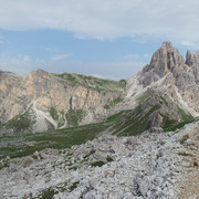
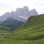
This is rather a long stage and mostly downhill. Along the way is an important archaeological site from the Mesolithic period, the burial place of the Mondeval man. The trail goes over the Giau pass. The long descent towards Pieve di Livinallongo affords fine views over Marmolada.
Detailed route description

From the Città di Fiume hut, trail 467 northwards follows the Alta via n. 1 trail. It leads through the Forca de la Puina pass (2034m), the Forcella de Col Roan pass (2075m – link to trail 458), the Malga Prendèra hut (2148m – link to trail 436), the Forcella Col Duron pass, around the foot of Mount Becco di Mezzodì (link to trails 434 - 466) to the Forcella Ambrizzòla pass (2277m). From there it is possible to follow trail 434 to the Croda da Lago-Palmieri hut (CAI – food and accommodation available – links to trails 435 & 466) with views over the Cortina d’Ampezzo valley. From the Forcella Ambrizzòla pass the Via Alpina trail continues along the Alta via trail n. 1, which takes a turn westwards and passes the extremely important archaeological burial site of the Mesolithic Mondeval man near the Malga Mondeval de Sora hut (2158m). It continues across the Mondeval habitat, skirting around the beautiful Lake Baste, below the overhanging cliffs of Lastoni di Formin, to the Forcella Giau pass (2360m – links to trail 465) and heads down into the valley below. Once past the Forcella di Zonia pass, it heads to the Giau pass (2236m, food and accommodation available).
There are bus links east to Cortina d’Ampezzo, west to Selva di Cadore (at the Museum see the Mondeval man graves, and reproductions of the Pelmetto dinosaur paw prints), the Staulanza Pass and the Zoldana valley on one side and Colle Santa Lucia, Caprile, Alleghe and Agordino on the other.
From the Giau pass head down, westwards, through fields to the Fedare hut (2000m, food and accommodation available – links to trail 464). Continue along gentle fields which command extensive views over the Marmolada range. Then take trail 441 to the SS48 road, near the fork to Andrai Castle (1804m).
Bus links to the Falzarego pass, Val Parola, Cortina d’Ampezzo to the east and Pieve di Livinallongo and Arabba to the west.
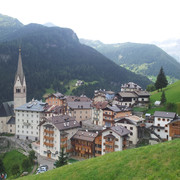
At the typical village of Castello, with the impressive remains of the Buchenstein castle (Sentiero delle Miniere del Fursil (old mining) trail – practice wall), the Via Alpina trail continues, steep at first, then gentle, to the small village of Agai (1776m) and, by road, to the village of Palla and the important town of Pieve di Livinallongo (1470m).
Museum of the History, customs and traditions of the Ladin People. Military Works of the Lana pass. Bus links north to Arabba, the Pordoi pass or Corvara and Val Badia; south to Caprile, Alleghe and Agordino.
(Regione Veneto)
Other long-distance trails and alternative routes
The Alta via n. 1 trail. Climbs to the peak and the Nuvolau hut 2575m (E). Climb to the Col di Lana pass 2452m (E).
Useful topographic maps
-
foglio 025 - 07 ~ Tabacco (1:25.000)
Useful guidebooks
-
Guida dei Monti d'Italia - Pelmo e Dolomiti di Zoldo ~ CAI-TCI (ISBN )
-
Dolomiti della Valle del Boite, ~ Edizioni Panorama (ISBN )
-
Via Alpina Gelber Weg, Evamaria Wecker ~ Bruckmann (ISBN 978-3-7654-4858-7)
Last update : 2009-12-03

 |
8h00 |
22.2 km
|
309 m
|
786 m
|
8h00 |
22.2 km
|
309 m
|
786 m





Favourites, criticisms ? Make your personal comments on this stage. For more general notes please use the comments section of the page Over to the Via Alpinists.