|
|
|
A56
|
Lenggries » Tutzinger Hütte
|
|
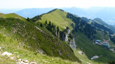
Via Alpina leads from Lenggries towards the west again along the Kaiser-Maximilian trail up to the Brauneck mountain. For those who would like to save themselves the long climb through the woods, it is also possible to take the Brauneck cable car. From the Brauneck, there is a leisurely hike at an altitude of 1,400-1,500m through mountain pines, alpine grass and sheer terrain along the Benediktenwand cliffs.
Detailed route description

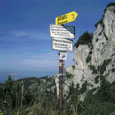
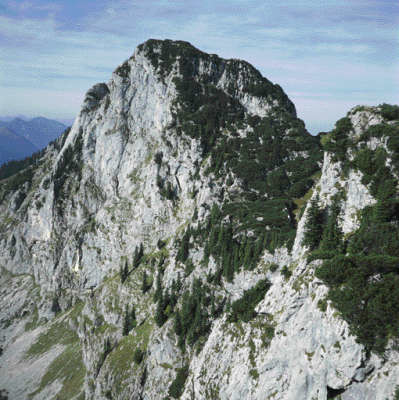
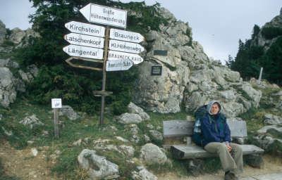
After crossing the Isar in Lenggries, follow the road towards the southwest to the valley station of the Brauneck cable car. The climb via the Reiseralm meadow is quite long, so you could very well take the mountain trip with the cable car. For those who wish to travel by foot, start off walking below the lift up along a wide hiking trail. The trail turns slightly to the right before reaching the Reiseralm meadow. Head through woodland and sometimes across meadows further uphill, and then again in a westward direction to reach the Garlandalm meadow. A steep upward walk across open terrain to the Brauneck summit and the mountain station of the Brauneck cable car. (approx. 3h) now follows. The trail now leads through alpine landscape below the Schrödelstein in a westward direction to the Stangeneck. From here, head to the south below the Vordere Kirchstein and continue following the ridge trail to the Latschenkopf peak. Next comes a descent towards the southwest through pine corridors to the Feichtecksattel pass between the Latschenkopf and Achselköpfe peaks. Now the trail changes to the north side of the ridge and leads westward through pines and partly across scrub below the Achselköpfe peaks to the Rotöhrsattel pass. Alternatively, you can also reach the Tutzinger Hut from the Rotöhrsattel pass via the Benediktenwand mountains (also with Via Alpina signposts, but only for the experienced). From there, a steep descent to the right and then an almost level stretch leads to a grassy ridge. Continue in hairpin bends to the west below the eastern section of the vast northern Benediktenwand with its numerous climbing routes down to the glorious setting of the Tutzinger Hut.
(Michael Kleider, Christina Schwann, OeAV)
Natural and cultural heritage
Ibexes have populated the Benediktenwand area again since 1959. An immigrant ibex was observed for the first time that year in the area. Later, two bucks and two does were added from Switzerland and then in 1971 another two does from the preserve of Neuburg an der Donau, but they soon perished due to their inability to adapt to mountain conditions. Nevertheless over the last 30 years at least, a colony of about 100 ibexes has formed, and recently animals were even released for hunting. The colony must in fact be maintained at 80 animals in order to avoid disease and food shortages. A bronze plaque was put up in the summer of 2004 on the large rock at the start of the Altweibersteig track (above the Bichler-Alm meadow) on which a brief rendering of the history of the ibex colony can be read. The model board, carved in wood, is kept at the Tutzinger Hut. In addition to the ibexes, another type of ibex from the goat family, namely the chamois, is native to the Benediktenwand.
(Michael Kleider)
Other long-distance trails and alternative routes
Maximiliansweg, E4
Useful topographic maps
-
Bad-Tölz, Lenggries u. Umgebung ~ Bayerisches Landesvermessungsamt München (1:50.000)
-
Nr. 7 Murnau - Kochel - Staffelsee, Nr.6 Walchensee - Wallgau - Krün ~ Kompass (1:50.000)
-
ÖK 50 87 ~ Bundesamt für Eich- und Vermessungswesen (1:50.000)
-
BY 11 Isarwinkel, Benediktenwand ~ Alpenverein (1:25.000)
Last update : 2011-08-17

 |
5h00 |
12.3 km
|
1225 m
|
582 m
|
5h00 |
12.3 km
|
1225 m
|
582 m


Favourites, criticisms ? Make your personal comments on this stage. For more general notes please use the comments section of the page Over to the Via Alpinists.