Hiking (mountain trail, in places narrow and exposed)
Alpine route (equipped or very exposed section, snow field, blocks)
B27
Bozen / Bolzano » Meraner Hütte / Rifugio Merano
|
6h55 |
27.5 km
|
3250 m
|
1556 m
Jenesien (1,100m) can be reached from Bolzano via cable car. From, the village of Jenesien, follow the approx. 20km track to the stage destination on Meran 2000, mainly on the European long-distance trail E5, which runs along the entire high ridge of the Tschögglberg. Refreshments along the way can be enjoyed at the Edelweiss and Langfenn inns and at the Möltner meadow.
From your accommodation in Bolzano, walk along the Talfer promenade along the water wall to reach the valley station of the cable car built in 1937 (study the map beforehand!), which will take you to Jenesien. This trip offers a wide-ranging view over the town of Bolzano, which lies in an extraordinarily fertile valley basin near the mouth of the Talfer, Eisack and Etsch rivers. Vineyards of worldwide repute flourish along the slopes of the Ritten and along the Guntschnaberg mountain. From Jenesien (1,087m) keep following the “E” markings to the north west for 1h, mainly on a moderate incline, up to the Edelweiss inn (1,351m). From there, continue on trail no. 1 (or E5) sometimes slightly up and downhill but overall on a rather level course through the extensive larch Salten meadowland to reach the Langfenn Hill (1,527m, inn), the highest point on the Salten. The Salten is the only high-alpine plateau in Europe with such a tremendous larch forest. From the Langfenn meadowland, walk for a short while downhill to the car park (Schermoos), from where the signs for the long-distance hiking trail must be followed up to the Rindlwiesen meadows or the Möltner Joch pass (1,733m), pastureland in the middle of vast larch clearings. At the same altitude, walk further through the Jöchlwald wood to the Möltener Kaser (catering). Still heading north, the European long-distance trail (E5) leads on a gentle incline to the Auener Jöchl pass. A detour to the “Stoanernen Mandln“ at the Schöneck should definitely be fitted in: the isolated rounded mountaintop high above Sarnthein offers views over many of the mountain ranges in South Tyrol. Via Alpina now runs along a high ridge on the Haflinger Ridge trail, over the Kreuzjoch pass (the highest peak of the ridge line) to the Maiser Rast and from there across flowery alpine pastures for only a few metres downhill to the Meraner Hut (1,960m), the stage destination. From the Möltner Kaser meadow, it takes approx. 2 hours to reach the destination. This is a relatively long stage covering 25km in total. However, it mainly covers flat or only slightly uphill terrain. Approx. 1km after the Möltener Joch pass, in the Rindlwiesen area, turn right from the gully trail onto track no. 4 (or E5) down to the Schermoos car park. This turn-off is not marked and would therefore be easy to miss. (Stefan Illmer, Karin Leichter, AVS)
Natural and cultural heritage
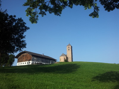
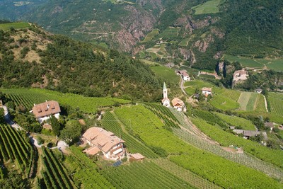
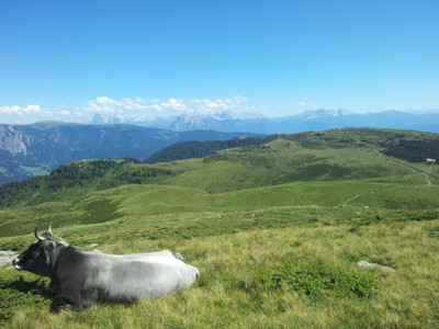
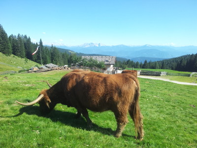
The vegetation of the Bolzano basin with its surrounding high plateaux and valley terraces is extraordinarily diverse. The Mediterranean flora stretches far into the low mountain region. Vineyards of superior grape varieties cover the slopes along the Etschtal valley, and also up the slopes of the Eisack valley and all of the terraces of the Bolzano basin. The Etschtal basin is one big orchard. Even in the side valleys, fruit is cultivated to the edge of the forest. Mixed and coniferous woodland climbs the slopes higher up. The glorious meadows and pastureland, such as on the Salten upland, are particularly characteristic. Geologically speaking, the area around Bolzano is known as the Bolzano porphyry plate. It stretches from Tisens in the west over the Salten in the north to the Karer pass in the east. The plate, which is the biggest volcanic mass of stone in Europe, is spread over the cracked and fissured quartz phyllite. The horseshoe-like Sarntal Alps surround the Sarntal valley, which runs from north to south, with their extensive mountainous terrain represent the geographical middle of South Tyrol. In the west and north west, they are hemmed in by the Etschtal and Passeiertal valleys. Old farmland covers vast sections of the Sarntal Alps. Farmers settled even far up the wooded slopes and wrested land for cultivation purposes from the forest through centuries of hard work. Beyond the forest boundary lie rolling meadows, many of which are used for cattle grazing in the summer. The Sarner Alps are above all mountain terrain for hikers still looking for natural, peaceful places. The Meraner Hut is the ideal base for numerous hikes over the high ridge of the Tschöggelberg and for mountain tours to the summits of the Ifinger and neighbouring mountains, or for crossing into the Sarntal valley. In the late 1960s, the Merano section of the Alpine Club of South Tyrol built the large house in the catchment area of today’s “Merano 2000“ winter sports resort. In memory of the Merano mountaineer who promoted this club section, the hut was given the name of “Hermann-Gritsch-Haus“.
(Stefan Illmer, Karin Leichter, AVS)
Other long-distance trails and alternative routes
Long distance trails: E5 (Bodensee-Adria) and "Sarner Hufeisentour" (Sarntal Alps trail).
Useful topographic maps
Nr. 53 Meran und Umgebung ~ Kompass (1:50.000)
Nr. 034 und 011 ~ Tabacco (1:25.000)
WKS 1 ~ Freytag & Berndt (1:50.000)
Useful guidebooks
Lexikon 53 Meran und Umgebung ~ Kompass (ISBN 3-85491-059-2)
Lexikon 54 Bozen ~ Kompass (ISBN 3-85491-061-4)
Wanderführer Rund um Bozen ~ Rother (ISBN 3-7633-4290-7)
Favourites, criticisms ? Make your personal comments on this stage. For more general notes please use the comments section of the page Over to the Via Alpinists.
Décidé de nous arrêter dans la ferme auberge de http://www.pirchhof.com/
Très bon accueil, eau chaude à volonté et beau décor. On est en plein Tyrol, à quelques heures de marche de l'Autriche et certains ici ne parlent pas du tout italien.
Automatic translation
[Google]
Decide to stop us in the farmhouse hostel http://www.pirchhof.com/ Very welcome, hot water at will and beautiful scenery. We are in the middle of the Tyrol, a few hours walk from Austria and some here do not speak Italian at all.
Attention à ne pas se tromper de télécabine. Le premier qu'on rencontre à Bolzano nous emmène à Oberbozen et non pas à Jenesien. Mais ce télécabine qui ne coûte que 6 CHF vaut vraiment le détour. Au dessus de Dorf Tyrol, le chemin qui longe la falaise est mémorable, sublime!
Automatic translation
[Google]
Be careful not to go wrong with a gondola. The first one we meet in Bolzano takes us to Oberbozen and not to Jenesien. But this gondola that costs only 6 CHF is really worth seeing. Above Dorf Tyrol, the path along the cliff is memorable, sublime!
Jean-Louis Giraud - 2014-03-19
Longue étape avec peu de dénivelé, qui se déroule dans les bois, puis au milieu d'alpages bien séparés par des barrières en bois, et enfin sur de vastes espaces de landes herbeuses et de paturages. Attention aux orages sur les crètes !
Le Rifugio Merano est un gite offrant des prestations de grande qualité.
Automatic translation
[Google]
Long stage with low gradient, which takes place in the woods and then to the well separated by wooden barriers alpine environment, and finally over large areas of moorland and grassy pastures. Beware of thunderstorms over the ridges! Rifugio Merano is a cottage offering high quality services.
Monaco - Trieste
Great location for bivouac near Moltner meadow
For people avoiding cable cars it takes about 1h30 to walk down to Bolzano from Jenesien (mostly on road, steeply down)
The campingplatz in Bolzano is way off the Via Alpina, tourist office by the main place
Mountain Girl - 2012-10-16
This is an absolutely lovely stage, crossing high mountain meadows with splendid views. Meraner hut is very comfortable: more like a 'pension' than a true mtn hut.

 |
6h55 |
27.5 km
|
3250 m
|
1556 m
|
6h55 |
27.5 km
|
3250 m
|
1556 m


Favourites, criticisms ? Make your personal comments on this stage. For more general notes please use the comments section of the page Over to the Via Alpinists.