Create your own guidebook
Download track
Quality : rough
GPX KML CSV
Location
Italy
Veneto
Belluno
Calalzo di Cadore - San Vito di C. - Borca di C.
M: Antelao - Marmarole - M. Pelmo

Key to symbols   
Stage point (start or end of stage)
Intermediate accommodation possibility
Summit
Pass
Town, village
Other locality

Catering
Doctor
Chemist
Bakery / grocery
Hardware / sports shop
Post
Bank / cash dispenser
Train
Coach
Taxi
Open automobile access

A Tarred or paved road
B Dirt track
C Mule trail
D Mountain trail
E Equipped trail (cables, ladders)
F No trail

Stroll / tourism (broad, non-exposed trail)
Hiking (mountain trail, in places narrow and exposed)
Alpine route (equipped or very exposed section, snow field, blocks)
B19 Rifugio P. Galassi » Rif. Città di Fiume
  |   6h40   |   17.3 km   |   2250 m   |   2351 m

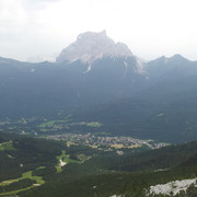
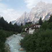
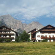
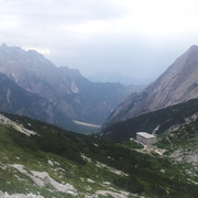
From the Galassi hut, past the historic San Marco hut, the trail descends into the Boite valley to San Vito di Cadore, a few kilometres from Cortina d'Ampezzo. On the other side of the valley the climb ends at the Città di Fiume hut. Looming over it is the imposing north face of Mount Pelmo.

Point Segment
Name Services Information Marking
Rifugio P. Galassi
2018 m
| D  1.3 km / 0h20
Forcella Piccola
2120 m
| D  1.6 km / 0h50
Rif. San Marco
1823 m
| BD  1.1 km / 0h40
Rif. Scotter-Paladini
1580 m
| AB  3.9 km / 1h00
S. Vito di Cadore
1010 m
| A  1.7 km / 0h35
Serdes
1000 m
| BD  4 km / 3h00
Forcella Forada
1977 m
| D  3.7 km / 0h15
Rif. Città di Fiume
1917 m
Detailed route description
Other long-distance trails and alternative routes
Alta via trail nos. 4, 5, 3 & 1.
Useful topographic maps
  • foglio 025 ~ Tabacco (1:25.000)
Useful guidebooks
  • Guida Monti d'Italia - Dolomiti or. Vol I parte 1^ ~ CAI-TCI (ISBN )
  • Dolomiti del Cadore, C. Berti e R. Tabacchi ~ Edizioni Panorama (ISBN )
  • Antelao-Sorapiss-Marmarole, L. Visentini ~ Athesia (ISBN )
  • Via Alpina Gelber Weg, Evamaria Wecker ~ Bruckmann (ISBN 978-3-7654-4858-7)
Comments

Favourites, criticisms ? Make your personal comments on this stage. For more general notes please use the comments section of the page Over to the Via Alpinists.


max. 1000 characters
  • Po & Ju - 2018-11-06
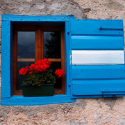
    Depuis le refuge Galassi, la descente vers San Vito est une belle traversée de versant, jusqu’au fameux refuge San Marco. Volets Bleus, géraniums aux fenêtres, vue à 360°, et belvédère en bois avec table et bancs (possibilité de pique-nique ou pause grignotage au belvédère … ). Ce refuge vaut le stop, malgré un accueil assez froid de la part des gardiens. La descente finale jusqu’à San Vito est longue et raide, armez vous de patience et de bâtons de marche pour éviter les articulations trop douloureuses ! Nous nous sommes arrêtées quelques jours à San Vito (juste à coté de Cortina d’Ampezzo, la ville principale de tourisme) pour profiter de la proximité des Tre Cime et des massifs au alentours (via ferrata, randonnées…)
    Automatic translation [Google]
    From the Galassi refuge, the descent to San Vito is a beautiful crossing of the slopes, to the famous San Marco refuge. Blue shutters, geraniums windows, 360 ° view, and wooden gazebo with table and benches (possibility of picnic or snack nibbling at the belvedere ...). This hut is worth the hitch, despite a fairly cold welcome from the guards. The final descent to San Vito is long and steep, arm yourself with patience and walking sticks to avoid too painful joints! We stopped a few days in San Vito (just next to Cortina d'Ampezzo, the main tourist town) to enjoy the proximity of Tre Cime and nearby mountains (via ferrata, hiking ...)
  • Jean-Louis Giraud - 2014-03-08
    Peu aprés avoir traversé San Vito di Cadore, prendre la direction de Serdes par un court passage sur route, puis traverser le village pour retrouver le balisage. Poursuivre sur une route forestière dans les bois avant de rejoindre la Forcella Forada par un bon sentier.
    Le dénivelé ainsi que le profil de cette étape, au final longue mais facile, sont à verifier...Je ne pense pas avoir effectué les dénivelés indiqués sur le topo !
    Réservation indispensable au Rifugio Citta di Fiume...Petite capacité d h'ébergement sur un itinéraire trés fréquenté.
    Douche chaude
    Automatic translation [Google]
    Shortly after crossing San Vito di Cadore, take direction Serdes by a short stint on the road, then through the village to find the markup. Continue on a forest road in the woods before joining the Forcella Forada by a good path. The altitude and the profile of this stage, the final long but easy to check are ... I do not think making the gradients shown on the topo! Booking essential at Rifugio Citta di Fiume ... Small capacity h'ébergement on a very busy route. Hot shower
  • Thierry M - 2014-01-26
    Monaco - Trieste
    From Rif. Scotter-Paladini there is a shortcut trail (steeper) to reach Forcella Piccola and avoid cute rifugio San Marco
    There is also an operating skier lift from san vito to nearby rif Scotter
  • Thierry M - 2014-01-26
    Monaco - Trieste
    Just before Serdes, there is a big roof (no walls) with table & bench + BBQ fireplace
    Forcella Forada - Serdes est assez long, mis 3h avec une longue pause cafe/lessive en chemin (ruisseau)
    Automatic translation [Google]
    Monaco - Trieste Just before Serdes, there is a big roof (no walls) with table BBQ & fireplace Forcella Forada bench - Serdes is long enough, put 3h with a long pause cafe / laundry path (stream)
  • Olivier Hunziker - 2013-08-11
    ...et il y a environ 7km (et non 4 comme indiqué) entre Serdes et Forcella Forada.
    Olivier
    Automatic translation [Google]
    And ... there are about 7km (not 4 as shown) between Serdes and Forcella Forada. Olivier
  • Olivier Hunziker - 2013-08-11
    Bonjour,
    Je pense que le profil d'altitude, et probablement aussi la dénivellation, son erronées: entre Forcella Forada et le Rifugio Citta di Fiume, il y a 1km et 50m de descente.
    Olivier
    Automatic translation [Google]
    Hello, I think the elevation, and probably also drop his wrong: between Forcella Forada and Rifugio Citta di Fiume, there is 1km and 50m descent. Olivier
Last update : 2011-08-15