|
|
|
B15
|
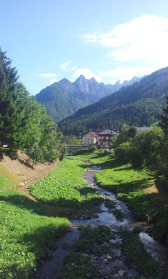
Sauris di Sotto » Forni di Sopra
|
|
From Sauris di Sotto the trail goes past Casera Pieltinis, through the Rioda pass to Casera Razzo. Once over the Croce di Tragonia gap the trail leads down to Casera Tragonia and on to Forni di Sopra.
Detailed route description

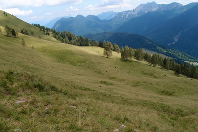
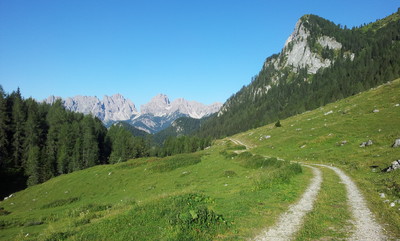
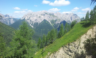
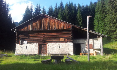
From Sauris di Sotto trail 218 climbs to Casera Pieltinis, where it meets trail 206, which runs across the green slopes of Mount Pieltinis (1934m) and Mt. Morgenlait. Down at the Festons pass (1855m) is the intersection with trail 204, which leads up from the village of Sauris di Sopra below and heads on northwards to Val Pesarina. Switch briefly to this trail, heading downwards, and then head west across the slopes of Mount Festons, Mount Oberkofel and Mount Rioda, about halfway up the slopes. From the rubble-covered vale of Mount Pezzocucco, the trail leads to the Rioda pass (1800m) and joins the Sauris – Razzo provincial road. Follow the road for a stretch. Head over the Razzo pass (1775m) to the Casera Razzo hut (1739m), beyond which trail 209 heads up to the Forca della Croce di Tragonia or Risumiela gap (1973m). The trail heads over the ridge that lies between Mount Bivera and Mount Tiarfin to reach Casera Tragonia (1760m) from where there are splendid views over the Tagliamento valley. At the bottom of the valley lies the village of Forni di Sopra with its picturesque outlying hamlets. Ahead are the jagged peaks of the Monfalconi range, that separates this valley from the Cimoliana valley, containing the Dolimiti Friulane park. To the west are the Cadore Dolomites. Follow trail 209 downwards to Malga dell’Aip (1598m), and then on to the hamlet of Vico (901m) near Forni di Sopra.
(Regione Friuli Venezia Giulia)
Natural and cultural heritage
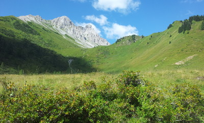
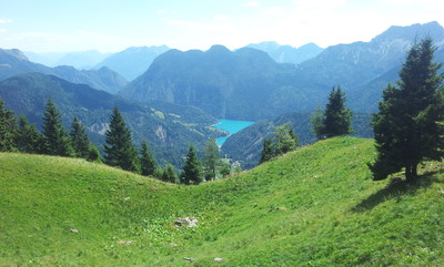
From the Sella di Rioda pass, the impressive erosion phenomenon that has produced horizontal stripes across Mount Pezzocucco can be seen. From the Sella di Razzo pastures there are splendid views right across the Pesarina Dolomites, from east to west, extending to the peaks that border with the Oltre Piave area and those of Mt. Comelico, over the Bivera-Clapsavon mountain range and the emerald basin of Lake Lumiei to the south.
(Regione Friuli Venezia Giulia)
Useful topographic maps
-
02 ~ TABACCO (1:25000)
-
Foglio B ~ TABACCO - Carnia Trekking (1:25000)
Useful guidebooks
-
Andar per monti in Friuli Venezia Giulia ~ Istituto Geografico de Agostini (ISBN 88.402.9640.9)
-
Dolomiti di Sinistra Piave e prealpi carniche ~ Edizioni Dolomiti (ISBN 88.85080.04.9)
-
Alpi Carniche, vol. II ~ CAI - TCI (ISBN 88.365.0807.3)
-
Via Alpina Gelber Weg, Evamaria Wecker ~ Bruckmann (ISBN 978-3-7654-4858-7)
Last update : 2009-12-03

 |
7h00 |
23 km
|
332 m
|
705 m
|
7h00 |
23 km
|
332 m
|
705 m


Favourites, criticisms ? Make your personal comments on this stage. For more general notes please use the comments section of the page Over to the Via Alpinists.