Hiking (mountain trail, in places narrow and exposed)
Alpine route (equipped or very exposed section, snow field, blocks)
B10
Passo di Tanamea » Resiutta
|
13h15 |
48 km
|
1403 m
|
1996 m
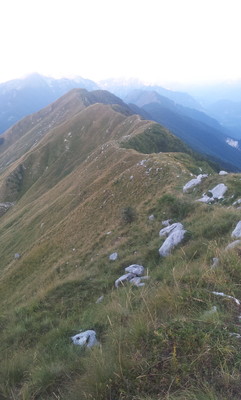
Trail 727 climbs to the Bocchetta di Zaiavor pass and on to Sella Carnizza. Trail 731 runs the length of the ridge above Uccea Valley. Near Mt. Guarda there is a fork. Trail 741 leads to Casera Coot. Trail 731 goes to Coritis and the road to Stolvizza. From here trail 643 climbs to Casera Lom, meets trail 632 which leads to the Curnic Pass and trail 631 leads to Resiutta.
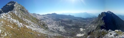
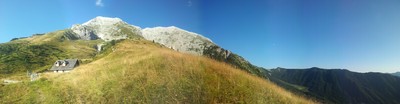
Trail 727 heads into the Prealpi Giulie Nature Park and up to the Bocchetta Zaiavor pass (1608m) and the church of Sant’Anna di Carnizza. The trail meets trail 739 to the Sella Carnizza pass (1077m), after which take trail 731 along a long ridge at the top of Val Resia valley, passing a number of peaks and passes as it winds up and down. These include: Mount Nische, the Pradolina pass, Mount Plagne, Mount Guarda (from where trail 741 leads up to the Casera Coot agriturismo (hotel/restaurant) and the Manzano Bivouac (1650m). From here the ”Alta Via Resiana” trail heads off to the Canin plateau, an area of great speleological interest, with underground shafts up to 800 metres deep. From the Manzano Bivouac head past the Casera Berdo di Sopra hut (from where an alternative route leads down to the Agriturismo di Casera Coot hotel/restaurant), past Stavoli Besa (888m) and then the road leads to Coritis (641m) and on to Stolvizza (573m). From Case Ladina, Stolvizza, trail 643 climbs towards the Igor Crasso hut (was the Regina Margherita hut) and the turning on the left leads to trail 632 across the Pusti Gost. Here take trail 631 which runs the full length of Val Resia about halfway up the slope, passing, in order, Tana Cope, Stavoli Segata, Stavoli Rut, Puschi Ur, Stavoli Ruschis and Stavolo Schiampon. At an altitude of 476m, below Mount Chichi, the trail descends to the mouth of Val Resia at Resiutta (317m). The ethnic identity of this valley, that lies to the west of the Canin range, is extremely interesting. The language spoken and the popular music tradition derive from ancient Slav. (Regione Friuli Venezia Giulia)
Natural and cultural heritage
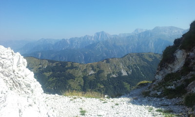
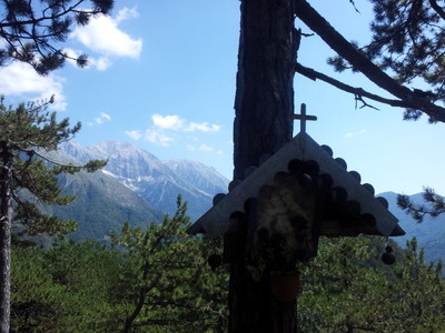
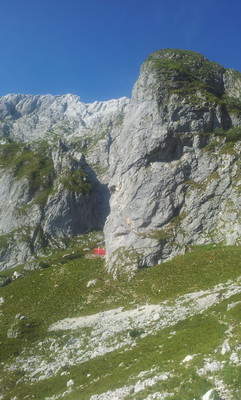
The mountain surroundings culminate in the Mt. Canin range. It lies within the Prealpi Giulie Nature Park and includes the whole of the extremely broad and long Resia valley (20 km) and the mountains that surround it. The great wall of the Mount Musi peaks is extremely unusual in shape. It is over 6 km long and very distinctive due to the remarkable geological phenomena on its surface (Karst) and the varieties of flora and fauna (lynx and brown bear), as well as the presence of people and architectures that are typical of Slavic culture and ethnicity. The local dialect and music is interesting, seen mostly during the carnival at Resia. The park has much of interest to offer: guided tours of the park and of the house during which the visitor is provided with thorough information in the most modern formats. Upon leaving the Resia valley, where the Resia stream joins the River Fella, the village of Resiutta is to be found, with a hotel, shop and a few trattorie (restaurants).The Venice-Udine-Tarvisio-Vienna railway passes through here, and there is a station. (Regione Friuli Venezia Giulia)
Other long-distance trails and alternative routes
Alta Via Resiana.
Useful topographic maps
027 ~ TABACCO (1:25000)
Useful guidebooks
Andar per monti in Friuli Venezia Giulia ~ Istituto Geografico de Agostini (ISBN 88.402.9640.9)
Favourites, criticisms ? Make your personal comments on this stage. For more general notes please use the comments section of the page Over to the Via Alpinists.
Jean-Louis GIRAUD - 2014-02-28
Le deuxième jour de l'étape, j'ai rejoint l'itinéraire suivant le bailsage 631. C'est un large chemin forestier qui parcourt les crètes sud du Val Resia au mileu de vastes espaces boisés avant de redescendre sur le petit village de Povici, puis remonter aux chalets de Lavorada, traverser la rivière FELLA et arriver dans le vieux bourg de Moggio Udinese. Prévoir une reserve d'eau. Sur l'itinéraire j'ai trouvé un seul point d'eau non loin d'un oratoire militaire, à l'intersection des sentiers 638 et 631 au dessus de Prato di Resia.
Albergo Leon Bianco
Piazza Uffici,4
Moggio Udinese
+39043351114
www.albergoleonbianco.info
Email: albergoleonbianco@tin.it
Automatic translation
[Google]
The second day of stage I joined the route along the 631 bailsage It is a wide woods road that runs through the southern ridges of the milieu Val Resia extensive forests before descending to the village of Povici then back to the chalets Lavorada, cross the river and reach FELLA in the old village of Moggio Udinese. Provide a reserve of water. On the route I found a single point of water not far from a military chapel, at the intersection of 638 and 631 trails above Prato di Resia. Albergo Leon Bianco Piazza Uffici, 4 Moggio Udinese www.albergoleonbianco.info 39043351114 Email: albergoleonbianco@tin.it
Jean-Louis GIRAUD - 2014-02-28
J'ai été surpris par la beauté du Val Resia. Malheureusement, les difficultés pour obtenir des informations sur l'état des sentiers et les hebergements resteront aussi la marque de cette vallée, par ailleurs classée en espace naturel protégé, mais qui mériterait plus d'attention.
J'ai parcouru l'étape sur deux longues journées. Le premier jour, depuis le Passo di Tanamea j'ai rejoint la brèche du Zaiavor avant de redescendre sur St Anna di Carnizza puis parcourir la Crète du Monte Nische par un mauvais sentier envahi par de hautes herbes.Surpris par l'orage et le brouillard, j'ai rejoint le fond du vallon à l'Auberge Malga Coot avant de prendre la direction de Stolvizza puis Prato di Resia par un long trajet penible. Dans ce bourg, j'ai trouvé un hébergement :
Albergo Alle Alpi
2,Via San Giorgio
Tel :+390433553912
33010 RESIA (UD)
alle.alpi@gmail.com
L'auberge est fermée le mercredi.
Pharmacie et epicerie dans le village.Prévoir des réserves d'eau !
Automatic translation
[Google]
I was surprised by the beauty of Val Resia. Unfortunately, the difficulties in obtaining information on trail conditions and accommodations will also remain the hallmark of this valley, also classified as protected natural area, but that deserves more attention. I went through the stage on two long days. On the first day, from the Passo di Tanamea I joined the breach of Zaiavor before returning to St Anna di Carnizza then browse Crete Monte Nische invaded by an evil high herbes.Surpris by storm path and fog I joined the valley floor at the Inn Malga Coot before taking the direction of Prato di Resia Stolvizza then a long drive painful. In this town, I found accommodation Albergo Alle Alpi 2, Via San Giorgio Tel: 33010 390 433 553 912 RESIA (UD) alle.alpi@gmail.com The hostel is closed on Wednesdays. Pharmacy and grocery in village.Prévoir water supplies!
Monaco - Trieste
Val Resia was the toughest (but one of my fav) area to hike through on my Via Alpina Journey. The lack of information did not help.
From Sella Carnizza it need to go up to 1610m in 1h30 (not mentionned still in the VA roadbook)
It need an extra hour to reach a road at Passo di Tanamea 890m (not even water there)
For water and food head to rifugio Aperta which is about 2h away up...it is not a CAI rifugio (ex military but who cares..a roof is a roof) and off Via Alpina but it is just below Punta Montemaggiore
Monaco - Trieste
From casera Canin to Monte kanin it took me 6h return to get up there at 2587m.
Casera Canin will have rain water if you are lucky.
Malga Coot is only 1h away from casera canin. it is off the Via Alpina but you can get water/food and even a bed if needed (B&B at 26euros)
Malga Coot - Bivacco Constantini about 1h15 and the best possible location of the Val Resia..no water there
Bivacco Constantini - Sella Carnizza (water/bar/restaurants) is about 3h30 on a stunning ridge hike
Monaco - Trieste
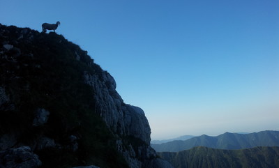
Val Resia is a tough, wild but awesome area. The Via Alpina goes around almost all of the Val Resia and it really worth doing it and more.Variantes or an excursion to Monte Kanin is highly recommended. Lots of possible shortcuts/bypass too.
In between Resiutta and Stolvizza there is only ONE water spot (that is visible/marked 20m off forestry trail at 1190m), there are others water spots but only locals now them
The trail in that area is poorly marked (did not passed by prato di resia), I also missed ricovero Igor Crasso. if you get there there is a trail up to Monte Kanin..no need to get low to Stolvizza like I did but if you want water/food you will need to come close to the Resia fiume.In Stolvizza the grocery store is runned/opened by the girl from the bar (almost can get grocery at any hour if the bar opened)
Stolvizza - Casera Canin is about 3h30 (wrongly mostly followed the road, good luck trying to find the trail)
Carol - 2013-11-01
After Chiessetta Sella di Sagata (above Prato di Resia at the intersection of 631 & 638), trail 631 does not continue as shown on the map. Instead, it continues NW along the dead-end road past the intersection and turns left near the end of the road. The section from there to the road at St. li Rud is meandering, overgrown and obviously poorly travelled, with lots of ticks.
Via Alpina International Secretariat - 2013-02-25
In the German guidebook "Via Alpina Gelber Weg" (out of print but still available from some bookshops) Evamaria Wecker suggests to divide this stage in three days. Accommodation is in the recent unmanned hut Casera Canin, then in Prato di Resia (in the Nature Park's foresteria or the private inn Alle Alpi). She recommends to then walk all the way to Moggio Udinese in order to shorten stage B11.
EllieSektionBritannia - 2011-10-03
Having stayed at Ai Ciclamini, which is a holiday centre and restaurant to the west of Passo Tanamea, we walked back up the next morning and found an old building at Passo Tanamea near where the road crosses the river: the roof was badly damaged probably by snow, and this may be the building referred to by "radagast" in 2009. We went over Sella Carnizza (2 newish restaurants and several small holiday chalets owned by locals) and Casera Nische, which is a ruined building from WW1, to Prato di Resia. The stage is far too long and would need 3 days to do it properly. We stayed at the Albergo Alle Alpi in Prato, very good food. Go and see the knife-grinders museum in Stolvizza, very interesting.
joan miller - 2010-07-26
Casera Coot was closed in late June 2010. The park authorities are very helpful at Resiutta and Pian dei Ciclamini. It is far too long to do as one stage.
wir waren 14 tage auf dem gelben weg unterwegs, bei dieser etappe von geplanten 48km !!! war am ende die unterkunft am passo di tanamea geschlossen. alles sieht sehr heruntergekommen aus - somit war nicht klar ob hier überhaupt nochmal aufgemacht wird.
Automatic translation
[Google]
We were 14 days on the yellow off the road, at this stage of the planned 48km! was closed at the end of the accommodation at the passo Tanamea Tues. everything looks very run down - so it was not clear whether this is ever opened again.

 |
13h15 |
48 km
|
1403 m
|
1996 m
|
13h15 |
48 km
|
1403 m
|
1996 m


Favourites, criticisms ? Make your personal comments on this stage. For more general notes please use the comments section of the page Over to the Via Alpinists.