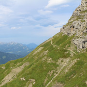
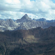
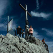
From the Prinz-Luitpold-Haus lodge, follow the Heilbronner Weg route until reaching the Schönberg hut. From here, walk uphill to the flowery Laufbacher Eck peak. Via Alpina follows the trail offering great views northwards to the Edmund-Probst-Haus lodge. From there, Oberstdorf can be reached either with the Nebelhorn cable car or by foot.
Detailed route description

From the Prinz Luitpold lodge, cross the scree-strewn slope below the Wiedemer Kopf peak to reach the grassy north-western ridge of the Wiedemer. Then follow the marked path through an alder thicket and steep grassy slopes to the lowest point of the trail (1,597m). Ignore the turnoff to the Giebelhaus lodge on the right and continue to the Schöneberg Alp. There, keep to the right in the direction of Laufbacher Eck, leaving the Red Trail of Via Alpina and reaching the Ochsen Alp across the undulating terrain (location of a mountain rescue base), to continue steeply uphill in hairpin bends to the Laufbacher Eck at 2,105m. On the other side, descend into the pass before the Lachenkopf peak and along the southern side of the Schochen onto the pass before the Kleiner Seekopf. Always staying on the western side of the ridge, walk along the grassy slopes of the Zeiger, which are of botanical interest, and then head north to the Edmund Probst lodge at 1,920m. The Edmund Probst lodge offers accommodation facilities and impressive sunsets. The Nebelhornbahn cable car offers a pleasant alternative way of reaching the valley. Otherwise, start off walking down the steep forest road to the See Alp and once there continue to follow the now tarred road. The walk down along the enchanted Faltenbach stream to Oberstdorf is admittedly a lovely alternative.
Head from Oberstdorf on the road and forest trail via the See Alp to the Edmund Probst lodge, or alternatively take the Nebelhornbahn cable car. From there, walk over the grassy slopes of Zeiger and Schochen to the Laufbacher Eck. On the other side, head steeply down in an eastward direction to the Ochsenalpe (mountain rescue base) and on to the Schönberg Alp. From here head over the "Gries" to the Prinz Luitpold lodge.
(Matthias Hill, DAV-Section Allgäu-Immenstadt)
Natural and cultural heritage

Oberstdorf, “the uppermost village” (in the valley), where the Breitach, Stillach and Trettach rivers meet at the River Ill, was founded in the 6th century. Discoveries from the Mesolithic era were indeed made in the valley basin of Oberstdorf and on the Nebelhorn peak, a cowbell and other things dating back to the Bronze Age have been found, but it owes its establishment as a perment settlement to the Alemanni who came here at the time of the Migration Period. Oberstdorf is surrounded by a wreath of well-known mountain peaks and today is famous as a spa and winter sports resort. The successful “car-free Oberstdorf” project has been running since 1992. The traffic in the town centre has been dramatically reduced and it has been possible to achieve air quality rating 1 again. The Laufbacher Eck, a high-alpine pastureland area in the heart of the Allgäu grass mountains, boasts flowers that have become rare in the Bavarian Alps. In addition to the sulphur yellow anemone, there are for instance still large quantities of edelweiss. One of the most beautiful ravines in the northern Limestone Alps has the hard Schrattenkalk limestone and the erosive force of the water to thank for its existence. The Breitach river, one of the three distributories of the Ill, has carved itself into the hard rock since the last Ice Age, thus creating the Breitachklamm ravine (referred to locally as the “Zwing”) near Oberstdorf. Over almost two kilometres in length, the Breitach river has broken through a limestone plate here and thus created rock walls of up to 100 metres in height. Enormous watermills and potholes demonstrate the mighty erosive power of the torrential water, which digs about 1 centimetre each year further into the rock. The ravine was opened in 1905 and today it attracts approximately 300,000 visitors yearly.
(Michael Kleider)
Useful topographic maps
-
Allgäuer Alpen ~ Bayerisches Landesvermessungsamt München (1 : 50000)
-
WK 351 Allgäuer Alpen - Lechtaler Alpen ~ Freytag&Berndt (1:50.000)
-
Nr. 3 Allgäuer Alpen - Kleinwalsertal, Nr. 4 Füssen - Außerfern ~ Kompass (1:50.000)
-
ÖK 50 114, 113 ~ Bundesamt für Eich- und Vermessungswesen (1:50.000)
Last update : 2014-08-27

 |
5h15 |
17.9 km
|
681 m
|
1698 m
|
5h15 |
17.9 km
|
681 m
|
1698 m


Favourites, criticisms ? Make your personal comments on this stage. For more general notes please use the comments section of the page Over to the Via Alpinists.