Hiking (mountain trail, in places narrow and exposed)
Alpine route (equipped or very exposed section, snow field, blocks)
A60
Garmisch-Partenkirchen » Linderhof
|
7h35 |
28.4 km
|
953 m
|
722 m
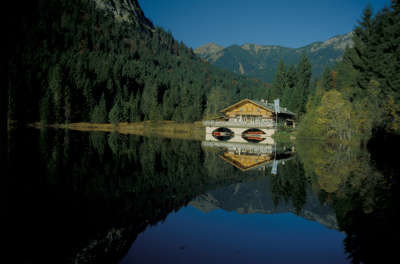
This is, admittedly, a very long stage, but it leads across very varied terrain from the lovely Pflegersee lake over the breathtaking mountain world of the western Ammer range to the almost untouched Elmaugrieß. And the grand finale: Castle Linderhof, the former residence of Ludwig II, King of Bavaria.
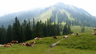
From Garmisch-Partenkirchen, follow the Kellerleitensteig track to the Pflegersee lake. The hiking trail leads through the wood on a slight incline to the beautiful setting of the Pflegersee lake, where the inn invites you for a rest. At the inn, follow the trail leading to the north and keep to the left. After the little clearing, the trail takes a turn to the south and becomes somewhat steeper. The scree trail soon becomes a narrow track that winds its way south of the Lahnenwiesgraben rift through the wood. It leads uphill to over 1,000m, partly over open terrain at the foot of the Königsstand. It descends for a short distance through the wood but then climbs uphill to over 1,100m before the track turns to the north and leads downward through woodland. You will soon come to a forest road. Follow it, keeping to the left, for a short distance uphill. After the hairpin bend, a scree trail turns to the left towards the east. Follow it on a steady, gentle incline. The trail becomes narrower and is soon only a path. Suddenly, it becomes a forest road that turns in a curve to the north. A track in the curve branches off northward to the Enningalm meadow. After a few metres in altitude, you will come to a hiking trail coming from the east. Follow it westward to the left to reach the Enningalm meadow (approx. 2h 10min). From the Enningalm meadow, follow the hiking trail downhill to the north. There is a steep descent through mixed mountain woodland until reaching the trail from the Stepbergalm meadow. From here, the trail widens out and is no longer so steep. Continue down at a leisurely pace to the Rotmoosalm meadow. Here, take the forest road turning to the north west across the pastureland and keep to the right. Via Alpina leads northward towards the mouth of the Elmau valley. After the little bridge, keep to the left and follow the forest road through the wood on the right-hand eastern bank of the Elmau. Cross the Elmau stream at a bridge. After a short distance, another forest road turns off to the left at a right angle. Follow it until a track towards the north turns off to the right. Follow this track to reach the Kuchelbach stream, which must be crossed. From the Kuchelbach hut, keep following the Fürstenweg trail to the north and the valley mouth. Just before the main road, a forest road turns off to the left that must be followed towards Höllgraben. Take the second turnoff on the right and then keep to the left again. At the little bridge, keep to the right and follow the scree trail. At the main road, turn left to the first houses. Here, cross the main road and follow the access road to Linderhof Castle. (Christina Schwann, OeAV)
Natural and cultural heritage
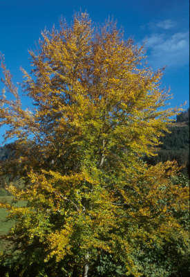
The legendary Bavarian King Ludwig II (also called “Kieni”) had Linderhof Castle built as an intimate retreat. It was built in the 1870s and is the only castle of the “fairytale king” that was entirely completed while he was still alive. This is where the melancholic monarch, tired of office, wanted to withdraw from the ceremonials of court. A lake nestles in the artificial grotto of the castle park, on which Ludwig was driven about in the shell-shaped boat. The circumstances of his death will probably never been explained – he drowned on 13 June 1886 in the Starnberg lake, two days after he was declared mentally ill and incapacitated. Ettal with its famous monastery is only nine kilometres away from Linderhof. It was founded in 1330 by Emperor Ludwig the Bavarian. Legend tells of a white Madonna who in the same year brought the monarch here from an Italian campaign, where he established the monastery in her honour. He manned it with Benedictine monks and founded another knights’ order, although it was only short-lived. Ettal developed into a world-famous place of pilgrimage dedicated to the Virgin Mary. In 1744, a major fire damaged the monastery, which was restored by 1745 under the management of Schmuzer, the monastery architect, partly according to the plans of Enrico Zuccalli. The medieval part in the centre was thus preserved and given a baroque dome. Almost all of the monastery buildings fell victim to the secularisation of 1803. In 1900, the monastery again came into the possession of the Benedictine order, and in 1907 Ettal became an abbey once more. Parts of today’s monastery building, built in the 20th century, now accommodate a boarding school. The Ammergau Alps is a many-peaked mountain area that follows on to the west between Loisach and Lech from the Estergebirge range. They are often also called the Ammergebirge mountains (after the Ammer river) and form a subgroup of the Bavarian Prealps. Within the Ammergebirge mountains, there are differences between the various mountain groups. While the northernmost groups are soft and round in shape (flysch zone), steeper forms dominate in the south, although less in the form of steep walls than of sheer rock faces. On the Klammspitzkamm ridge, and also in parts of the Hochplatten and Säulings groups in the west, grass-covered mountains with little rocky peaks occur along the summit line. The higher summits lie in the Kramer, Kreuzspitz and Daniel areas (east, middle and south), composed of a mighty layer of main dolomite together with limestone (platy limestone), a part of the Lechtal nappe that was moved here during orogenesis. The so-called “Grieße” are scree patches with little vegetation brought about by the dolomite, which splinters into small particles. (Michael Kleider)
Other long-distance trails and alternative routes
Possible to take the Karmersteig track via the Kramerspitz to the Stepbergalm and Rothmoosalm meadows. Owing to the great difference in altitude, however, this is much more strenuous and time-consuming than the normal route.
Favourites, criticisms ? Make your personal comments on this stage. For more general notes please use the comments section of the page Over to the Via Alpinists.
hotel linderhof kann über booking com gebucht werden, DZ 112 E, eine Alternative ist der Aufstieg zum August Schuster Haus (ca. 1St. 30 min) telef anmelden 004988223567
Automatic translation
[Google]
Hotel Linderhof can be booked through booking com, DZ 112 E, an alternative is the ascent to the August Schuster House (about 1hr 30 min) sign up for a phone 004988223567
Roger Caffin - 2012-09-13
Hotel Linderhof is an extremely popular tourist hotel. It is very expensive, and MUSt be pre-booked some days in advance. Ther is no alternate accomodation
Christoph Bücheler - 2010-08-25
Alternative für Genießer: Ab Garmisch auf dem Kramerplateauweg entlang der Südseite des Kramers bis zum Abzweig zur Stepberg-Alm. Dann auf teils steilem Wald- und Bergpfad Aufstieg zur Stepberg-Alm mit hinreißender Aussicht auf den Wetterstein mit Zugspitze. Nach lohnender Einkehr auf der wunderschön gelegenen Alm weiter in Richtung Rothmoos-Alm zur Normalroute. Weniger ermüdende Fahrwege und kaum länger.
Automatic translation
[Google]
Alternative for connoisseurs: From Garmisch on Kramerplateauweg along the southern branch to step up to the Kramers-Alm. Then on some steep forest and mountain climbing path for Step-Alm with enchanting views of the Wetterstein with Zugspitze. After worthwhile stop on the beautifully located pasture and toward Roth Moss Alm to normal route. Less tiring routes and hardly longer.

 |
7h35 |
28.4 km
|
953 m
|
722 m
|
7h35 |
28.4 km
|
953 m
|
722 m


Favourites, criticisms ? Make your personal comments on this stage. For more general notes please use the comments section of the page Over to the Via Alpinists.