Hiking (mountain trail, in places narrow and exposed)
Alpine route (equipped or very exposed section, snow field, blocks)
A59
Weilheimer Hütte » Garmisch-Partenkirchen
|
5h20 |
15.5 km
|
483 m
|
1725 m
This time, you have a leisurely stage ahead of you. There are just 500 –metres to climb. The numerous alpine meadows and the beautiful Wank area invite you to linger for a while. From the Weilheimer hut, the trail leads over the Krottenkopf mountain to the Esterbergalm pasture and the Wank, the native mountain of the inhabitants of Garmischn. If you are feeling tired, glide down into Garmisch-Partenkirchen with the cable car.
From the Weilheimer Hut, descend towards the west at first. At the start of the goods lift, the trail turns into a little road. It heads downhill over open terrain and later through sparse woodland. You will reach another road, which must be followed to the south west, i.e. to the right, down to the Hintere Esterbergalm meadow. It is now only a stone’s throw away to the Esterbergalm meadow, which invites you to take a rest (approx. 1h 30min). A few hundred metres to the west, the climb over the wooded north-east slope of the Wank begins. Later, the track winds its way upward close to the northern ridge of a foresummit and finally reaches the Wank and Wankhaus lodge via the northern ridge. The view is marvellous! Alternatively, keep to the left at the Esterbergalm meadow and climb the Wank via the eastern side. (WK2 and WK4, 1h 30min). From the Wankhaus lodge, you can glide down to Garmisch-Partenkirchen with the Wankbahn cable car. The footpath leads down past the Ecken Hut and the Gams Hut along a track through the wood, taking approx. 2h to reach Garmisch. In Garmisch-Partenkirchen, walk towards the east and head up either on foot or with the Wankbahn cable car to the Wank peak. (Michael Kleider, Christina Schwann, OeAV)
Natural and cultural heritage
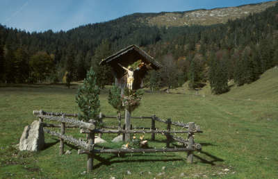
Werdenfels castle in the Loisachtal valley north of Garmisch-Partenkirchen, built in the 12th century, gives the Werdenfelser Land region its name. In 1249, Schweicker von Mindelheim sold the castle with its entire property and estates to the Prince-Bishop of Freising. A caretaker managed the Prince-Bishop’s land from the castle. The independent imperial “Prince-bishopric of Freising, County of Werdenfels” remained in Freising’s possession until its expropriation by the Bavarian state (secularisation of 1803), but the castle fell into disrepair in the 17th century. In the 18th century, its stones were used to build Garmisch parish church. The two towns of Garmisch and Partenkirchen experienced their first economic upturn in the High Middle Ages. The wealthier town of Partenkirchen was a resting place for tradesmen coming to and from Italy and was situated on the much-travelled Rottstraße road from Venice to Augsburg (“Rott” refers to a union of town carters). Garmisch was a centre for rafting. Important goods such as wood, chalk, limestone and plaster were transported on the Loisach river at the time. In the Thirty Year War, the prosperity of the Werdenfelser Land dwindled with the decline in trade from Italy. Nor was it spared the ravages of the plague (1633). The next economic upturn occurred in 1889, when tourist activity started due to the completion of the railway connection with Munich. In 1935, the two until then separate and independently developing markets became the twin town of Garmisch-Partenkirchen. The spa resort has its proximity to the Zugspitze, Germany’s highest mountain (2,962m), and the winter sports Olympic buildings (the Games were held here in 1936) to thank for its prominent status. The cultural offer in Garmisch-Partenkirchen is vast: its spa concerts, farmers’ theatre, the Richard Strauss days and the military music festival are just a few examples. The votive and pilgrimage church of St. Anton, built in 1704, features among the buildings worth visiting in Partenkirchen. Four citizens held that it was due to its construction that Partenkirchen had been spared the horrors of the Spanish War of Succession. The original building was expanded in 1738/39 and Johann Evangelist Holzer painted a fresco for the church which in itself justifies a visit to the little rococo church. The Partnachklamm and Höllentalklamm ravines near Garmisch-Partenkirchen are two of the most well-known natural spectacles in the Werdenfelser Land. While the ravine of the Partnach (a short tributary of the Loisach river) looks narrow and gloomy, the Höllentalklamm ravine varies much more in form and is more broken up. Here, the Hammerbach stream was able to break through the rock, giving the scenery a romantically wild aspect. In the early 20th century, the ravine was made accessible to the public with the construction of trails and tunnels. (Michael Kleider)
Favourites, criticisms ? Make your personal comments on this stage. For more general notes please use the comments section of the page Over to the Via Alpinists.
Christoph Bücheler - 2010-08-25
Alternativroute für Berggänger: Von der Weilheimer Hütte auf dem sog. "Oberauer Steig" auf der Westseite um den Bischof herum und über den Hohen Fricken mit teils sehr steilem Abstieg nach Süden ins Tal der Esterberg-Alm. Schmaler Bergsteig, sehr aussichtsreich, schöne Bergwiesen, man umgeht den Rummel der Tagesausflügler auf der Esterbergalm, zusätzlich ca. 400 hm. Bis auf den Schlussabstieg gut beschildert.
Zuvor jedoch zum Sonnenaufgang auf den Krottenkopf!
Automatic translation
[Google]
Alternative route for hikers: From Weilheimer hut on the so-called "Oberauer riser" on the west side to the bishop around and through the High Fricken with some very steep descent into the valley to the south of the ester-Alm. Narrow mountain trail, very promising, beautiful mountain meadows, to handle the hustle and bustle of day-trippers on the Esterbergalm and additionally about 400 hm. Except for the final descent well signposted.
However, before the sunrise on the Krottenkopf!

 |
5h20 |
15.5 km
|
483 m
|
1725 m
|
5h20 |
15.5 km
|
483 m
|
1725 m


Favourites, criticisms ? Make your personal comments on this stage. For more general notes please use the comments section of the page Over to the Via Alpinists.