|
|
|
A58
|
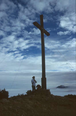
Herzogstand » Weilheimer Hütte
|
|
A long stage awaits you, but a stop-off in Eschenlohe can be fitted in if necessary. From the Herzogstand peak, climb down on the western side to Heimgarten. Several spots require you to be sure of foot and free of vertigo and are secured in parts with cables. After the climb down into the Loisachtal valley, the ascent over the Hohe Kisten to the Weilheimer hut begins.
Detailed route description

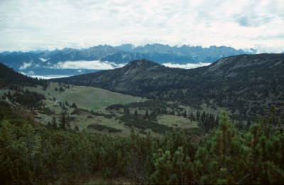
From the Herzogstand houses, take the winding track along the Herzogstand summit slope up to the pavilion. The crossing to the Heimgarten peak now leads westward at first down to the ridge level and offers exciting views over the northern slope of the Herzogstand. The trail is exposed in parts and secured with ropes, requiring you to be sure of foot and free of vertigo. Walk through pine-scattered fields to the highest point. Just beside the summit stands the Heimgartenhüttl hut, which offers simple catering. Now head downhill to the south towards the Ohlstädter meadow and the fork in the road. Here, follow the right-hand trail to the west down into the Grießlaine rift. The forest road that begins here leads first to the Hirschau service hut and then in several sharp bends down to the Eschenlaine valley, the junction of the road coming from Einsiedl. Follow the trail out of the valley until a trail just before Eschenlohe branches off on the left into the Asamklamm ravine (approx 4h). On the opposite side, you will again arrive at a forest road, which must be followed eastward to the left. The forest road is identical to the "Walchenseer Steig" track and leads directly to the Estergebirg plateau. Those who do not suffer from vertigo and are still in search of a little challenge can also turn right onto the track to the Hohe Kisten peak. It heads uphill through pine fields and rocky terrain. Several places are secured with ropes and require you to be sure of foot, but it is not difficult and comes recommended. On meeting the Walchenseer track again, keep heading west and follow the track on the south side below the Hohen Kisten and the Archtalkopf peak through into the hollow between the Schindlerskopf and Obere Kisskopf and south to the Weilheimer Hut.
(Michael Kleider, Christina Schwann, OeAV)
Natural and cultural heritage
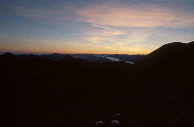
At Eschenlohe, the Loisachtal valley opens out onto a wide basin. Places in such a location almost always have castles, and this is the case here: the castle of Eschenlohe stood on a rocky promontory (Vestbichl) from 1150 to 1300, where the Nikolauskapelle chapel stands today. This chapel was built in 1628 from the collapsed tower of the castle. After the Counts of Eschenlohe exercised seigniorial rights there until the 14th century, the Count of Eschenlohe’s land by the same name became church property after the lineage had died out, first with the high monastery of Augsburg and later the Ettal monastery (until secularisation in 1803). This explains why the parish church of St. Clement, which was built between 1764 and 1782 by the Ettal monastery in late baroque style, was for a village church so expensive. Fortunately, it was spared the major fire of 1801. The fresco painted by Jakob Zeiller over the high altar can still be seen clearly from the very back pew. The Weilheimer Hut at 1,955m in altitude is the highest situated hut in all the Bavarian Prealps. It can also look back over a long history, as it was built back in 1884. Krottenkopf (2,086m) and Oberer Risskopf (2,049m), the two main peaks of the Estergebirge range, stand to the south and north immediately above the hut and are easy to climb. A far-reaching panorama can be enjoyed from the Krottenkopf, and the summit is also famous for its glorious sunrises. “The Werdenfelser land is beautiful. So beautiful that one almost finds it too much, a magnificent specimen of German territory, a heavenly setting ideal for tourism, a countryside caricature” (Ulrich Greiner). The number of overnight stays by tourists seems to justify his words. The area below the Zugspitze peak as far as Murnau, bordered in the south by the mountain massifs of the Karwendel and the Wetterstein and dotted with numerous charming prealpine lakes, is a tourist magnet. Between Loisach in the west and Walchensee in the east lies the Estergebirge, a little mountain range set apart on its own. As it is often overlooked in spite of its romantic character and stands in the shadow of the Wetterstein, it is occasionally still possible to experience the hoped-for mountain isoluation here. The areas to the east and south of the Krottenkopf are covered with many meadows including the Esterbergalm (see stage 59), which is one of the oldest meadowlands in the Werdenfelser Land region. It is in a very lovely setting in a high valley basin framed by woodland between Krottenkopf and Wank.
(Michael Kleider)
Other long-distance trails and alternative routes
Hohe Kisten (1,922m), need to be sure of foot, 1/4h from the Plateaustieg to the Weilheimer Hut (orange markings); Krottenkopf (2,086m), not difficult, 1/2h from the Weilheimer Hut; Maximiliansweg, E4
Useful topographic maps
-
Nr.6 Walchensee - Wallgau - Krün ~ Kompass (1:50.000)
-
Bad Tölz-Lenggries u. Umgebung ~ Bayerisches Landesvermessungsamt München (1:50.000)
Last update : 2011-08-17

 |
8h35 |
28.3 km
|
1713 m
|
1330 m
|
8h35 |
28.3 km
|
1713 m
|
1330 m


Favourites, criticisms ? Make your personal comments on this stage. For more general notes please use the comments section of the page Over to the Via Alpinists.