|
|
|
A51
|
Oberaudorf » Brünnsteinhaus
|
|
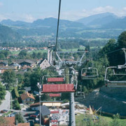
Another rather easy stage, especially whenever taking the chair lift from Oberaudorf to Hocheck. Most of the time is spent hiking leisurely through shady woodland. Only the last 500-metre climb gets tough. Here, the trail becomes steep and, in parts, rocky, until reaching the Brünnsteinhaus lodge.
| Point |
Segment |
|
Name |
Services |
|
Information |
Marking |
 |
Oberaudorf
483 m
|
|
|
|
|
|
|
B
3 km / 1h05 |
 |
 |
Hocheck
791 m
|
|
|
|
|
|
|
5.5 km / 2h10 |
 |
 |
Brünnsteinhaus
1324 m
|
 |
Detailed route description

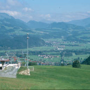
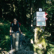
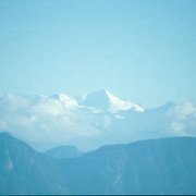
From the western end of Oberaudorf village, a little uphill track branches off towards the west into the wood. Follow it and keep to the left after the little bridge to reach Eck. You can, however, also follow the road to Eck. Or – for those who wish to spare themselves a few metres’ climb – take the Hocheck railway (runs from June to October daily from 9.30am). From Eck, a road leads further up to Hocheck and the mountain station of the Hocheck railway. Follow the trail, which soon narrows into a mountain path, towards the west. Ignore the turnoff to the left down to Rechenau and also the turnoff to the right towards Zimmerau. The trail now leads through the wood. Continue at a leisurely pace up and downhill towards the west. You will reach the road that runs from the Rechenau to the Buchau area and follow it for a short while to the south in the direction of Wildgrub. At the next turnoff, keep sharply to the right (north) and walk uphill through the wood to reach a fork in the trail, at which you must keep to the left. This is where the ascent to the Brünnsteinhaus lodge begins. Head uphill in a northwesterly direction. The forest road becomes a track and heads west along rugged rocks and through high-altitude forest to the Brünnsteinhaus lodge. It takes 45min to climb Brünnstein mountain. The trail over the Himmelmoosalm meadow is neither difficult nor very steep. Only the last stretch is secured with a rope. But all effort is greatly rewarded by the wonderful view over the Kaisergebirge and Hohe Tauern mountains.
(Michael Kleider, Christina Schwann, OeAV)
Natural and cultural heritage

Alpine farming has been practiced around the Brünnsteinhaus lodge for centuries. The meadows, which are at least 400 years old and the even older farm pastureland (Fellalm, Unterbergalmen, Steilneralmen, Himmelmoosalmen and Seeonalm) are not cooperative-owned pastures but rather small, private alpine farm communities. They are farmed in the months of June to September; cheese and butter is still produced on the Fellalm. After it was no longer permitted to use artificial fertiliser in alpine farming, the plant world recovered again and today boasts splendid diversity. The old, extensive larch wood between the Himmelmoosalm and Seeonalm meadows is particuarly worth mentioning. There are also many types of fauna: for instance, golden eagles, mountain cock, ibexes, chamois, roe deer, true deer and blue hare. The Traithen and Brünnstein areas mainly consist in limestone and very often dolines can be found here (particularly on the limestone plateaux of the flat pastureland), a typical type of karstic terrain. Dolines are created by dissolution weathering and can be seen in the landscape in the form of large “holes” or little ponds filled with water or, as on the Seeonalm, as a doline lake. Their diameter varies from a few metres to hundreds of metres, and even the depth of these hollow forms varies enormously. A distinction is made between dissolution dolines and collapsed dolines – the latter were created by the collapse of a cave ceiling. The entire area of the Bavarian Prealps is much visited by holidaying locals and foreigners alike and is very accessible thanks to its roads, hiking trails and cable cars. Dozens of tourists seeking relaxation make their way to the Brünnstein and Rotwand area on pleasant summer and autumn weekends, including many families from the nearby cities of Munich and Rosenheim. This is not surprising, as from the summits of the Bavarian Prealps, which are part of the northern Limestone Alps, a dreamy alpine panorama can be enjoyed on clear days. In the south, they reach to the glacier-covered Central Alps and in the north over the entire alpine foreland. Dense woods with a great abundance of game, from small animals to the stags and chamois, grow below the far-reaching pastureland areas that encircle the summits.
(Michael Kleider)
Other long-distance trails and alternative routes
Ascent of the Brünnstein, the "local mountain" of the people of Oberaudorf (1,634m) walking time of 45min; easy route: from the AV-Haus lodge westward from the Himmelmoosalm meadow over the southern slope to the summit, the last 100m along a safety rope. Difficult route: via ferrata to the peak. A little chapel stands at the peak.
Useful topographic maps
-
WK 301 Kufstein - Kaisergebirge - Kitzbühel ~ Freytag & Bernd (1:50.000)
-
Mangfallgebirge ~ Bayerisches Landesvermessungsamt München (1:50.000)
-
Nr. 8 Tegernsee - Schliersee - Wendelstein ~ Kompass (1:50.000)
-
ÖK 50 90 ~ Bundesamt für Eich- und Vermessungswesen (1:50.000)
-
BY 16 Mangfallgebirge Ost, Wendelstein ~ Alpenverein (1:25.000)
Last update : 2011-08-17

 |
3h15 |
8.5 km
|
932 m
|
91 m
|
3h15 |
8.5 km
|
932 m
|
91 m


Favourites, criticisms ? Make your personal comments on this stage. For more general notes please use the comments section of the page Over to the Via Alpinists.