|
|
|
A48
|
Kampenwand Bergstation » Priener Hütte
|
|
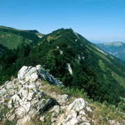
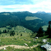
The stage from the Kampenwand mountain to the Priener Hut displays fantastic views and lovely meadowland. However a short stretch, the climb to the Weitlahnerkopf, is secured by cables and requires you to be sure of foot. The relatively short stage allows a detour to the Geigelstein, which will be rewarded by the wonderful panorama over the Kaisergebirge mountains.
Detailed route description

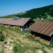
From the Sonnenalm meadow, walk for 100m to the mountain station of the Kampenwand chair cable car, from where you must follow the hiking trail leading down to the South West. You will come to a fork in the road after just a short while. Keep to the left here, walking practically straight ahead and soon arriving in sparse woodland, through which a downward trail leads towards the South West. Further down, it meets a forest road. Follow it on the right-hand side for approx. 50-70m before a path turns left into the wood. At the turnoff to the Dalsenalm meadow, follow the signpost to the right in the direction of "Weitlahner/Geigelstein". After a few minutes you will reach a barbed wire fence, which can be crossed via an opening. Then walk for approx. 100m to the left along the fence and you will reach the steep track that leads to the Weitlahnerkopf. On nearing the top, the bends become narrower and lead eastwards to the ridge. From there, continue further to the right along the summit rocks. This part of the trail entails a short stretch secured with wire cables. After a good 2h, you will reach the 1,615-metre high Weitlahnerkopf. Via Alpina now runs towards the South West below the ridge of the Aschentaler Wände peak and past the start of the path stretching up from the Haidenholzeralm meadow to the Roßalm meadow. Continue southwards on an almost level course at a comfortable pace across the meadowland. At the pass between Wandspitz and Roßalpenkopf, the trail branches off to the right towards the 1,685-metre high Wandspitz. However, Via Alpina follows the second turn-off to the right in the direction of the Priener Hut. The route straight ahead would lead to the 1,913-metre high Geigelstein, to which a detour is by all means a possibility, and its wonderful view over the Kaisergebirge mountains is charming. However, Via Alpina still continues southwards and downwards, straight ahead until reaching a small roadway that leads directly to the Priener Hut.
(Michael Kleider, Christina Schwann, OeAV)
Natural and cultural heritage

The Geigelstein, the second highest mountain in the Chiemgau Alps (1,808 m), has been under nature protection since 1991. Before this, the future of the mountain had been the subject of fierce disputes. In the early 1970s, it was to be developed with state intervention – with roads and technical lift equipment for ski tourism. The “Save the Geigelstein” citizen’s initiative finally won the day and achieved the protection status now enjoyed by the mountain. Today, there are plans to build a roadway through the heart of the nature reserve from the Oberkaseralm to the Rossalm meadow, and this has again triggered strong protests. The Bund Naturschutz (Nature Protection Federation) and the citizen’s initiative brought proceedings against the construction decision of the Government of Oberbayern, and the court ruled in their favour in July 2004. The basis for the judgement is interesting: the Geigelstein would benefit from such a high degree of protection as a nature reserve according to the EU Directive on Flora, Fauna and Habitat (FHH) that the grounds given by the Government of Oberbayern for building a road did not suffice. The government is currently checking this to decide whether to appeal against the decision. Nearly all of the vegetation belts, except for the high alpine belt, are represented in the Chiemgau mountains. Deciduous forests can be found in the valley (ash, beech, alder and oak), the lakes are mostly bordered by a belt of reeds, and the extensive moorland is a special particularity. The turf derived from it is used for business and spa purposes. Further up the valley, the sycamore maple gives way to spruce and larch, and pine and Swiss mountain pine can be found in the higher areas. The farmland of the dozens of still used alpine meadows are populated among other things by juniper, bilberry and alpine rose.
(Michael Kleider)
Other long-distance trails and alternative routes
Hike to the Breitenstein (1,661m) walking time of 1h; Geigelstein (1,808m) walking time of 1h 30min; Mühlhörndl (1,518m) walking time of 1h; Wandberg (1,598m) walking time of 1h 30min
Useful topographic maps
-
Nr. 10 Chiemsee - Simssee ~ Kompass (1:50.000)
-
Chiemsee u. Umgebung ~ Bayerisches Landesvermessungsamt München (1:50.000)
Websites relative to natural and cultural heritage
Last update : 2011-08-17

 |
3h10 |
14.3 km
|
648 m
|
678 m
|
3h10 |
14.3 km
|
648 m
|
678 m


Favourites, criticisms ? Make your personal comments on this stage. For more general notes please use the comments section of the page Over to the Via Alpinists.