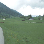
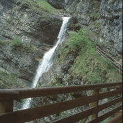
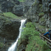
A wonderful stage awaits you, offering the impressive Staubfall waterfall in addition to the alpine landscape on the Peitingköpfl, beautiful high meadowland and the peaceful Heutal valley. The trail passes behind (!) the waterfall. A marvellous experience, particularly pleasant on hot days.
Detailed route description

From Unken, follow trail no. 21 westwards, which turns off to the right of the road just after the church. The hiking trail leads gently uphill across the fields and later along the outskirts of the wood. At the first fork in the road, keep to the left and continue on a gentle incline. Follow the path that turns into the wood and runs on an almost even course until coming out onto a road from the right. From here, the route becomes somewhat steeper again. Just after the wayside shrine, turn right and follow the path uphill until coming onto a forest road. Keep to the right here. After the 3rd sharp bend, a little path again turns right up into the wood. Follow this through a wooded area steeply uphill until you cross the stream. The path also leads uphill directly alongside the waterfall until the wood thins out, opening onto the Hölzkaser alpine meadowland. At the upper alpine farm buildings, the path splits into two. The right-hand path leads to the Wetterkreuz and later to the Obere Hölzalm meadow. The left-hand path is the direct route to the Obere Hölzalm, which Via Alpina also follows. From here, a small climb to the Peitingköpfl (1,720m) still lies ahead. Via the ridge, you will arrive down on the Hochalm meadowland, where the hiking trail widens out and moves onto a gully trail. Keep to the left at the little chapel on the Hochalm meadow and walk across the meadowland past several alpine farm buildings down into the Angerertal valley and the magnificent Heutal valley (approx. 5h). After a short while along the road, Via Alpina soon turns off northwards again to the right into the Fischbachtal valley. The trail follows the course of the Fischbach stream in a very beautiful setting. It leads past the Fischbachfall waterfall and the Austrian-German border, even behind the Staubfall waterfall! This is a wonderful experience that is still to be matched. Afterwards, the trail leads downhill. At the overgrown Fischbachalm meadow, change from the footpath over the bridge to the western side of the Fischbach stream and follow the forest road out of the valley until Laubau. Pass the Holzknechtmuseum (woodcutters’ museum) and walk along the Weiße Traun river to reach Fuchsau, Grashof and finally Ruhpolding (approx. 3h 30min from the Heutal valley).
(Michael Kleider, Christina Schwann, OeAV)
Natural and cultural heritage

One of the most interesting upper Bavarian churches is the St. Georg parish church, located on the slopes of the Kirchbichl in Ruhpolding (where the existence of a church was already mentioned in official records in the 11th century). It was consecrated in 1754 after an approx. 20-year construction period. The master builder Johann Baptist Gunezrheiner kept the outer facade simple, but on entering the church you will be overwhelmed by the shimmering gold rococo furnishings and the beautifully carved figures of saints. The left-hand side of the pulpit is a highlight yet to be equalled in Bavaria. The gold casing of the right-hand altar holds the sculpture of greatest artistic value, the Roman Madonna from the 12th century, which was only found again in 1655. The master craftsman and origin of the sculpture are unknown. The Holzknechtmuseum (Woodcutters’ Museum) in Laubach is also worth a visit: transferred and reconstructed woodcutters’ dwellings from the surrounding woodland have been erected on a large stretch of open terrain. "Holzknecht" (woodcutter, the modern German term being "Forstwirt") was an independent profession that was closely linked to the salt works in Traunstein (1619-1912), which required large amounts of firewood. Until the end of the 19th century, forestry was the most important employment sector in the valley. An idea of the strenuous labour done by woodcutters is given by the representation of the work and living conditions at the time (old tools, tape and video recordings, a changing special exhibition, etc.). The municipality of Ruhpolding – whose surface area of 148 square kilometres makes it the fourth largest municipality in Bavaria – has above-average forest cover (52.5% of the area). Together with the medium altitude of the municipality (centre at 690 metres), these climate factors mean that sultry, hot weather is an extremely rare experience. Ruhpolding has been a recognised climatic health resort since the 1960s.
(Michael Kleider & TV-Ruhpolding)
Other long-distance trails and alternative routes
Ascent of the Sonntagshorn (1,961m), good weather conditions essential, very steep. Maximiliansweg, E4
Useful topographic maps
-
Pinzgauer Saalachtal Wander-u. Tourenkarte, ~ Mayr (1:35.000)
-
Topographische Karte Berchtesgadener Alpen, Chiemsee und Umgebung ~ Bayerisches Landesvermessungsamt München (1:50.000)
-
WK 104 Chiemgauer Alpen ~ Freytag&Berndt (1:50.000)
-
Nr. 14 Berchtesgadener Land - Chiemgauer Alpen ~ Kompass (1:50.000)
-
ÖK 50 92 ~ Bundesamt für Eich- und Vermessungswesen (1:50.000)
-
BY 19 Chiemgauer Alpen Ost, Sonntagshorn ~ Alpenverein (1:25.000)
Last update : 2011-08-16

 |
8h30 |
27.4 km
|
1131 m
|
1024 m
|
8h30 |
27.4 km
|
1131 m
|
1024 m


Favourites, criticisms ? Make your personal comments on this stage. For more general notes please use the comments section of the page Over to the Via Alpinists.