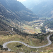
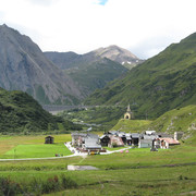
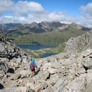
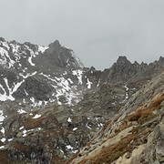
Leave Robiei and head to the west, slowly climbing up past the Matörgn lake to the Bocchetta di Val Maggia gap. Here, cross the border into Italy. The trail descends steeply towards the Boden lakes, after which the road to the San Giacomo pass begins. Follow it down to Riale.
Detailed route description

Link to more route details: www.komoot.de/collection/901145/-via-alpina-5-10
Only the 360-metre long barrage lets you guess that just after Hotel Robiei comes a walk on top of a dense network of water tunnels. The mountain trail leads westward along the side of the Pizzo dell Arzo mountain to the Matörgn lake. This lake is one of the highest lakes to be populated by fish – Canadian trout. In addition to the delightful rock landscape with its numerous mineral types, the view over the Basòdino glacier provides for a first stop. Then the trail continues on a gentle ascent past rocks and over boulder-strewn slopes to the Bocchetta di Val Maggia pass. Here, the view into the Toggia valley with its numerous lakes opens out. After crossing the Italian border, there is a sharp descent across a boulder field to the enchanting Boden lake plateau. From here, the track leads down to the side outlet from Toggia lake. Cross and follow it on the right-hand bank. Just before Castel lake, turn off to the right, whereupon you sill see the stage destination, the Maria-Luisa CAI hut on the Toggia Alp.
(ATSE)
Useful topographic maps
-
265T Nufenenpass ~ Swisstopo (1: 50'000)
-
Tessin Sopraceneri 3-259-00831-4 ~ Hallwag Kümmerly und Frey AG, Urtenen BE (1: 60'000)
-
n° 11 ~ Istituto Geografico Centrale - Torino (1:50.000)
Useful guidebooks
-
Locarno (V.Verzasca / V.Maggia) / Arno Hofmann ~ Hallwag Kümmerly und Frey AG (ISBN 3-259-03642-3)
-
Wanderwelt Tessin / SAW und Geotechnisches Institut ~ Hallwag Kümmerly und Frey AG (ISBN 3-259-03698-9)
Last update : 2019-12-17

 |
4h15 |
13.4 km
|
803 m
|
966 m
|
4h15 |
13.4 km
|
803 m
|
966 m


Favourites, criticisms ? Make your personal comments on this stage. For more general notes please use the comments section of the page Over to the Via Alpinists.