Hiking (mountain trail, in places narrow and exposed)
Alpine route (equipped or very exposed section, snow field, blocks)
R39
Rastkogelhütte » Kellerjochhütte
|
4h05 |
16.5 km
|
707 m
|
824 m
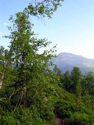
A leisurely hike over alpine meadowland and mixed mountain forest is on the agenda. There is a gentle downhill walk from the Rastkogel hut to Hochfügen and from there only a slight upward incline to the Loassattel pass, from where it is by all means possible to climb up to the Kellerjoch hut on the same day.
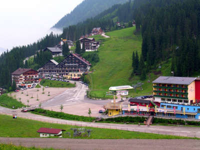
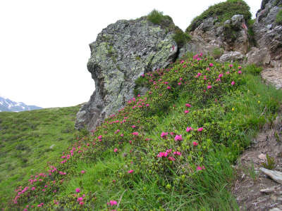
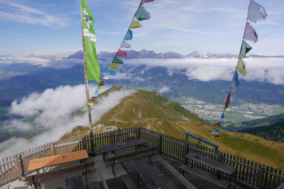
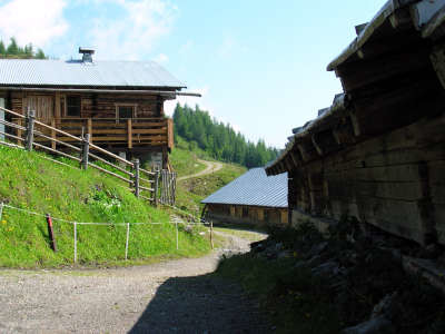
From the Rastkogel Hut, follow the signposts in the direction of Rastkogel and Sidanjoch. A gentle uphill walk across the beautiful mountain world with magnificently blooming almrausch takes you to the Sidanjoch pass in approx. 15min. This is where the turnoff can be taken to the Rastkogel summit on the one hand (the Via Alpina Innsbruck alternative) and the right-hand trail down to Hochfügen on the other. A narrow trail leads downward. A little above the Pfundsalm meadow, you will reach a roadway. The trail to the lower Pfundsalm meadow takes approx. 1h. Here, you must decide whether to take the detour to Hochfügen to have something to eat, or to walk directly to the Lamargalm meadow. The trail to the Lamargalm meadow offers an advantage in that it crosses the sloping ridge at a more or less even altitude and can save you approx. 30min. The other option is the trail to the right towards Hochfügen (2h from the Rastkogel Hut). After the newly built valley station for the connecting railway between Hochfügen and Hochzillertal, a road leads uphill to the left. After several hairpin bends, you will reach the Lamargalm meadow with an approx. 20min climb. Keep to the right here and follow the road further on a gentle incline, until a little track branches off into the wood on the right-hand side. Trail number 10 is very beautiful, and mainly runs along the sloping ridge through sparse trees and across wide spaces that are almost entirely covered in almrausch. After approx. 1h 15min, you will reach the Maschentalalm meadow. Keep slightly to the left here and follow the path between the Alpine huts to the rather elevated bench. The roadway is soon reached and the trail continues in parallel to it. After a short downhill stretch, there will be another fork in the road. Keep to the left once more, following the signposts for the Loassattel pass. After approx. 2h from Hochfügen, you will reach the lovely setting of the Loassattel pass and enjoy a view over the Karwendel massif and the Inntal valley for the first time. The Gamsstein inn is being renovated and will only open again for guests in a few years. However, an alternative overnight accommodation option is the Gasthof Loas inn, which is only 500m further downhill along the road. For those who are not overly tired, it is also possible to go directly to the Kellerjoch Hut, which means a further climb of approx. 2h. (Christina Schwann, OeAV)
Natural and cultural heritage
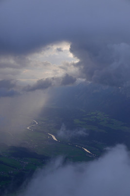
After the Reichenspitze peak and the Pfunderer mountains, the Tuxer Alps represent the third largest subgroup in the Zillertal Alps. The widely interspersed foothills differ enormously in height and landscape character from the high ridges in the South. From the highest peak in the group, the Lizumer Reckner standing at 2,886m, the ridge stretching northwards from the Tuxer Joch pass divides into several branches. They are named the Glungezerkamm, Malgrüberkamm, Hirzerkamm and Rastkogelkamm ridges after their most important elevations. The summits are free of glaciers and alpine grass colonies and almrausch roses grow at very high altitudes, but there are also distinctive mountain personalities here such as the Rastkogel standing at 2,762m in altitude or the Kellerjoch standing at 2,344m in altitude. In addition to this, these mountains situated to the side of the lofty Karwendel limestone massif – separated by the wide Inntal valley – offer a wonderful view back over the Zillertal Alps and northwards into the Karwendel mountains. (Christina Schwann, OeAV)
Other long-distance trails and alternative routes
Turnoff from the connecting route to Innsbruck, leaving from the Rastkogel Hut.
ÖK 50 149, 2230, 150 ~ Bundesamt für Eich- und Vermessungswesen (1:50.000)
Nr. 37 Zilletaler Alpen, Tuxer Alpen und Nr. 28 Achensee, Rofan, Zillertal ~ Kompass (1:50.000)
Picture gallery
Add your own pictures!
Comments
Favourites, criticisms ? Make your personal comments on this stage. For more general notes please use the comments section of the page Over to the Via Alpinists.
Carsten - 2022-01-10
R39 (mis-posted under R38): Water at Pfundsalm, Lamarkalm, and Maschentalalm.
The guidebook includes the 2-hour ascent to the Kellerjochhuette in both R39 and R40.
Die Rastkogelhütte ist leider nicht zu empfehlen. Die Gastwirte sind sehr unfreundlich und diese Unfreundlichkeit macht sich im ganzen Haus bemerkbar.
Da wir in der Hütte nichts verzehrt, sondern uns draußen selbst versorgt hatten, mussten wir pro Person 5,- „Infrastrukturbeitrag“ zahlen, worauf wir vorher nicht hingewiesen wurden.
Ich kann den Grundgedanken verstehen, dass ein Konsum in der Hütte gewünscht wird, allerdings kann dies auch anders und netter kommuniziert werden.
Wir haben uns hier rundum unwohl und nicht willkommen gefühlt.
Automatic translation
[Google]
The Rastkogelhütte is unfortunately not recommended. The innkeepers are very rude and this unfriendliness makes itself felt throughout the house. Since we had not consumed anything in the hut, but had taken care of ourselves outside, we had to pay per person 5, - "infrastructure contribution", which we were not previously informed. I can understand the basic idea that a consumption in the hut is desired, but this can also be communicated differently and netter. We felt uncomfortable and unwelcome here.
POPEYE GG - 2019-02-01
Samedi 16 juin 2018
Belle étape bien fleurie. Nous avions prévu d'aller jusqu'à la Kellerjochhütte, mais un samedi soir par beau temps et sans réserver malgré le début de saison: plus de place!
Nous avons dû redescendre de 850m et trouvé au sympathique Alpengasthof Hübertus à 1400m d'altitude, un peu en dehors du chemin, et au-dessus de Schwaz. Cette 2ème étape n'a pas été non plus de tout repos!
Automatic translation
[Google]
Saturday, June 16, 2018 Beautiful step well flowery. We had planned to go to the Kellerjochhütte, but a Saturday night in good weather and without booking despite the start of the season: more space! We had to descend from 850m and found at the friendly Alpengasthof Hübertus at 1400m altitude, a bit off the road, and above Schwaz. This 2nd stage was not easy!
Brigitte Duquesnay - 2018-09-24
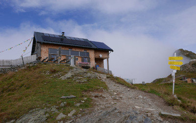
Le refuge de Loassatel était complet, nous avions donc réservé à Kellerjochhütte. Et nous n'avons pas regretté. D'abord, après 3 jours de mauvais temps, nous sommes arrivés au moment où les nuages se dispersaient et le site est extraordinaire. On a une vue à 360° et on découvre la vallée de l'Inn avec Innsbrück et Schwaz. De plus l'accueil est chaleureux et nous avons passé une excellente soirée. Le refuge a été restauré avec goût. Je recommande donc de faire cette montée supplémentaire qui allonge un peu l'étape mais permet de goûter la plénitude de la montagne.
Automatic translation
[Google]
The refuge of Loassatel was complete, so we had booked at Kellerjochhütte. And we have not regretted. First, after 3 days of bad weather, we arrived at the moment when the clouds were dispersing and the site is amazing. We have a 360 ° view and we discover the Inn Valley with Innsbrück and Schwaz. In addition the welcome is warm and we had a great evening. The refuge has been tastefully restored. I therefore recommend to make this extra climb that lengthens a little the stage but allows to taste the fullness of the mountain.
Stay out of the abandoned ski-resort of Hochfügen. Try to make it to the Kellerjochhütte, with a beautiful view over the Inn-valley and Innsbruck. You will also see the Zug-spitze that you will pass later. Be sure to fill up your water-bottles in Loassattel, because there is no drinking-water at the hut, on the ridge the next day, until you are down in the woods again.
Von der Rastkogel oder Kellerjochhütte zweigt der "Inntaler Höhenweg" Richtung Innsbruck ab, das ist eine Variante des Roten Weges, über Lizumer- und Glungezerhütte zum Patscherkofel, nach Innsbruck und mündet im Karwendel wieder in die Hauptroute ein. Details unter www.glungezer.at
Automatic translation
[Google]
From the Rastkogel Kellerjochhütte or branches of "Inntaler trail" from the direction of Innsbruck, which is a variant of the Red path across Lizumer and Glungezerhütte to Patscherkofel, Innsbruck and the Karwendel flows back into the main route. Details at www.glungezer.at

 |
4h05 |
16.5 km
|
707 m
|
824 m
|
4h05 |
16.5 km
|
707 m
|
824 m


Favourites, criticisms ? Make your personal comments on this stage. For more general notes please use the comments section of the page Over to the Via Alpinists.