Hiking (mountain trail, in places narrow and exposed)
Alpine route (equipped or very exposed section, snow field, blocks)
A19
Pack » Salzstiegelhaus
|
5h25 |
19.1 km
|
765 m
|
339 m
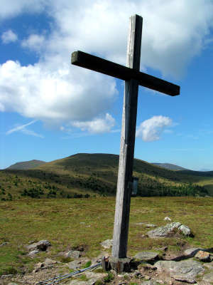
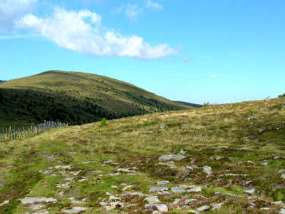
This stage leads over the sprawling alpine pastures of the Hirscheggeralm pasture and offers beautiful views. On the other side of the Peterer Sattel pass you reach the Salzstiegelhaus lodge on the Hirschegger Sattel pass, which promises you a very pleasant rest thanks to painstaking craftsmanship and care for detail outside as well as inside.
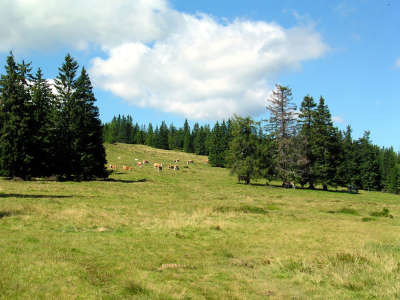
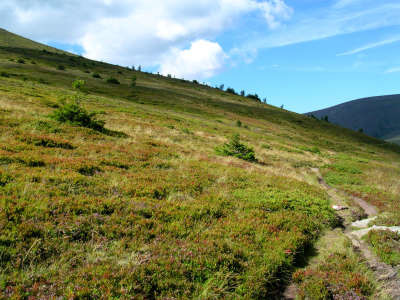
In Pack, keep to the left on passing the church, cross the main road and follow the asphalt road steeply uphill. A forest path soon turns sharply off to the right towards the Knödel Hut. Following this, the route starts a steep incline after a bend to the left and soon evens out again until coming out onto the forest path coming from the Barbarahaus inn. Here, go to the right, take a left turn into the wood at the signpost, thereby reaching open meadowland and continuing to a forest road, following it further up on a gentle incline. At the fork in the path, take the right-hand option that leads upwards through the wood and meets the forest road below the Knödel Hut. Now follow this road for approx. 10min to the beautiful and very inviting Knödel Hut (approx. 1h 30min), which is used by many people from the nearby and more distant surroundings as a starting point for hikes over the Hirscheggeralm meadow. At the Knödel Hut, Via Alpina then keeps to the right and leads over the meadowland on a gentle incline, later passing through a sparse copse to the Bernstein Hut. Here, walk straight ahead and follow the track, now a little steeper, up to the sprawling Hirscheggeralm meadow. The larches and spruces are soon left behind and the typical sight of the rounded hilltops and meadowland bursting with cranberries and bilberries can once again be enjoyed. A gently undulating route takes you past the first turn-off to the Görlitzer Alm meadow and a little later past the second turn-off, both of which must be ignored, as it continues along the sloping ridge. On the Peterer Alm meadow, the Carinthian border hiking trail (KGW), which Via Alpina has been following for so long, turns off to the left. Via Alpina, on the other hand, takes the right-hand path along the sloping ridge to the Peterer Sattel pass (approx. 3h from the Knödel Hut). From here, the trail leads to the right onto the flank of the Speikkogel mountain and through alder and spruce thicket, ending with a short uphill stretch to the mountain station of the ski lifts from the Hirschegger Sattel pass. The path turns off to the left towards the Speikkogel. It then heads downwards over the ski run and later along a wider hiking trail until reaching the Salzstiegelhaus lodge (approx. 1h from the Peterer Sattel pass).
(Christina Schwann, OeAV)
Natural and cultural heritage
Like the Koralm, the Herschegger Alm meadow’s soft forms are enchanting. A wonderful hiking area, which in the area of the Knödel Hut attracts numerous visitors from the immediate vicinity and from neighbouring provinces. Above the timberline, at an altitude of approx. 1,500m, the far-reaching meadowland is reminiscent of the Scottish Highlands. In addition to alpine societies of long grass, the vegetation is also marked by juniper, blueberries, cowberries and of course the pink flowering ericaceae. Various lichen species such as the Iceland and Reindeer (Cladina Rangiferina) mosses are mixed among them. The stones are covered above all in yellow map lichen and numerous other species, which on closer examination reveal beautiful flowers. The lichens are the perfect example of a perfect symbiosis. They represent the coexistence of fungus and alga. The alga sources energy from the sunlight (photosynthesis) and thus feeds itself and the fungus. In return, the fungus offers a habitat, protection from drying out and mineral salts. Scientists refer to the science of lichen as lichenology. Fungus represents the mycobionts, and alga the photobionts or phytobionts. Lichens are generally used as bio-indicators, as they are very sensitive to air pollutants. The fact that the dense forest in this area only reaches as far as 1,500m in altitude can be explained by the intensive pastureland farming. Stretches of land are kept “open” by grazing that would otherwise become overgrown within a very short space of time. In many pasture areas, alpine farming became too strenuous and was therefore abandoned. In these places, the appearance of young trees and bushes can be clearly seen. (Christina Schwann, OeAV)
Favourites, criticisms ? Make your personal comments on this stage. For more general notes please use the comments section of the page Over to the Via Alpinists.

 |
5h25 |
19.1 km
|
765 m
|
339 m
|
5h25 |
19.1 km
|
765 m
|
339 m


Favourites, criticisms ? Make your personal comments on this stage. For more general notes please use the comments section of the page Over to the Via Alpinists.