Create your own guidebook
Download track
Quality : very good
GPX KML CSV
Location
France / Italy
Piemonte / Provence-Alpes-Côte d'Azur
Torino / Hautes-Alpes
Crissolo / Ristolas
Monviso / Queyras
Parc Naturel Régional du Queyras
Key to symbols   
Stage point (start or end of stage)
Intermediate accommodation possibility
Summit
Pass
Town, village
Other locality

Catering
Doctor
Chemist
Bakery / grocery
Hardware / sports shop
Post
Bank / cash dispenser
Train
Coach
Taxi
Open automobile access

A Tarred or paved road
B Dirt track
C Mule trail
D Mountain trail
E Equipped trail (cables, ladders)
F No trail

Stroll / tourism (broad, non-exposed trail)
Hiking (mountain trail, in places narrow and exposed)
Alpine route (equipped or very exposed section, snow field, blocks)
D46 Pian del Re » Refuge du Viso
  |   3h35   |   8.1 km   |   973 m   |   535 m

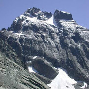
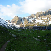
From the Pian del Re hut the trail follows the Giro del Viso round trail. It crosses the broad Pian del Re plain and climbs towards the Traversette pass and "Buco di Viso", the first alpine tunnel on the jagged crest that links Mount Monviso to Mount Granero. Once over the pass, the trail is in French territory and leads to the Viso hut.

Point Segment
Name Services Information Marking
Pian del Re
2020 m
| C  5.1 km / 2h40
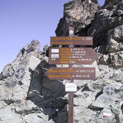
Col de la Traversette
2922 m
| C  3 km / 0h55
Refuge du Viso
2463 m
Detailed route description
Other long-distance trails and alternative routes
Giro del Viso round trail. From Pian del Re it is possible to climb Mount Monviso (EE rating), allowing for an overnight stop at the Quintino Sella hut.
Useful topographic maps
Useful guidebooks
  • Monviso e le sue Valli, G.Berutto ~ Guide IGC/TO (ISBN 1991)
  • Camminaitalia, Cannobini, Carnovalini, Valsesia ~ Le guide di Airone, Mondadori (ISBN 1995)
  • In cima-Alpi Cozie Meridionali. M.Bruno ~ L'Arciere/CN, vol.3 (ISBN )
  • La Grande Traversée des Alpes et le Tour de l'Ubaye - Réf. 531 ~ Fédération Française de Randonnée (ISBN 978-2-7514-0267-8)
Comments

Favourites, criticisms ? Make your personal comments on this stage. For more general notes please use the comments section of the page Over to the Via Alpinists.


max. 1000 characters
  • Via Alpina international secretariat - 2014-11-12
    The "Buco di Viso" has been completely refurbished this summer by the Italian and French authorities! You can now reliably use the oldest tunnel of the Alps rather than climb up the Traversette pass.
  • Marco - 2011-06-27
    il colle delle traversette è esposto e pericoloso nel primo tratto, anche quando piove. meglio passare per il buco di viso
    Automatic translation [Google]
    the hill of Traversette is exposed and dangerous in the first part, even when it rains. better to go through the hole face
  • M. Keller - 2010-08-21
    juillet 2010: D46 Refuge Viso-Pian del Re
    Le col de la Traversette est enneigé en début d’été, mais peut être généralement gravi sans crampons bien qu’ils puissent se révéler bien utiles car certains endroits sont parfois un peu raides.
    Automatic translation [Google]
    July 2010: D46 Refuge Viso-Pian del Re The neck is Traversette snow in early summer, but can usually be climbed without crampons although they can be very useful because some places are sometimes a little stiff.
Last update : 2013-06-14