Create your own guidebook
Download track
Quality : rough
GPX KML CSV
Location
Italy
PIEMONTE
TO
GHIGO DI PRALI
VAL GERMANASCA

Key to symbols   
Stage point (start or end of stage)
Intermediate accommodation possibility
Summit
Pass
Town, village
Other locality

Catering
Doctor
Chemist
Bakery / grocery
Hardware / sports shop
Post
Bank / cash dispenser
Train
Coach
Taxi
Open automobile access

A Tarred or paved road
B Dirt track
C Mule trail
D Mountain trail
E Equipped trail (cables, ladders)
F No trail

Stroll / tourism (broad, non-exposed trail)
Hiking (mountain trail, in places narrow and exposed)
Alpine route (equipped or very exposed section, snow field, blocks)
D41 Ghigo di Prali » Rifugio Lago Verde
  |   3h40   |   9.3 km   |   1090 m   |   0 m

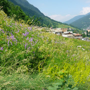
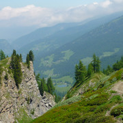
From Ghigo di Prali the trail follows the course of the Germanasca stream, passing a number of villages, to the pastures at Bout du Col. It passes through larches and rhododendrons to the Freiboujo plateau, and then towards the Founzét fork. The last section leads to the Lago Verde hut on the shores of the lake of the same name.

Point Segment
Name Services Information Marking
Ghigo di Prali
1454 m
|   9.3 km / 3h40
Rifugio Lago Verde
2586 m
Useful topographic maps
Useful guidebooks
  • Valli di Susa-Chisone-Gerrmanasca, IGC/TO. G.Berutto ~ Guide IGC-TO (ISBN 1993)
  • Camminaitalia, Cannobini, Carnovalini, Valsesia ~ Le guide di Airone, Mondadori (ISBN 1995)
Comments

Favourites, criticisms ? Make your personal comments on this stage. For more general notes please use the comments section of the page Over to the Via Alpinists.


max. 1000 characters
  • M.Keller - 2010-08-21
    Juillet 2010 dans le sens Serre di val d'Elva/Chiesa di Bellino:
    La trace GPS fait passer par Castres et Laurenti, mais à ce point le départ du sentier pour le col de Bicocca est introuvable. Il est souhaitable de suivre la GTA depuis Serre di Val d’Elva (sentier en crête).
    Automatic translation [Google]
    July 2010 in the sense of Serre di val Elva / Chiesa di Bellino: GPS track passed through Castres and Laurenti, but at this point the trailhead for the neck Bicocca was not found. It is advisable to follow the GTA since Serre di Val d'Elva (path peak).
  • M.Keller - 2010-08-21
    (Juillet 2010)
    Vers Pomieri (quelques km avant Ghigo dans le sens Gigho -Lago Verde), le pont a été emporté. Traverser à pied (enlever les chaussures !). Ensuite rester sur le chemin qui longe la rive gauche du torrent.
    Automatic translation [Google]
    (July 2010) To Pomieri (a few km before Ghigo in the sense Gigho-Lago Verde), the bridge was washed away. Walk through (remove shoes!). Then stay on the path that runs along the left bank of the river.
Last update : 2013-05-30