|
Create your own guidebook
Location
Key to symbols

|
 |
4h40 |
15.02 km
|
878 m
|
1192 m |
4h40 |
15.02 km
|
878 m
|
1192 m
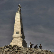
From the Arlaud hut, a dirt track leads through fields and thin pinewoods to Mount Testa dell'Assietta. A broad mule track, almost level, leads to the Assietta pass. A trail then leads down to Balboutet, where it becomes a mule track again and leads easily on to Usseaux.
Other long-distance trails and alternative routes
The track up Mount Assietta continues through the Finestre pass and on to Susa; it is used by mountain bikers, mostly foreign.
Useful topographic maps
Useful guidebooks
Websites relative to natural and cultural heritage
Tourist offers
Last update : 2013-06-14
|
||||||||||||||||||||||||||||||||||||||||||||||||||||||||||||||||||||||||||||||||||||||||||||||||||||||||||||||||||||||||||||||||||||||||||||||||||||||||||||||||||||||||




Favourites, criticisms ? Make your personal comments on this stage. For more general notes please use the comments section of the page Over to the Via Alpinists.