|
|
|
D33
|
Rifugio Riposa » Rifugio Stellina
|
|
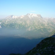
The trail climbs the uncomfortably steep slopes of Mount Rocciamelone. Its peak is the site of the highest shrine in Europe, a well-known spot for pilgrimages. After Cà d'Asti the trail follows less well-known routes. The views are excellent and the trail is certainly less frequented than routes to the top of Rocciamelone.
Detailed route description

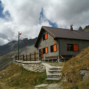
From the La Riposa hut a busy trail climbs sharply up the steep and rough southern slope of Mount Rocciamelone. Finally at the Cà d'Asti hut, leave the trail that leads to the peak and follow the red and white signs that lead to an enormous scree slope west of the hut. This trail leads down to Alpe Crest. It enters woods, cutting across the slope about half way up, and becomes faint and sometimes hidden by landslides. It winds up and down to Alpe Prapiano. A final, long climb lasting two and a half hours leads to the stunning views of the Stellina hut.
(Regione Piemonte)
Natural and cultural heritage

From Prà Piano a track leads down to the hamlet of Novalesa, a typical mountain hamlet with paved streets and numerous tiny alleys and courtyards leading off the main street. The area around Novalesa is well-known for its splendid waterfalls and especially for the Abbey which is still lived in by monks and is famous for its ancient library. It is possible to stay at the abbey, spending a relaxing holiday living at the pace of the monks.
(Regione Piemonte)
Other long-distance trails and alternative routes
From Cà d'Asti there is access to the peak of Rocciamelone.
Useful topographic maps
-
ASFn°13 ~ IGN (1:25.000)
-
2 ~ IGC Valle di Lanzo e Moncenisio (1: 50000)
Useful guidebooks
-
Camminaitalia, Cannonini, Carnovalini, Valsesia ~ CAI-TCI (ISBN 1995)
-
Andar per rifugi, Bersezio, Tirone ~ De Agostini (ISBN 1988)
Last update : 2013-06-14

 |
6h30 |
12.3 km
|
1648 m
|
1264 m
|
6h30 |
12.3 km
|
1648 m
|
1264 m


Favourites, criticisms ? Make your personal comments on this stage. For more general notes please use the comments section of the page Over to the Via Alpinists.