|
|
|
D26
|
Talosio » San Lorenzo
|
|
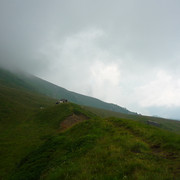
The first part of the stage along the bottom of the valley follows a road. A broad trail then crosses high pastures up to the Crest pass. Through steep grassy slopes the trail goes down to the Shrine at Prascondù, near the hamlet of Talosio, which can be reached by road.
Detailed route description

From Ronco Canavese follow the road along the valley floor all the way to the bridge on the Forzo stream and across. Leaving the main road, head to the hamlet of Bosco and continue through the woods, about halfway up the slope, along a minor road. At Masonaie a trail climbs to the pastures at Ciavanis and Gioie. From the latter the trail heads left, circling round the Cima Rosta peak. It climbs the steep, green slopes and is hard to make out. Finally the trail reaches the Crest pass. From the pass the descent is immediately steep, leading quickly to Alpe Rocco. Further down, the trail enters a beautiful birch wood and leads to the Shrine of Prascondù. The old trail that used to lead down to Talosio can no longer be used. The descent is therefore by road.
(Regione Piemonte)
Natural and cultural heritage

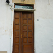
The Shrine of Prascondù, built at 1320m of altitude on the site of a chapel that dated from 1620, was rebuilt and extended several times. Inside is a valuable 17th century icon. Next to the church there is a small hostel for pilgrims.
(Regione Piemonte)
Other long-distance trails and alternative routes
The trail mostly follows the route of GTA stage 230.
Useful topographic maps
-
3 ~ IGC Il Parco naturale del Gran Paradiso (1: 50000)
Useful guidebooks
-
Camminaitalia, Carnovalini, Cannobini, Valsesia ~ CAI-TCI (ISBN 1995)
Picture gallery


Last update : 2013-05-29


Favourites, criticisms ? Make your personal comments on this stage. For more general notes please use the comments section of the page Over to the Via Alpinists.