Hiking (mountain trail, in places narrow and exposed)
Alpine route (equipped or very exposed section, snow field, blocks)
D23
Alpe Péradza » Bivacco Bausano
|
3h25 |
9.8 km
|
239 m
|
893 m
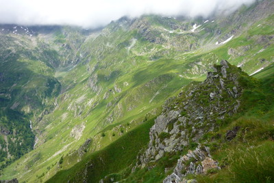
Passing the Arriettaz pass, one of the highest points in the Via Alpina trail, the trail enters the Piedmont and leads to the Bausano hut. The slope up to the Borra pass leads to a final descent into Piamprato. The surroundings are pleasant and rich from the natural point of view.
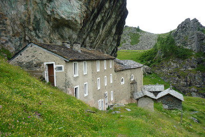
From the Sogno Fortuna hut the trail, marked 10, crosses a flattish area which then heads gently down to Cogne. As it hits the broad Cote de Gratton hillside the views over the valley below, with its pastures and small lakes, are astounding. The trail, used to take the animals up to pasture in the summer, climbs through a detritus covered area as it reaches the Nouva (or Ariettaz) pass. At 2938m this is one of the highest points of the Via Alpina trail. The pass is on the border between Aosta valley and the Piedmont. Here begins the Piedmontese valley of San Besso. From the pass the trail downwards is steep and rocky for almost 2 hours, passing some old huts and finally reaching the Bausano hut, near the Shrine of San Besso. A series of bends lead upwards once more to the Borra pass and the remains of an old mine. The descent into the Borra valley is rapid. There is a good chance here of coming across wild animals. The trail heads on to Alpe Vandilliana, a pasture that is still in use today. The trial winds all the way down to the bottom of the valley, crossing the Piamprato stream and joining the dirt track that leads through conifer woods to Piamprato Soana, lying in a gentle vale amongst pastures. (Regione Valle d’Aosta, Regione Piemonte)
Natural and cultural heritage
Of interest to nature lovers because of the very large number of alpine flower species. (Regione Valle d’Aosta)
Useful topographic maps
9 ~ IGC, IVREA, BIELLA E BASSA VALLE D'AOSTA (1: 50.000)
3 ~ IGC, PARCO NATURALE DEL GRAN PARADISO (1: 50.000)
Useful guidebooks
Guida n°2-I monti di Aosta, Cogne, l'Avic e Champorcher, Luca Zavatta. ~ Le Guide dell'Escursionista (ISBN )
Websites relative to natural and cultural heritage
Favourites, criticisms ? Make your personal comments on this stage. For more general notes please use the comments section of the page Over to the Via Alpinists.
Itinéraire réalisé de Riale (D1) à MontCenis (D34) du 19/08 au 12/09/23.
En partant du Refuge Péradzà, fermé, descendre un peu sur le sentier carrossable puis rapidement prendre à gauche sur un chemin bien marqué en direction de l'ensemble des lacs de Miserin, mais ne pas y aller, et prendre vers la gauche en direction du Col d'Arrietaz, d'abord en prairie, puis gravière à l'approche du Col.
Ce magnifique passage est classé EE, assez vertical sur la fin et la redescente, avec chaines (plusieurs ne sont plus accrochées). Soyez vigilants et tout se passera bien !
Quelques zones de bivouac dans ces passages, et présence d'eau à la ferme plus bas (plusieurs zones d'élevage alentours, attention à l'eau).
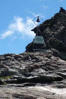
A San Besso (Monte Fautino), présence d'un ermitage et d'une chapelle sous une roche, absolument magnifique. Tout était fermé, mais sanitaires à l'extérieur et fontaine d'eau (possibilité de bivouaquer au col un peu au-dessus). Il parait qu'un prêtre est là de temps en temps...
JeanCat - 2022-11-02
Coup de coeur pour le colle dell' Arietta et redescente dans les névés (juillet 2021)
Via Alpina International Secretariat - 2013-07-17
WARNING! This stage is being modified, the map and passing points are correct, the times, descriptions and on-site markings will be updated shortly.

 |
3h25 |
9.8 km
|
239 m
|
893 m
|
3h25 |
9.8 km
|
239 m
|
893 m


Favourites, criticisms ? Make your personal comments on this stage. For more general notes please use the comments section of the page Over to the Via Alpinists.