“Currently, the alpine regions do not have any harmonised cartography and the map quality is uneven. On too many stages of the Via Alpina, maps are only available at a small scale, are outdated or difficult to find. The available digital maps do not cover all the stages, tend to be expensive, are found in proprietary formats or only sold with a particular GPS receiver. We want to fix this, beginning with the Western Alps, by contributing data to OpenStreetMap. OSM addresses these issues. It is the largest open source cartographic effort ever made: nearly half a million registered volunteers have contributed more than 2700 millions track points and 1300 millions database nodes. Based on OSM data, many websites publish maps and GPS receiver maps for people doing outdoor activities (hikers, cyclists, mountain bikers, horse riders, kayakers...). But OSM efforts are not systematic. We want to make a coordinated effort.
Methodology State-of-the-art techniques will be used to produce professional quality geospatial data. We will combine ground observation, interviews with local people such as hut-keepers, and satellite imagery to add into OSM any significant geographic features including ways (trails, roads, bridges...), amenities (huts, fountains...), shops, viewpoints, natural features (forests with type of trees, lakes, rivers...), inhabited areas, cultural and architectural heritage (ruins, shrines...), and many more, following OSM's high mapping standard. Trails and track type and surface, hiking difficulty, trail visibility, signposts, will also be described, as well as any data relevant to hiking, cycling, mountain biking, horse-riding and public transportation.
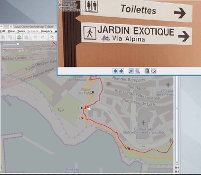
Photo mapping techniques are generally used with devices that do not record all the necessary information (in particular, the azimuth while shooting and the GPS accuracy). We will collect those data for all pictures using the antenna of a GPS receiver carried on top of the head. A handheld GPS receiver with OSM data loaded will help focus on missing data while hiking. Several providers of satellite imagery (including Microsoft's Bing, contrary to Google) allows OSM mappers to use their imagery. We will use these to map relevant areas on each side of the Via Alpina. The acquired data will be prepared for inclusion into OSM every evening from a netbook and uploaded to OSM regularly. We will use the data from the Via Alpina secretariat to produce higher quality data. In multilingual areas, we will translate names in all the local languages.
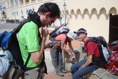
Participants 6 of us live in Italy, 5 in France, 1 in both, and the list is growing. None of us is a professional of outdoor mountain activities; however, we developed some skills useful for the project, for instance in GIS, environment sciences or photography.
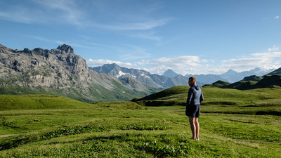
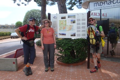
Itinerary We will start from Monaco in June 2012 (stage R161), then follow the Blue Trail to Switzerland (D61 to D5), then the Red Trail (R97 to R106 then from R115 back to the South). We will end in mid-August in Vallouise (R128) in the French Ecrins massif after about 75 days of hiking. Public transportation will be used as much as possible for participants to join and leave the hike.
Communication The cartography part of the project is all about communication of geographic data related to the Via Alpina. Beyond this, we will publish and regularly update an internet blog (in French, Italian and English). About once a day, we will choose a place to take a 360° panorama using a tripod, publishing the best views on the blog. We will produce a 15’ film recorded in HD video. On our way, we will distribute multilingual A5 flyers about Via Alpina and the Alpine Convention. We will aim at presenting the project in various events such as Alpine Club meetings, specialist workshops and mountain film festivals.”
Mayeul Kauffmann, the initiator of the project, had to stop his hike early due to an injury in the knee. But other team members went on. In total, technical data and photographs have been gathered for some twenty stages and are in the process of being entered on OpenStreetMap. Most of all, methods have been refined. Listen to the explanations in the concluding video of the project. And why not joining yourself the community of OSM contributors?