Passeggiata / turismo (sentiero largo non esposto)
Escursione (sentiero di montagna, a volte stretto ed esposto)
Escursione alpina (passaggio attrezzato o molto esposto, nevaio, blocchi rocciosi)
R36
Pfitscherjoch / Passo Vizze » Ginzling
|
5h40 |
24.6 km
|
86 m
|
1358 m
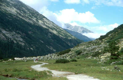
Arrivando dalPasso Vizze si cammina nella splendida valle dello Zamser Grund fino al lago artificiale Schlegeisstausee, meta di numerose gite e quindi molto frequentato, ma dietro alla diga è più tranquillo. Passando Breitlahner la Via Alpina segue il sentiero di scoperta „Lass’ dir erzählen“ (“Lascia che ti racconti”), che riporta alla luce molte particolarità dimenticate della valle Zillertal.
Al passo di Vizze a 2.246m (Pfitscherjoch) si attraversa il confine italo austriaco. Il sentiero scende alla valle Zamser Grund. Nel fondovalle quasi piano scorre il torrente Zamserbach e si attraversano numerosi ruscelletti che scendono dai pendii. Al Zamsgatterl si trova una piccola cappella. Sulla sinistra un parcheggio per le automobili che arrivano percorrendo la strada a pedaggio che porta al lago artificiale Schlegeisstausee, che durante l'estate attira moti turisti. Lungo la strada che percorre la riva, un po' elevato sulla sinistra, s'incontra il rifugio Dominikushütte. Presso l'ultimo parcheggio, la strada continua nel tunnel, mentre il sentiero scende a destra verso Breitlahner, subito dietro la diga. Il tracciato continua in discesa all'ombra della possente diga. Si continua così a scendere dolcemente per un comodo sentiero a zigzag verso il fondovalle. Ad un certo punto s'incrocia la strada rotabile, si attraversa e si prosegue per il sentiero tenendosi sulla destra. Verso sinistra il sentiero sale ai rifugi Friesenberghaus e Olperer Hütte. Si continua tra i prati fino al disopra della casa del dazio, dopo alcune strette serpentine sempre in discesa nel bosco si vede la strada e subito dopo, a destra la locanda alpina Alpengasthof Breitlahner (3h40min dal rifugio Pfitscherjoch-Haus). Dalla locanda Breitlahner fino all'alpe Kaserleralm si cammina sulla strada poiché attualmente non c'è un sentiero segnato sulla riva orientale del torrente. In futuro la situazione potrebbe anche variare. Dopo ca. 30min di cammino dall'alpe Kaserleralm prendere la piccola strada a sinistra, che prosegue con un leggero saliscendi. (Attenzione a non seguire la strada che sale, sempre a sinistra, verso l'alpe Birgelbergalm). Ci si può riposare nella Gasthof Roßhag prima di arrivare, all'altezza dell'omonima centrale elettrica, sul sentiero più largo. Continuare a sinistra (non a destra oltre il ponte), prima di continuare verso Ginzling. A Ginzling rimanere sulla sponda occidentale del torrente Zemmbach (non passare il ponte) superare la chiesa, il centro polifunzionale e la piccola cappella. All'alpe Kaserleralm rimanere sulla strada e seguirla fino a Breitlahner. Subito dietro la casa del dazio, il sentiero si biforca e sale nel bosco Seguirlo fino alla diramazione per Friesenberghaus, qui attraversare la strada e continuare dall'altro lato. (Gudrun Wallentin, Christina Schwann, Hochgebirgs-Naturpark Zillertaler Alpen, OeAV)
Patrimonio naturale e culturale
Il Parco Naturale Alpino delle Alpi della valle Zillertal si estende su una superficie di 372km². Insieme al Parco Naturale degli Alti Tauri e al Parco Naturale dell'Alto Adige Vedrette di Ries-Val Aurina, rappresentano la più ampia zona protetta nelle Alpi. Tutti e tre si propongono gli stessi obiettivi: 1°protezione e ricerca del paesaggio naturale, 2°informazione e educazione all'ambiente, 3°esperienza della natura e del paesaggio 4° sviluppo regionale durevole e cura del paesaggio antropizzato. Il Parco Naturale Alpino delle Alpi della valle Zillertal, zona protetta già dal 1991 come zona riposo, si trova nel territorio dei comuni di Mayrhofen, Finkenberg, Brandberg e della frazione di Ginzling del distretto di Schwaz. Spostandosi dal passo di Vizze al lago artificiale di Schlegeisstausee si attraversa proprio questa zona d'alta montagna protetta. Di seguito la Via Alpina continua al margine fino a Ginzling. Le alpi Zillertaler Alpen furono scoperte molto presto quale fonte di energia elettrica: nel 1939 fu costruita la centrale elettrica di Gerlos, nel 1963 il serbatoio artificiale di Durlaßboden, nel 1964 quello di Neves. Nel 1972, dopo quasi cinque anni di lavori fu terminata la diga del serbatoio di Schlegeis. Ad invaso colmo il bacino chiuso dalla diga alta 131m e lunga 725m ha una capienza di 126,5 km³. Il rifugio Dominikushütte dovette essere ricostruito un po' più in alto per non essere sommerso dalle acque. La presenza del Parco Naturale impedisce la realizzazione di ulteriori collegamenti avveniristici come ad esempio l'autostrada Alemagna che avrebbe dovuto collegare, secondo i piani del 1970, l'Italia e la Germania passando per la Zillertal e la Val Aurina. Al momento dunque la costruzione di tale strada in territorio austriaco è vietata dalla Convenzione delle Alpi. Il progetto dell'autostrada Alemagna è ancora attuale, infatti, è già stato costruito il tratto che da Mestre, passando per Treviso e Vittorio Veneto arriva a Belluno e Pieve di Cadore. La zona protetta non ha solo un valore politico, è anche molto importante per l'ambiente. Costituisce, infatti, una sorta di spazio di compensazione ecologica alle zone intensamente sfruttate dal punto di vista turistico della valle Zillertal. L'ambiente intatto in alta montagna con ripide pareti, estesi boschi di pini cembri, grandi cespugli di rododendri e prati variopinti offre spazio vitale a numerose specie di animali e piante. Si possono osservare aquile, marmotte e camosci e con un po' di fortuna un ospite sempre più raro: l'avvoltoio degli agnelli, divoratore di carogne con un'apertura alare di oltre 2,5 m. (Christina Schwann, OeAV, Gudrun Wallentin, Hochgebirgs-Naturpark Zillertaler Alpen)
Altri grandi itinerari e varianti
Dal rifugio Dominikus Hütte diramazione per il rifugio Friesenberghaus con il monumento agli ebrei e uno splendido panorama. A Breitlahner si ritrova la Via Alpina.
Carte topografiche utili
35/2, Zillertaler Alpen, Mitte und 35/1, Zillertaler Apen, West ~ Oesterreichischer Alpenverein (1:25.000)
Una gradita sorpresa, una critica? Inserite il vostro commento personale su questa tappa. Per osservazioni più generali, utilizzate la funzione commento della pagina La parola ai Via Alpinisti.
Raphael - 26/09/23
After reading the previous comments on R36 and R37, I decided to replace them by two legs of the „Berliner Höhenweg“ (check: https://www.tirol.at/reisefuehrer/sport/wandern/wandertouren/a-wanderung-berliner-hoehenweg). I replaced R36 with hiking to the Friesenberghaus and R37 by going from the Friesenberghaus to the Gamshütte. Both were very nice trips, which were not too demanding at most parts but included large boulders again, which were difficult in the rain. Still, the tours had very scenic views on the Zillertal and the Schlegeisspeicher and the huts were nice and with friendly service. From the Gamshütte I descended to Mayrhofen, which takes around 3h. If you want to avoid walking roads down in the valley I strongly suggest taking this option!
Carsten - 10/01/22
(2) Half a dozen buses a day run from the dam of the Schlegeis reservoir (about 5km into this stage) to Ginzling and on to Mayrhofen (resupply). I did not see a shop in Ginzling (or anything else of interest). Restaurants were closed, and I didn't look for and didn't see accommodation.
In good weather, from near the dam of the Schlegeis Reservoir (or perhaps where one first reaches the reservoir) it’s possible to follow signposts for sections of the Berliner Hoehenweg via the Olperer Huette and the Gams Huette to Finkenberg (a worthy highline trail). Google Berliner Hoehenweg for more information. Probably really nice.
Carsten - 10/01/22
(1) WARNING R36 starting from the Schlegeis Reservoir through halfway of R38 is a Via Horribile Anti-Alpina (low-level valley walk, on or near asphalt roads (with cars), nothing to see...)
Default: Take the bus from the Schlegeis Reservoir to Mayrhofen (full resupply, affordable hotels), and then a bus from Mayrhofen to Moesl (the Finkenberg-Moesl leg is a pointless up and down in a non-satisfying environment). From Moesl, it’s possible to walk to Schwaz (end of R40) in one day (R39 and R40 double-count the ascent to Kellerjochhuette, and one may well bypass the final climb to that hut). Schwaz (also) has excellent resupply. -- I am not in favor of taking buses to shorten the distance walked, but the situation here is different from Pragser Wildsee to St Martin, which gave me a nice impression of the changing landscape. Here, in R36-R38, there is nothing worth to be experienced; the routing is plain offensive.
Lolo - 29/07/19
Passage en Autriche. Descente le long du mur du barrage. Descente le long de la rivière. Suivre le chemin balisé car il y a des tunnels à passer par la route. A Ginzling je décidé de continuer jusqu'à Finkenberg 10 km de plus. Balisage moyen...
Traduzione automatica
[Google]
Passaggio in Austria. Discesa lungo il muro della diga. Discesa lungo il fiume. Seguire il sentiero segnato in quanto ci sono tunnel per passare dalla strada. A Ginzling ho deciso di continuare fino a Finkenberg 10 km in più. Contrassegni medi ...
POPEYE GG - 13/06/18
11 juillet 2017
Aucune difficulté pour cette étape malgré la grande dénivelée en descente (1400m).
Toujours de beaux panoramas avec ici une multitude de cascades.
Le chemin passe au pied d'un barrage, équipé d'une impressionnante via ferrata.
A Ginzling, pour l'hébergement, le plus simple est d'aller voir l'office du tourisme: je recommande l'hôtel Schwarzenstein: pour plus de détails, voir aussi mon blog "vivelaretraitesurlaviaalpina.blogspot.com".
Traduzione automatica
[Google]
11 luglio 2017 Nessuna difficoltà per questa tappa nonostante il forte calo di discesa (1400m). Panorami sempre belli con qui una moltitudine di cascate. Il sentiero passa ai piedi di una diga, dotato di un'impressionante via ferrata. A Ginzling, per la sistemazione, il modo più semplice è quello di andare all'ufficio turistico: consiglio l'hotel Schwarzenstein: per maggiori dettagli, vedi anche il mio blog "vivelaretraitesurlaviaalpina.blogspot.com".
Between Ginzling and Breitlahner is an official Bivouac field. It's next to the road and full of rockclimbers :-) People might call it a campsite (and they might say it's in Ginzling), but in both cases you'll be disappointed.
Domenikus Hütte is a very nice place indeed. They have no problem with camping for 1 night as long as you ask. Super friendly staff who love to "help" hikers. Warmly recommended!
Traduzione automatica
[Google]
Tra Ginzling e Breitlahner è un campo bivacco ufficiale. È vicino alla strada e pieno di rockclimbers :-) La gente potrebbe chiamarlo un campeggio (e potrebbero dire che è a Ginzling), ma in entrambi i casi rimarrai deluso. Domenikus Hütte è davvero un bel posto. Non hanno problemi con il campeggio per 1 notte fino a quando chiedi. Personale super cordiale che ama "aiutare" gli escursionisti. Calorosamente raccomandato!
gianadda marie-jo - 17/08/15
Sommes descendues jusqu'à Hôtel Breitlahner. Itinéraire de fond de vallée encore assez sympa.
Traduzione automatica
[Google]
Siamo scesi a Breitlahner Hotel. Cross-percorso ancora piuttosto fresco valle.
When you arrive at the newly rebuilt Pfitscherjoch Hut, you instantly feel the urge to move on!
The privately owned Dominikushutte is great. Owners are very friendly, and they have a free laundry service!
Traduzione automatica
[Google]
Quando si arriva al Rifugio Passo Vizze recentemente ricostruito, si sente immediatamente la voglia di andare avanti! Il Dominikushutte proprietà privata è grande. I proprietari sono molto cordiale, e hanno un servizio di lavanderia gratuito
Elisabeth - 24/12/12
Prix prohibitif à Pfitscherjochhaus (6 € l'apfelstrudel !)
Traduzione automatica
[Google]
Prix à prohibitif Pfitscherjochhaus (6 € l'strudel di mele!)
Alpinisten - 24/09/12
Wir können die Dominikushütte wärmstens empfehlen! Kamen vonr der Hochfeilerhütte und hatten keine Lust auf den Baulärm am Pfitscher Joch (Umbau)...Sehr gut essen kann man im Gasthof "Alt-Ginzling" (Familie Kröll), die aber keine Übernachtung anbieten.
Traduzione automatica
[Google]
Consigliamo vivamente il Dominikushütte! È venuto il rifugio OFR Hochfeiler e non aveva tempo per il rumore dei lavori in Pfitscherjoch (ricostruzione) ... Molto buono si può mangiare alla locanda "Alt Ginzling" (famiglia Kroell), l'offerta ma non pernottamenti.
Mountain Girl - 21/12/11
As you come into the village of Ginzling (from Passo Vizze), the first house with a sign for "Zimmer" (rooms) is comfortable. Food options in Ginzling are limited to a bakery with sporadic hours, and a Gasthof, that also offers rooms.
Traduzione automatica
[Google]
Come si arriva nel villaggio di Ginzling (da Passo Vizze), la prima casa con un cartello per "Zimmer" (camere) è comodo. Opzioni alimentari in Ginzling sono limitati a una panetteria con ore sporadici, e un Gasthof, che offre anche camere.
Mountain Girl - 27/10/11
Dominikushuette is the first hut coming off the Passo Vizze -- 8km down--and a welcome choice. Hosts love hearing hiker stories, offer great food and comfortable lodging. Plus, there's a superb view of the glacier outside the dining room window. Highly recommended!
Traduzione automatica
[Google]
Dominikushuette è la prima capanna venuta fuori la Vizze Passo - 8 km verso il basso - e una scelta di benvenuto. Host piace ascoltare le storie escursionisti, offrono ottimo cibo e alloggio confortevole. Inoltre, c'è una splendida vista sul ghiacciaio fuori dalla finestra della sala da pranzo. Altamente consigliato!

 |
5h40 |
24.6 km
|
86 m
|
1358 m
|
5h40 |
24.6 km
|
86 m
|
1358 m


Una gradita sorpresa, una critica? Inserite il vostro commento personale su questa tappa. Per osservazioni più generali, utilizzate la funzione commento della pagina La parola ai Via Alpinisti.